TopoQuest Logo
Do you find TopoQuest useful?
Help keep TopoQuest running and adding new maps/features by donating!
Bitcoin:  19c7KJd3qBynnjoSw5npx9KScwjBe4ifkT
Litecoin:  LXs6TkuXGGXo1vDsWCkWVdjQX94eUKd6ui
Home View Maps Find Maps Find Places Resources & Links


Owl Hollow, Texas Topographic Map

USGS Map Title: Owl Hollow, TX
USGS Map MRC: 29099G7
DRG (GeoTIFF) Download: o29099g7.tif


Neighboring USGS Topographic Map Quads:


  Joy Hollow, TX  
29099H8
 

  Bee Cave Hollow, TX  
29099H7
 

  Hillcrest Ranch, TX  
29099H6
 

  Jo Jan Van Camp, TX  
29099G8
 

  Owl Hollow, TX  
29099G7
 

  Circle Bluff, TX  
29099G6
 

  Crown Mountain, TX  
29099F8
 

  Leakey, TX  
29099F7
 

  Rio Frio, TX  
29099F6


Map MRC Location:

N30°
W100°
N30°
W99°
H8 H7 H6 H5 H4 H3 H2 H1
G8 G7 G6 G5 G4 G3 G2 G1
F8 F7 F6 F5 F4 F3 F2 F1
E8 E7 E6 E5 E4 E3 E2 E1
D8 D7 D6 D5 D4 D3 D2 D1
C8 C7 C6 C5 C4 C3 C2 C1
B8 B7 B6 B5 B4 B3 B2 B1
A8 A7 A6 A5 A4 A3 A2 A1
N29°
W100°
N29°
W99°

Owl Hollow, TX USGS 1:24K Topographic Map Preview:
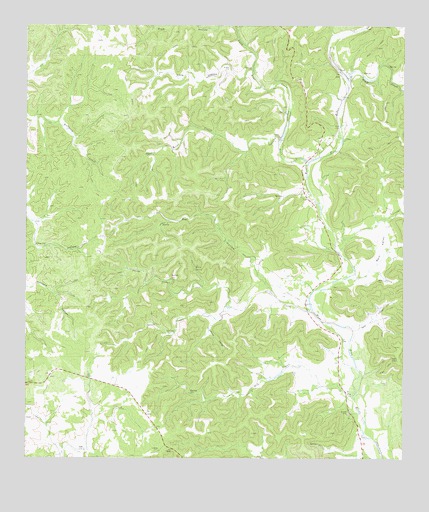
Owl Hollow, TX USGS Topographic Map
Click on map above to begin viewing in our Map Viewer.

This topographic map contains these locations and features:
Feature Name Type Latitude Longitude GNIS ID View Map
Ash CreekStreamN29.7683°W99.7667°1351299View Map
Bluff CreekStreamN29.8574°W99.7684°1352510View Map
Buckalue HollowValleyN29.8725°W99.7741°1372792View Map
Camp Wood-Leakey DivisionCivilN29.8317°W99.8222°1938595View Map
Cedar CreekStreamN29.7916°W99.7789°1354047View Map
Kent CreekStreamN29.8361°W99.7820°1360592View Map
Lawson HollowValleyN29.7896°W99.8135°1360997View Map
Lewis Ranch AirportAirportN29.7948°W99.7838°1387063View Map
Long HollowValleyN29.8626°W99.8008°1361732View Map
Long Kent CreekStreamN29.8411°W99.7912°1374708View Map
North Cedar CreekStreamN29.7938°W99.8078°1364016View Map
Owl HollowValleyN29.8011°W99.7961°1364641View Map
Perry HollowValleyN29.7873°W99.7664°1365080View Map
Rain ValleyValleyN29.8027°W99.7659°1365969View Map
Real CountyCivilN29.8317°W99.8222°1383978View Map
Real County Historical MuseumBuildingN29.8613°W99.7990°2014426View Map
Riemer CreekStreamN29.8580°W99.7520°1366450View Map
Short Kent CreekStreamN29.8411°W99.7912°1368234View Map
South Cedar CreekStreamN29.7938°W99.8078°1368654View Map
White SpringSpringN29.8049°W99.8190°1371415View Map

Note: Coordinates in the location and feature list above are referenced to NAD83 datum.


Copyright (C) 2008-2025 Ryan Niemi / Sunset Dynamics ... All Rights Reserved