TopoQuest Logo
Do you find TopoQuest useful?
Help keep TopoQuest running and adding new maps/features by donating!
Bitcoin:  19c7KJd3qBynnjoSw5npx9KScwjBe4ifkT
Litecoin:  LXs6TkuXGGXo1vDsWCkWVdjQX94eUKd6ui
Home View Maps Find Maps Find Places Resources & Links


Jo Jan Van Camp, Texas Topographic Map

USGS Map Title: Jo Jan Van Camp, TX
USGS Map MRC: 29099G8
DRG (GeoTIFF) Download: o29099g8.tif


Neighboring USGS Topographic Map Quads:


  Hackberry, TX  
29100H1
 

  Joy Hollow, TX  
29099H8
 

  Bee Cave Hollow, TX  
29099H7
 

  Vance, TX  
29100G1
 

  Jo Jan Van Camp, TX  
29099G8
 

  Owl Hollow, TX  
29099G7
 

  Camp Wood, TX  
29100F1
 

  Crown Mountain, TX  
29099F8
 

  Leakey, TX  
29099F7


Map MRC Location:

N30°
W100°
N30°
W99°
H8 H7 H6 H5 H4 H3 H2 H1
G8 G7 G6 G5 G4 G3 G2 G1
F8 F7 F6 F5 F4 F3 F2 F1
E8 E7 E6 E5 E4 E3 E2 E1
D8 D7 D6 D5 D4 D3 D2 D1
C8 C7 C6 C5 C4 C3 C2 C1
B8 B7 B6 B5 B4 B3 B2 B1
A8 A7 A6 A5 A4 A3 A2 A1
N29°
W100°
N29°
W99°

Jo Jan Van Camp, TX USGS 1:24K Topographic Map Preview:
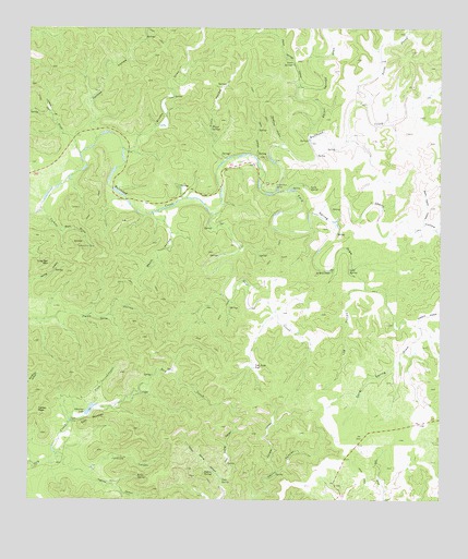
Jo Jan Van Camp, TX USGS Topographic Map
Click on map above to begin viewing in our Map Viewer.

This topographic map contains these locations and features:
Feature Name Type Latitude Longitude GNIS ID View Map
Boon Camp HollowValleyN29.8232°W99.8801°1352679View Map
Booth HollowValleyN29.8263°W99.9627°2785044View Map
Brushy DrawValleyN29.8433°W99.9717°1372776View Map
Cave SpringSpringN29.7558°W99.9412°1354009View Map
Cherry HollowValleyN29.8238°W99.9070°1354361View Map
Cord SpringSpringN29.8107°W99.9030°1354983View Map
Cord Spring DrawValleyN29.8317°W99.9250°1354984View Map
Devils CanyonValleyN29.7505°W99.9316°1373384View Map
Echo MountainSummitN29.7716°W99.9781°1356793View Map
Flint CanyonValleyN29.7752°W99.9807°1357482View Map
Flynn HollowValleyN29.8395°W99.9414°1357521View Map
Flynn SpringsSpringN29.8486°W99.9445°1357522View Map
Hells HollowValleyN29.8413°W99.9314°1359013View Map
Highline CanyonValleyN29.7620°W99.9918°1359217View Map
Hog Pen MountainSummitN29.8130°W99.9942°1359373View Map
Holland HollowValleyN29.7968°W99.8824°1359411View Map
Holmes HollowValleyN29.8463°W99.9802°1374115View Map
Ice WaterholeSpringN29.8108°W99.9083°1359879View Map
Indian SpringSpringN29.7577°W99.9441°1359983View Map
Indian Spring CanyonValleyN29.7559°W99.9418°1359988View Map
Javalina CanyonValleyN29.7574°W99.9831°1360168View Map
Jo Jan Van CampLocaleN29.8299°W99.9256°1360271View Map
Kelly SpringSpringN29.7564°W99.9670°1360549View Map
Klondike CanyonValleyN29.7576°W99.9247°1360715View Map
Lacy DrawValleyN29.8426°W99.9851°1360821View Map
Log HollowValleyN29.8062°W99.8977°1361613View Map
Lynn SpringSpringN29.8330°W99.9148°1362007View Map
New CreekStreamN29.8261°W99.9431°1363704View Map
North Prong Bullhead CreekStreamN29.8552°W99.8976°1375185View Map
Pecan SpringsSpringN29.8658°W99.9192°1364987View Map
Pecan Springs DrawValleyN29.8460°W99.9152°1375399View Map
Pecan Springs HollowValleyN29.8603°W99.9181°1375400View Map
Pfletcher LakeLakeN29.7739°W99.9818°1365128View Map
Pletcher Lake DamDamN29.7736°W99.9837°1862088View Map
Spring CanyonValleyN29.7559°W99.9418°1368957View Map
Turkey PeakSummitN29.7738°W99.9976°1370271View Map
Turkey Pen DrawValleyN29.8253°W99.9947°1370273View Map
Two Acre FlatFlatN29.7858°W99.9315°1370383View Map
Vander Stucken SpringsSpringN29.8252°W99.9253°1998348View Map
Waldroop HollowValleyN29.8449°W99.9230°1370747View Map

Note: Coordinates in the location and feature list above are referenced to NAD83 datum.


Copyright (C) 2008-2025 Ryan Niemi / Sunset Dynamics ... All Rights Reserved