TopoQuest Logo
Do you find TopoQuest useful?
Help keep TopoQuest running and adding new maps/features by donating!
Bitcoin:  19c7KJd3qBynnjoSw5npx9KScwjBe4ifkT
Litecoin:  LXs6TkuXGGXo1vDsWCkWVdjQX94eUKd6ui
Home View Maps Find Maps Find Places Resources & Links


Kahoka SE, Missouri Topographic Map

USGS Map Title: Kahoka SE, MO
USGS Map MRC: 40091C5
DRG (GeoTIFF) Download: o40091c5.tif


Neighboring USGS Topographic Map Quads:


  Kahoka, MO  
40091D6
 

  Wayland, MO  
40091D5
 

  Keokuk, IA  
40091D4
 

  Saint Patrick, MO  
40091C6
 

  Kahoka SE, MO  
40091C5
 

  Warsaw, IL  
40091C4
 

  Benjamin, MO  
40091B6
 

  Canton, MO  
40091B5
 

  Lima, IL  
40091B4


Map MRC Location:

N41°
W92°
N41°
W91°
H8 H7 H6 H5 H4 H3 H2 H1
G8 G7 G6 G5 G4 G3 G2 G1
F8 F7 F6 F5 F4 F3 F2 F1
E8 E7 E6 E5 E4 E3 E2 E1
D8 D7 D6 D5 D4 D3 D2 D1
C8 C7 C6 C5 C4 C3 C2 C1
B8 B7 B6 B5 B4 B3 B2 B1
A8 A7 A6 A5 A4 A3 A2 A1
N40°
W92°
N40°
W91°

Kahoka SE, MO USGS 1:24K Topographic Map Preview:
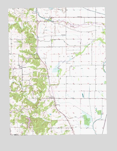
Kahoka SE, MO USGS Topographic Map
Click on map above to begin viewing in our Map Viewer.

This topographic map contains these locations and features:
Feature Name Type Latitude Longitude GNIS ID View Map
Big BranchStreamN40.3148°W91.5613°735509View Map
Bluff Springs ChurchChurchN40.2787°W91.5665°714446View Map
Britton PrairieAreaN40.3195°W91.5577°714725View Map
Buck-Doe Run Creeks Watershed 32 DamDamN40.2817°W91.5718°760650View Map
Buck-Doe Run Watershed Structure Number 2 DamDamN40.2650°W91.5718°762769View Map
Frazee CemeteryCemeteryN40.3615°W91.5792°718182View Map
Gravel Hill SchoolSchoolN40.2864°W91.5693°718739View Map
Keystone Church (historical)ChurchN40.3478°W91.5504°731747View Map
Keystone SchoolSchoolN40.3481°W91.5515°720564View Map
Lake of the OaksReservoirN40.2633°W91.6005°760405View Map
Lake of the Oaks DamDamN40.2667°W91.6002°760404View Map
Lone Star School (historical)SchoolN40.3223°W91.5174°731752View Map
Morris CemeteryCemeteryN40.3731°W91.5727°722647View Map
Mount Albia SchoolSchoolN40.3700°W91.5879°722708View Map
Mount Zion CemeteryCemeteryN40.3419°W91.6141°722940View Map
Plainview SchoolSchoolN40.3659°W91.5360°735784View Map
Pleasant Hill SchoolSchoolN40.3253°W91.5860°724551View Map
Rose PondSwampN40.3392°W91.5077°737835View Map
Saint Patrick CemeteryCemeteryN40.2630°W91.6248°725855View Map
Stone PondLakeN40.2885°W91.5305°727135View Map
Sugar CreekStreamN40.3370°W91.5238°735872View Map
Township of ClayCivilN40.3148°W91.5515°766491View Map
Weaver CemeteryCemeteryN40.3698°W91.5777°728448View Map
WinchesterPopulated PlaceN40.3178°W91.6113°728989View Map

Note: Coordinates in the location and feature list above are referenced to NAD83 datum.


Copyright (C) 2008-2025 Ryan Niemi / Sunset Dynamics ... All Rights Reserved