TopoQuest Logo
Do you find TopoQuest useful?
Help keep TopoQuest running and adding new maps/features by donating!
Bitcoin:  19c7KJd3qBynnjoSw5npx9KScwjBe4ifkT
Litecoin:  LXs6TkuXGGXo1vDsWCkWVdjQX94eUKd6ui
Home View Maps Find Maps Find Places Resources & Links


Saint Patrick, Missouri Topographic Map

USGS Map Title: Saint Patrick, MO
USGS Map MRC: 40091C6
DRG (GeoTIFF) Download: o40091c6.tif


Neighboring USGS Topographic Map Quads:


  Medill, MO  
40091D7
 

  Kahoka, MO  
40091D6
 

  Wayland, MO  
40091D5
 

  Neeper, MO  
40091C7
 

  Saint Patrick, MO  
40091C6
 

  Kahoka SE, MO  
40091C5
 

  Williamstown, MO  
40091B7
 

  Benjamin, MO  
40091B6
 

  Canton, MO  
40091B5


Map MRC Location:

N41°
W92°
N41°
W91°
H8 H7 H6 H5 H4 H3 H2 H1
G8 G7 G6 G5 G4 G3 G2 G1
F8 F7 F6 F5 F4 F3 F2 F1
E8 E7 E6 E5 E4 E3 E2 E1
D8 D7 D6 D5 D4 D3 D2 D1
C8 C7 C6 C5 C4 C3 C2 C1
B8 B7 B6 B5 B4 B3 B2 B1
A8 A7 A6 A5 A4 A3 A2 A1
N40°
W92°
N40°
W91°

Saint Patrick, MO USGS 1:24K Topographic Map Preview:
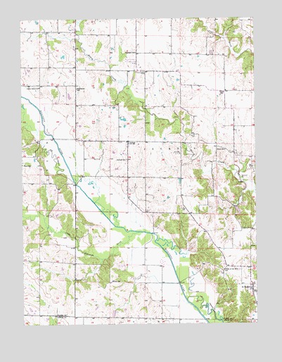
Saint Patrick, MO USGS Topographic Map
Click on map above to begin viewing in our Map Viewer.

This topographic map contains these locations and features:
Feature Name Type Latitude Longitude GNIS ID View Map
AntiochPopulated PlaceN40.3248°W91.6932°713309View Map
Antioch SchoolSchoolN40.3175°W91.6941°713348View Map
Bash CemeteryCemeteryN40.3098°W91.6321°713712View Map
Buschling Lake DamDamN40.2517°W91.6418°765256View Map
Cedar Grove ChurchChurchN40.3473°W91.7404°715598View Map
Clark SchoolSchoolN40.3156°W91.7496°715886View Map
Cowgill CemeteryCemeteryN40.2975°W91.6643°716416View Map
Day CemeteryCemeteryN40.3136°W91.6268°716753View Map
Diamond SchoolSchoolN40.3612°W91.6885°716878View Map
Enterprise SchoolSchoolN40.3464°W91.7207°717611View Map
Gem Post Office (historical)Post OfficeN40.3442°W91.6479°759809View Map
Gem SchoolSchoolN40.3448°W91.6413°718379View Map
Higbee CemeteryCemeteryN40.2886°W91.6324°719509View Map
Honey Creek CemeteryCemeteryN40.3528°W91.6840°735654View Map
Honey Creek Congregational Church (historical)ChurchN40.3514°W91.6841°731744View Map
Little Wyaconda RiverStreamN40.2878°W91.6882°721361View Map
Mitts CemeteryCemeteryN40.3198°W91.6657°722500View Map
Pride of the West SchoolSchoolN40.2723°W91.6427°724931View Map
Rossi Lake DamDamN40.2984°W91.6352°761626View Map
Saint PatrickPopulated PlaceN40.2645°W91.6277°735832View Map
Saint Patrick Post OfficePost OfficeN40.2633°W91.6270°2782944View Map
Saint Patrick SchoolSchoolN40.2631°W91.6260°731743View Map
Sisson CemeteryCemeteryN40.3275°W91.6577°726491View Map
Sisson ChapelChurchN40.3284°W91.6579°731745View Map
Stone SchoolSchoolN40.3214°W91.6413°727138View Map
Township of JacksonCivilN40.3172°W91.6650°766495View Map
White SchoolSchoolN40.2675°W91.7027°728772View Map

Note: Coordinates in the location and feature list above are referenced to NAD83 datum.


Copyright (C) 2008-2024 Ryan Niemi / Sunset Dynamics ... All Rights Reserved