TopoQuest Logo
Do you find TopoQuest useful?
Help keep TopoQuest running and adding new maps/features by donating!
Bitcoin:  19c7KJd3qBynnjoSw5npx9KScwjBe4ifkT
Litecoin:  LXs6TkuXGGXo1vDsWCkWVdjQX94eUKd6ui
Home View Maps Find Maps Find Places Resources & Links


Karbers Ridge, Illinois Topographic Map

USGS Map Title: Karbers Ridge, IL
USGS Map MRC: 37088E3
DRG (GeoTIFF) Download: o37088e3.tif


Neighboring USGS Topographic Map Quads:


  Rudement, IL  
37088F4
 

  Equality, IL  
37088F3
 

  Shawneetown, IL  
37088F2
 

  Herod, IL  
37088E4
 

  Karbers Ridge, IL  
37088E3
 

  Saline Mines, IL  
37088E2
 

  Shetlerville, IL  
37088D4
 

  Rosiclare, IL  
37088D3
 

  Cave-in-Rock, IL  
37088D2


Map MRC Location:

N38°
W89°
N38°
W88°
H8 H7 H6 H5 H4 H3 H2 H1
G8 G7 G6 G5 G4 G3 G2 G1
F8 F7 F6 F5 F4 F3 F2 F1
E8 E7 E6 E5 E4 E3 E2 E1
D8 D7 D6 D5 D4 D3 D2 D1
C8 C7 C6 C5 C4 C3 C2 C1
B8 B7 B6 B5 B4 B3 B2 B1
A8 A7 A6 A5 A4 A3 A2 A1
N37°
W89°
N37°
W88°

Karbers Ridge, IL USGS 1:24K Topographic Map Preview:
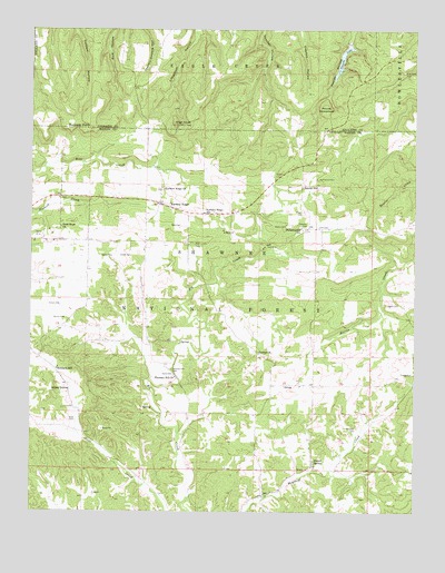
Karbers Ridge, IL USGS Topographic Map
Click on map above to begin viewing in our Map Viewer.

This topographic map contains these locations and features:
Feature Name Type Latitude Longitude GNIS ID View Map
Beaver TrailTrailN37.6184°W88.2750°423633View Map
Big Creek School (historical)SchoolN37.5350°W88.3284°1808756View Map
Blue Blaze MineMineN37.6145°W88.2542°424656View Map
Brushy Fork School (historical)SchoolN37.5764°W88.3559°1808757View Map
Central ChurchChurchN37.5412°W88.3006°424734View Map
Coghill CemeteryCemeteryN37.5537°W88.2592°424762View Map
Decker SpringSpringN37.5134°W88.2823°424825View Map
Good Hope CemeteryCemeteryN37.5737°W88.3664°1820779View Map
Good Hope ChurchChurchN37.5739°W88.3653°424935View Map
Grindstaff HollowValleyN37.6241°W88.3222°424953View Map
Grindstaff Hollow Club DamDamN37.6200°W88.3250°1690969View Map
Grindstaff Hollow Club LakeReservoirN37.6200°W88.3250°1690970View Map
GrossPopulated PlaceN37.5331°W88.2906°424954View Map
Hamp MineMineN37.5706°W88.3725°424960View Map
Hardin CountyCivilN37.5182°W88.2669°424236View Map
Harp MineMineN37.5698°W88.3670°1808766View Map
Hicks DomeSummitN37.5314°W88.3684°424984View Map
High KnobSummitN37.6003°W88.3281°424985View Map
High Knob Picnic AreaLocaleN37.6003°W88.3231°423643View Map
High Knob Recreation SiteLocaleN37.6014°W88.3300°423642View Map
Hill CemeteryCemeteryN37.5992°W88.2770°424987View Map
Holbrook CemeteryCemeteryN37.5217°W88.2686°425005View Map
Illinois Furnace (historical)LocaleN37.5003°W88.3286°1808770View Map
Indian Wall Picnic AreaLocaleN37.6056°W88.2803°423637View Map
Jacksons Store (historical)LocaleN37.5106°W88.2753°1808771View Map
Joyce CemeteryCemeteryN37.5356°W88.3284°425066View Map
Karber CemeteryCemeteryN37.5662°W88.3484°425070View Map
Karbers RidgePopulated PlaceN37.5798°W88.3334°425071View Map
Karbers Ridge ChurchChurchN37.5839°W88.3317°425072View Map
Karbers Ridge Post OfficePost OfficeN37.5784°W88.3289°1808772View Map
Karbers Ridge Recreatrion SiteLocaleN37.5812°W88.3245°425996View Map
Karbers Ridge SchoolSchoolN37.5773°W88.3184°425073View Map
Kaskaskia Experimental ForestForestN37.5209°W88.3473°425997View Map
Lakeview Picnic AreaLocaleN37.6198°W88.2695°423634View Map
Lane CemeteryCemeteryN37.5739°W88.2781°425095View Map
Lee MineMineN37.5695°W88.2981°425098View Map
Martha Furnace (historical)LocaleN37.5101°W88.2895°1808777View Map
Mathews CemeteryCemeteryN37.5739°W88.2845°425172View Map
McPherson CemeteryCemeteryN37.5864°W88.2817°425186View Map
Monroe Election PrecinctCivilN37.5551°W88.3388°1928574View Map
Pankeys Store (historical)LocaleN37.5042°W88.2992°1808781View Map
Philadelphia ChurchChurchN37.5737°W88.2875°425328View Map
Philadelphia School (historical)SchoolN37.5739°W88.2875°1808782View Map
Pine Ridge CampgroundLocaleN37.6148°W88.2678°423639View Map
Pleasant Hill CemeteryCemeteryN37.5367°W88.3289°425336View Map
Pleasant Hill ChurchChurchN37.5348°W88.3278°425339View Map
Pounds EscarpmentCliffN37.6059°W88.2800°426593View Map
Pounds Hollow DamDamN37.6217°W88.2714°1691014View Map
Pounds Hollow Recreation AreaLocaleN37.6175°W88.2714°423638View Map
Pounds LakeReservoirN37.6174°W88.2739°425352View Map
Pyle CemeteryCemeteryN37.5697°W88.3218°425356View Map
Pyles CemeteryCemeteryN37.5744°W88.3261°425357View Map
Reiner CemeteryCemeteryN37.5500°W88.3636°425371View Map
Richland ChurchChurchN37.5375°W88.3656°423641View Map
Richland SchoolSchoolN37.5370°W88.3664°425377View Map
Ridge MineMineN37.5728°W88.3123°425381View Map
Rim Rock Forest Trail Point of InterestLocaleN37.6037°W88.2720°423636View Map
Rim Rock Recreation AreaLocaleN37.6042°W88.2767°423635View Map
River to River TrailTrailN37.5856°W88.2650°423640View Map
Rogers CemeteryCemeteryN37.5778°W88.2867°425408View Map
Rose Hill CemeteryCemeteryN37.5242°W88.3625°425417View Map
Russell CemeteryCemeteryN37.5867°W88.2956°425427View Map
Schutt CemeteryCemeteryN37.5534°W88.3695°425468View Map
Shore to Shore Horse TrailTrailN37.6034°W88.2600°425995View Map
Sneed CemeteryCemeteryN37.5664°W88.3464°425499View Map
Sparks HillPopulated PlaceN37.5848°W88.2870°425509View Map
Sparks Hill Post Office (historical)Post OfficeN37.5845°W88.2873°1808789View Map
Tinsley CemeteryCemeteryN37.5359°W88.2545°425561View Map
Waters CemeteryCemeteryN37.5739°W88.2917°425624View Map
Wolrab Mill (historical)LocaleN37.5087°W88.3400°1808795View Map

Note: Coordinates in the location and feature list above are referenced to NAD83 datum.


Copyright (C) 2008-2024 Ryan Niemi / Sunset Dynamics ... All Rights Reserved