TopoQuest Logo
Do you find TopoQuest useful?
Help keep TopoQuest running and adding new maps/features by donating!
Bitcoin:  19c7KJd3qBynnjoSw5npx9KScwjBe4ifkT
Litecoin:  LXs6TkuXGGXo1vDsWCkWVdjQX94eUKd6ui
Home View Maps Find Maps Find Places Resources & Links


Keefton, Oklahoma Topographic Map

USGS Map Title: Keefton, OK
USGS Map MRC: 35095E3
DRG (GeoTIFF) Download: o35095e3.tif


Neighboring USGS Topographic Map Quads:


  Southwest Muskogee, OK  
35095F4
 

  Southeast Muskogee, OK  
35095F3
 

  Braggs, OK  
35095F2
 

  Oktaha, OK  
35095E4
 

  Keefton, OK  
35095E3
 

  Webbers Falls, OK  
35095E2
 

  Warner NW, OK  
35095D4
 

  Warner, OK  
35095D3
 

  Holt Mountain, OK  
35095D2


Map MRC Location:

N36°
W96°
N36°
W95°
H8 H7 H6 H5 H4 H3 H2 H1
G8 G7 G6 G5 G4 G3 G2 G1
F8 F7 F6 F5 F4 F3 F2 F1
E8 E7 E6 E5 E4 E3 E2 E1
D8 D7 D6 D5 D4 D3 D2 D1
C8 C7 C6 C5 C4 C3 C2 C1
B8 B7 B6 B5 B4 B3 B2 B1
A8 A7 A6 A5 A4 A3 A2 A1
N35°
W96°
N35°
W95°

Keefton, OK USGS 1:24K Topographic Map Preview:
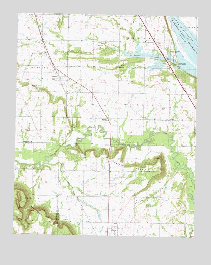
Keefton, OK USGS Topographic Map
Click on map above to begin viewing in our Map Viewer.

This topographic map contains these locations and features:
Feature Name Type Latitude Longitude GNIS ID View Map
Agnew CemeteryCemeteryN35.6076°W95.3191°1089553View Map
Coal CreekStreamN35.6107°W95.2900°1091513View Map
Elm Grove CemeteryCemeteryN35.6048°W95.2661°1092584View Map
Elm Grove ChurchChurchN35.6104°W95.2858°1092586View Map
KeeftonPopulated PlaceN35.5898°W95.3394°1094301View Map
Keefton Volunteer Fire DepartmentBuildingN35.5903°W95.3399°2657491View Map
MartinPopulated PlaceN35.5665°W95.3108°1100607View Map
McLainPopulated PlaceN35.5665°W95.2689°1100620View Map
McLain CemeteryCemeteryN35.5729°W95.2747°1095261View Map
Oknoname 101016 DamDamN35.5251°W95.2669°1755374View Map
Oknoname 101016 ReservoirReservoirN35.5251°W95.2669°1755375View Map
Rock Grove CemeteryCemeteryN35.5587°W95.3675°1097348View Map
Spaniard Creek Public Use AreaParkN35.5995°W95.2644°1098333View Map
Trinity ChurchChurchN35.6079°W95.3572°1098979View Map
Warner Elementary SchoolSchoolN35.5012°W95.3047°1819450View Map
Warner Memorial CemeteryCemeteryN35.5331°W95.3033°1099373View Map
Warner MountainSummitN35.5415°W95.2752°1099374View Map
Webbers Falls ReservoirReservoirN35.6235°W95.2676°1099462View Map

Note: Coordinates in the location and feature list above are referenced to NAD83 datum.


Copyright (C) 2008-2025 Ryan Niemi / Sunset Dynamics ... All Rights Reserved