TopoQuest Logo
Do you find TopoQuest useful?
Help keep TopoQuest running and adding new maps/features by donating!
Bitcoin:  19c7KJd3qBynnjoSw5npx9KScwjBe4ifkT
Litecoin:  LXs6TkuXGGXo1vDsWCkWVdjQX94eUKd6ui
Home View Maps Find Maps Find Places Resources & Links


Kempster, Wisconsin Topographic Map

USGS Map Title: Kempster, WI
USGS Map MRC: 45089C2
DRG (GeoTIFF) Download: o45089c2.tif


Neighboring USGS Topographic Map Quads:


  Enterprise, WI  
45089D3
 

  Elcho, WI  
45089D2
 

  Post Lake, WI  
45089D1
 

  Bavaria, WI  
45089C3
 

  Kempster, WI  
45089C2
 

  Pearson, WI  
45089C1
 

  Black Brook, WI  
45089B3
 

  Antigo, WI  
45089B2
 

  Bryant, WI  
45089B1


Map MRC Location:

N46°
W90°
N46°
W89°
H8 H7 H6 H5 H4 H3 H2 H1
G8 G7 G6 G5 G4 G3 G2 G1
F8 F7 F6 F5 F4 F3 F2 F1
E8 E7 E6 E5 E4 E3 E2 E1
D8 D7 D6 D5 D4 D3 D2 D1
C8 C7 C6 C5 C4 C3 C2 C1
B8 B7 B6 B5 B4 B3 B2 B1
A8 A7 A6 A5 A4 A3 A2 A1
N45°
W90°
N45°
W89°

Kempster, WI USGS 1:24K Topographic Map Preview:
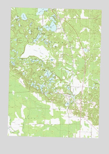
Kempster, WI USGS Topographic Map
Click on map above to begin viewing in our Map Viewer.

This topographic map contains these locations and features:
Feature Name Type Latitude Longitude GNIS ID View Map
Alga LakeLakeN45.3442°W89.2060°1560758View Map
Alta LakeLakeN45.3423°W89.1958°1560803View Map
Bass Lake Country ClubLocaleN45.3550°W89.1865°1581169View Map
Beaver LakeLakeN45.3629°W89.2394°1561467View Map
Birch LakeLakeN45.3591°W89.2223°1561807View Map
Black Oak LakeLakeN45.2985°W89.2145°1561873View Map
Bogus LakeLakeN45.3250°W89.1919°1562013View Map
Bogus SwampSwampN45.3327°W89.2115°1562014View Map
Bogus Swamp State Natural AreaParkN45.3319°W89.2098°2057496View Map
Borth LakeLakeN45.2828°W89.1691°1562083View Map
Chub LakeLakeN45.3138°W89.1692°2784067View Map
Clear LakeLakeN45.3660°W89.2321°1563152View Map
Crooked LakeLakeN45.3192°W89.2047°1563543View Map
Deep Wood LakeLakeN45.3456°W89.2128°1563816View Map
Elder LakeLakeN45.3651°W89.2415°1564496View Map
Evangeline LakeLakeN45.3018°W89.1333°1564726View Map
Forest School (historical)SchoolN45.3119°W89.2493°1840767View Map
Fox LakeLakeN45.3577°W89.2380°1565217View Map
Gabriel LakeLakeN45.2980°W89.1300°1565374View Map
Greater Bass LakeLakeN45.3580°W89.1939°1565793View Map
Hazel LakeLakeN45.3381°W89.1899°1566233View Map
High LakeLakeN45.2987°W89.1680°1566377View Map
Indian LakeLakeN45.3239°W89.2126°1566918View Map
KempsterPopulated PlaceN45.2897°W89.1668°1567401View Map
Kettle LakeLakeN45.3506°W89.2089°1567439View Map
Kimball LakeLakeN45.2897°W89.1617°1567481View Map
KoepenickPopulated PlaceN45.3366°W89.1668°1577683View Map
Lady LakeLakeN45.3677°W89.1903°1567714View Map
Lakeside CemeteryCemeteryN45.3725°W89.2004°1567776View Map
Little Chicago School (historical)SchoolN45.2650°W89.1373°1840784View Map
Little Pike LakeLakeN45.3434°W89.2428°1568351View Map
Long LakeLakeN45.2985°W89.2049°1568552View Map
Lower Bass LakeLakeN45.3052°W89.1914°1568716View Map
Lower Clear LakeLakeN45.3111°W89.1970°1568721View Map
McDonald LakeLakeN45.3220°W89.2300°2784074View Map
Noboken LakeLakeN45.3354°W89.1462°1570324View Map
Ormsby DamDamN45.2569°W89.2490°1792867View Map
Perch LakeLakeN45.3517°W89.2234°1571201View Map
Perch LakeLakeN45.2850°W89.1633°2784127View Map
Perch LakeLakeN45.3218°W89.2250°2784128View Map
Shanty Bottom LakeLakeN45.3244°W89.2290°1573967View Map
Shoestring LakeLakeN45.3147°W89.2000°1574067View Map
Snag LakeLakeN45.3238°W89.2164°1574329View Map
Squaw LakeLakeN45.3226°W89.2082°1574771View Map
Sucker LakeLakeN45.3206°W89.2452°1575010View Map
Summit LakeLakeN45.3745°W89.2072°1575060View Map
Sunfish LakeLakeN45.2974°W89.1884°1575074View Map
Susan LakeLakeN45.3416°W89.2010°1575135View Map
Town of UphamCivilN45.3358°W89.1764°1584321View Map
Typner LakeLakeN45.3079°W89.2056°1575842View Map
Water Power LakeLakeN45.3546°W89.2091°1576285View Map
WRLO-FM (Antigo)TowerN45.3677°W89.1390°1582371View Map

Note: Coordinates in the location and feature list above are referenced to NAD83 datum.


Copyright (C) 2008-2024 Ryan Niemi / Sunset Dynamics ... All Rights Reserved