TopoQuest Logo
Do you find TopoQuest useful?
Help keep TopoQuest running and adding new maps/features by donating!
Bitcoin:  19c7KJd3qBynnjoSw5npx9KScwjBe4ifkT
Litecoin:  LXs6TkuXGGXo1vDsWCkWVdjQX94eUKd6ui
Home View Maps Find Maps Find Places Resources & Links


Pearson, Wisconsin Topographic Map

USGS Map Title: Pearson, WI
USGS Map MRC: 45089C1
DRG (GeoTIFF) Download: o45089c1.tif


Neighboring USGS Topographic Map Quads:


  Elcho, WI  
45089D2
 

  Post Lake, WI  
45089D1
 

  Mole Lake, WI  
45088D8
 

  Kempster, WI  
45089C2
 

  Pearson, WI  
45089C1
 

  Pickerel, WI  
45088C8
 

  Antigo, WI  
45089B2
 

  Bryant, WI  
45089B1
 

  Polar, WI  
45088B8


Map MRC Location:

N46°
W90°
N46°
W89°
H8 H7 H6 H5 H4 H3 H2 H1
G8 G7 G6 G5 G4 G3 G2 G1
F8 F7 F6 F5 F4 F3 F2 F1
E8 E7 E6 E5 E4 E3 E2 E1
D8 D7 D6 D5 D4 D3 D2 D1
C8 C7 C6 C5 C4 C3 C2 C1
B8 B7 B6 B5 B4 B3 B2 B1
A8 A7 A6 A5 A4 A3 A2 A1
N45°
W90°
N45°
W89°

Pearson, WI USGS 1:24K Topographic Map Preview:
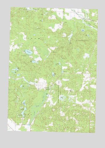
Pearson, WI USGS Topographic Map
Click on map above to begin viewing in our Map Viewer.

This topographic map contains these locations and features:
Feature Name Type Latitude Longitude GNIS ID View Map
Anderson LakeLakeN45.2782°W89.1020°1560858View Map
Blue SpringsSpringN45.3722°W89.1018°1561959View Map
Cloverdale School (historical)SchoolN45.3716°W89.0290°1840752View Map
Crystal Spring Fish HatcheryLocaleN45.2939°W89.0665°1581200View Map
Ferguson PondLakeN45.2950°W89.0668°1564917View Map
Game LakeLakeN45.3204°W89.0904°1565388View Map
Gilkey LakeLakeN45.3532°W89.0211°1565523View Map
High LakeLakeN45.3121°W89.1146°1566378View Map
High LakeLakeN45.3481°W89.0132°1566379View Map
Hunting RiverStreamN45.3644°W89.0209°1566819View Map
Jack LakeLakeN45.3299°W89.0977°1567055View Map
Langlade CountyCivilN45.2623°W89.0719°1581093View Map
Low LakeLakeN45.3095°W89.1184°1568708View Map
Markgras SpringsSpringN45.3608°W89.0487°1569052View Map
North Neva LakeLakeN45.2723°W89.1005°1570470View Map
PearsonPopulated PlaceN45.3641°W89.0165°1571127View Map
Pence LakeLakeN45.3081°W89.0618°1571169View Map
Pence Lake Lookout TowerTowerN45.3305°W89.0640°1581309View Map
Peters LakeLakeN45.2834°W89.0500°1571261View Map
Peters Marsh State Wildlife AreaParkN45.2922°W89.0537°1571264View Map
Rogers LakeLakeN45.2955°W89.1067°1572534View Map
Shadick SpringSpringN45.2869°W89.0690°1573942View Map
South Neva LakeLakeN45.2673°W89.1035°1574471View Map
Stevens SpringsSpringN45.3400°W89.0407°1574883View Map
Upper Ventor LakeLakeN45.3192°W89.0529°1576000View Map
Ventor LakeLakeN45.3113°W89.0490°1576056View Map
Veterans Memorial County ParkParkN45.3261°W89.0998°1576072View Map
Willow SpringsSpringN45.3622°W89.0801°1576799View Map
Wolf River State Fishery AreaParkN45.3658°W89.0282°1580824View Map
Wooduck SpringsSpringN45.3680°W89.0779°1577039View Map

Note: Coordinates in the location and feature list above are referenced to NAD83 datum.


Copyright (C) 2008-2025 Ryan Niemi / Sunset Dynamics ... All Rights Reserved