TopoQuest Logo
Do you find TopoQuest useful?
Help keep TopoQuest running and adding new maps/features by donating!
Bitcoin:  19c7KJd3qBynnjoSw5npx9KScwjBe4ifkT
Litecoin:  LXs6TkuXGGXo1vDsWCkWVdjQX94eUKd6ui
Home View Maps Find Maps Find Places Resources & Links


Kiester, Minnesota Topographic Map

USGS Map Title: Kiester, MN
USGS Map MRC: 43093E6
DRG (GeoTIFF) Download: o43093e6.tif


Neighboring USGS Topographic Map Quads:


  Brush Creek, MN  
43093F7
 

  Wells, MN  
43093F6
 

  Alden, MN  
43093F5
 

  Bricelyn, MN  
43093E7
 

  Kiester, MN  
43093E6
 

  Conger, MN  
43093E5
 

  Buffalo Center NE, IA  
43093D7
 

  Vinje, IA  
43093D6
 

  Lake Mills, IA  
43093D5


Map MRC Location:

N44°
W94°
N44°
W93°
H8 H7 H6 H5 H4 H3 H2 H1
G8 G7 G6 G5 G4 G3 G2 G1
F8 F7 F6 F5 F4 F3 F2 F1
E8 E7 E6 E5 E4 E3 E2 E1
D8 D7 D6 D5 D4 D3 D2 D1
C8 C7 C6 C5 C4 C3 C2 C1
B8 B7 B6 B5 B4 B3 B2 B1
A8 A7 A6 A5 A4 A3 A2 A1
N43°
W94°
N43°
W93°

Kiester, MN USGS 1:24K Topographic Map Preview:
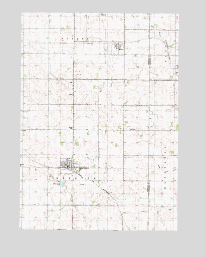
Kiester, MN USGS Topographic Map
Click on map above to begin viewing in our Map Viewer.

This topographic map contains these locations and features:
Feature Name Type Latitude Longitude GNIS ID View Map
American Lutheran Church CemeteryCemeteryN43.5358°W93.7041°1817525View Map
City of KiesterCivilN43.5366°W93.7112°2395527View Map
City of WaltersCivilN43.6049°W93.6743°2397184View Map
Fairview CemeteryCemeteryN43.5583°W93.7088°643504View Map
Gospel ChurchChurchN43.5336°W93.7072°1817524View Map
Grace United Methodist ChurchChurchN43.5380°W93.7113°2049203View Map
KiesterPopulated PlaceN43.5363°W93.7122°646138View Map
KiesterLocaleN43.5350°W93.7127°2049199View Map
Kiester AmbulanceBuildingN43.5365°W93.7085°2721296View Map
Kiester City HallBuildingN43.5363°W93.7124°2049196View Map
Kiester Medical CenterHospitalN43.5366°W93.7124°2049195View Map
Kiester Middle SchoolSchoolN43.5375°W93.7138°2049200View Map
Kiester Post OfficePost OfficeN43.5361°W93.7124°2049198View Map
Kiester Volunteer Fire DepartmentBuildingN43.5356°W93.7085°2049197View Map
Our Saviour's Lutheran ChurchChurchN43.5363°W93.7161°2049201View Map
Passer Landing Strip (historical)AirportN43.6238°W93.6877°1817522View Map
Saint Johns CemeteryCemeteryN43.6072°W93.6933°1817523View Map
Township of KiesterCivilN43.5432°W93.7084°664627View Map
United Brethren Cemetery (historical)CemeteryN43.5583°W93.6405°2049887View Map
United Lutheran CemeteryCemeteryN43.6069°W93.6780°2049243View Map
WaltersPopulated PlaceN43.6058°W93.6733°653749View Map
Walters (historical)LocaleN43.6077°W93.6736°2049166View Map
Walters Post OfficePost OfficeN43.6058°W93.6733°2049301View Map
Walters Volunteer Fire DepartmentBuildingN43.6059°W93.6737°2666476View Map

Note: Coordinates in the location and feature list above are referenced to NAD83 datum.


Copyright (C) 2008-2025 Ryan Niemi / Sunset Dynamics ... All Rights Reserved