TopoQuest Logo
Do you find TopoQuest useful?
Help keep TopoQuest running and adding new maps/features by donating!
Bitcoin:  19c7KJd3qBynnjoSw5npx9KScwjBe4ifkT
Litecoin:  LXs6TkuXGGXo1vDsWCkWVdjQX94eUKd6ui
Home View Maps Find Maps Find Places Resources & Links


Conger, Minnesota Topographic Map

USGS Map Title: Conger, MN
USGS Map MRC: 43093E5
DRG (GeoTIFF) Download: o43093e5.tif


Neighboring USGS Topographic Map Quads:


  Wells, MN  
43093F6
 

  Alden, MN  
43093F5
 

  Albert Lea West, MN  
43093F4
 

  Kiester, MN  
43093E6
 

  Conger, MN  
43093E5
 

  Emmons, MN  
43093E4
 

  Vinje, IA  
43093D6
 

  Lake Mills, IA  
43093D5
 

  Bristol, IA  
43093D4


Map MRC Location:

N44°
W94°
N44°
W93°
H8 H7 H6 H5 H4 H3 H2 H1
G8 G7 G6 G5 G4 G3 G2 G1
F8 F7 F6 F5 F4 F3 F2 F1
E8 E7 E6 E5 E4 E3 E2 E1
D8 D7 D6 D5 D4 D3 D2 D1
C8 C7 C6 C5 C4 C3 C2 C1
B8 B7 B6 B5 B4 B3 B2 B1
A8 A7 A6 A5 A4 A3 A2 A1
N43°
W94°
N43°
W93°

Conger, MN USGS 1:24K Topographic Map Preview:
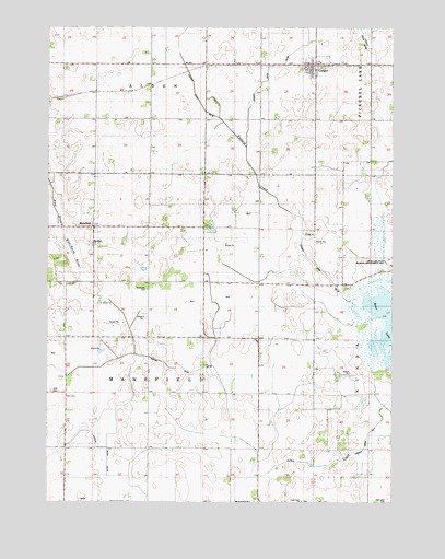
Conger, MN USGS Topographic Map
Click on map above to begin viewing in our Map Viewer.

This topographic map contains these locations and features:
Feature Name Type Latitude Longitude GNIS ID View Map
Babbitt SchoolSchoolN43.6025°W93.5483°639544View Map
Bear LakeLakeN43.5469°W93.5004°639774View Map
Bidne SchoolSchoolN43.5241°W93.5283°640075View Map
City of CongerCivilN43.6146°W93.5284°2393619View Map
CongerPopulated PlaceN43.6150°W93.5283°641442View Map
Conger (historical)LocaleN43.6152°W93.5283°2049857View Map
Conger City HallBuildingN43.6150°W93.5283°2049856View Map
Conger Community CemeteryCemeteryN43.6158°W93.5185°2049905View Map
Conger Fire DepartmentBuildingN43.6140°W93.5280°2049855View Map
Conger Post OfficePost OfficeN43.6150°W93.5283°2049853View Map
County Ditch Number FiveCanalN43.5130°W93.5122°1817519View Map
County Ditch Number FortyeightCanalN43.6091°W93.5488°1817536View Map
County Ditch Number TwentythreeCanalN43.6138°W93.5752°1817537View Map
Judicial Ditch Number TwentyfiveCanalN43.5386°W93.5961°1817518View Map
Judicial Ditch Number TwentysixCanalN43.5186°W93.6127°1817517View Map
Laugen SchoolSchoolN43.5291°W93.5694°646523View Map
MansfieldPopulated PlaceN43.5725°W93.6088°647450View Map
Mansfield ChurchChurchN43.5680°W93.6088°1817521View Map
Mansfield Lutheran CemeteryCemeteryN43.5685°W93.6100°2049888View Map
Mansfield Post Office (historical)Post OfficeN43.5725°W93.6088°2049715View Map
Oak Lawn CemeteryCemeteryN43.5001°W93.5015°648841View Map
Opdahl SchoolSchoolN43.5725°W93.5494°648977View Map
Saint Paul Lutheran ChurchChurchN43.6150°W93.5283°2049854View Map
Schmidt SchoolLocaleN43.5580°W93.5958°651297View Map
Schnieder CemeteryCemeteryN43.5558°W93.5894°651305View Map
State Line SchoolLocaleN43.5011°W93.5494°652590View Map
Steward CreekStreamN43.5511°W93.5105°1817538View Map
Township of MansfieldCivilN43.5430°W93.5885°664892View Map
Zion CemeteryCemeteryN43.5291°W93.6236°1817520View Map
Zion ChurchChurchN43.5288°W93.6238°654462View Map

Note: Coordinates in the location and feature list above are referenced to NAD83 datum.


Copyright (C) 2008-2025 Ryan Niemi / Sunset Dynamics ... All Rights Reserved