TopoQuest Logo
Do you find TopoQuest useful?
Help keep TopoQuest running and adding new maps/features by donating!
Bitcoin:  19c7KJd3qBynnjoSw5npx9KScwjBe4ifkT
Litecoin:  LXs6TkuXGGXo1vDsWCkWVdjQX94eUKd6ui
Home View Maps Find Maps Find Places Resources & Links


Lake Mills, Iowa Topographic Map

USGS Map Title: Lake Mills, IA
USGS Map MRC: 43093D5
DRG (GeoTIFF) Download: o43093d5.tif


Neighboring USGS Topographic Map Quads:


  Kiester, MN  
43093E6
 

  Conger, MN  
43093E5
 

  Emmons, MN  
43093E4
 

  Vinje, IA  
43093D6
 

  Lake Mills, IA  
43093D5
 

  Bristol, IA  
43093D4
 

  Forest City, IA  
43093C6
 

  Pilot Knob, IA  
43093C5
 

  Fertile, IA  
43093C4


Map MRC Location:

N44°
W94°
N44°
W93°
H8 H7 H6 H5 H4 H3 H2 H1
G8 G7 G6 G5 G4 G3 G2 G1
F8 F7 F6 F5 F4 F3 F2 F1
E8 E7 E6 E5 E4 E3 E2 E1
D8 D7 D6 D5 D4 D3 D2 D1
C8 C7 C6 C5 C4 C3 C2 C1
B8 B7 B6 B5 B4 B3 B2 B1
A8 A7 A6 A5 A4 A3 A2 A1
N43°
W94°
N43°
W93°

Lake Mills, IA USGS 1:24K Topographic Map Preview:
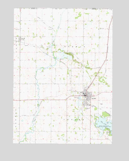
Lake Mills, IA USGS Topographic Map
Click on map above to begin viewing in our Map Viewer.

This topographic map contains these locations and features:
Feature Name Type Latitude Longitude GNIS ID View Map
Asbury United Methodist ChurchChurchN43.4194°W93.5313°1925655View Map
Bolstad Wildlife AreaParkN43.4472°W93.5427°1925586View Map
Center ChurchChurchN43.4011°W93.6127°455281View Map
Center Synod CemeteryCemeteryN43.4010°W93.6124°1925666View Map
City of Lake MillsCivilN43.4169°W93.5321°2395595View Map
City of ScarvilleCivilN43.4710°W93.6166°2396551View Map
Dahle ParkParkN43.4661°W93.5760°455766View Map
Dakken Chiropractic OfficeHospitalN43.4200°W93.5341°1925660View Map
Drainage Ditch Number 108CanalN43.4847°W93.5858°465760View Map
Drainage Ditch Number 18CanalN43.4680°W93.6163°465777View Map
Drainage Ditch Number 92CanalN43.4502°W93.5430°465821View Map
Family Dental CenterHospitalN43.4191°W93.5308°1925663View Map
Family Optometry CenterHospitalN43.4197°W93.5341°1925662View Map
Grace Community ChurchChurchN43.4188°W93.5344°1925654View Map
Greenley Lake (historical)LakeN43.4111°W93.5427°464047View Map
Helgeson Truman Civic CenterBuildingN43.4191°W93.5347°1925647View Map
Hogsback Marsh Public Hunting AreaAreaN43.4550°W93.5583°464358View Map
Hogsback Park AnnexParkN43.4522°W93.5685°457547View Map
Hogsback Wildlife AreaParkN43.4583°W93.5572°457546View Map
Immanuel CemeteryCemeteryN43.4802°W93.6175°457763View Map
Immanuel Lutheran ChurchChurchN43.4705°W93.6177°1925628View Map
Lake MillsLocaleN43.4200°W93.5383°1925636View Map
Lake MillsPopulated PlaceN43.4194°W93.5333°458192View Map
Lake Mills Ambulance ServiceBuildingN43.4183°W93.5335°2599819View Map
Lake Mills Care CenterHospitalN43.4105°W93.5294°1925659View Map
Lake Mills ClinicHospitalN43.4108°W93.5283°1925658View Map
Lake Mills Community Elementary SchoolSchoolN43.4153°W93.5314°2719970View Map
Lake Mills Community High SchoolSchoolN43.4153°W93.5314°1925665View Map
Lake Mills Community Middle SchoolSchoolN43.4153°W93.5314°2720020View Map
Lake Mills Fire DepartmentBuildingN43.4196°W93.5373°1925644View Map
Lake Mills Municipal AirportAirportN43.4088°W93.5117°466847View Map
Lake Mills Police DepartmentBuildingN43.4169°W93.5354°1925648View Map
Lake Mills Post OfficePost OfficeN43.4205°W93.5352°1925646View Map
Lake Mills Public LibraryBuildingN43.4188°W93.5327°1925650View Map
Lande River Conservation Wildlife AreaParkN43.4416°W93.5919°1925587View Map
Larson - Tweed Wildlife AreaParkN43.4472°W93.5335°1925585View Map
Lime Creek CemeteryCemeteryN43.4999°W93.5327°646661View Map
Lime Creek ChurchChurchN43.5000°W93.5327°646662View Map
Lime Creek ChurchChurchN43.4816°W93.5166°458348View Map
Mercy Family Care CenterHospitalN43.4186°W93.5272°1925664View Map
Oakwood ParkParkN43.4133°W93.5316°1925649View Map
Related Health Care CenterHospitalN43.4163°W93.5294°1925661View Map
Rice LakeReservoirN43.3969°W93.5127°460604View Map
Rice Lake Golf and Country ClubLocaleN43.3861°W93.5072°1925667View Map
Rice Lake State ParkParkN43.3833°W93.5022°460606View Map
Saint Patricks Catholic ChurchChurchN43.4161°W93.5313°1925652View Map
Salem CemeteryCemeteryN43.4260°W93.5330°461361View Map
Salem Lutheran ChurchChurchN43.4163°W93.5322°1925651View Map
Salem Memorial CemeteryCemeteryN43.4452°W93.5140°461371View Map
ScarvilleLocaleN43.4694°W93.6174°1925629View Map
ScarvillePopulated PlaceN43.4705°W93.6177°461455View Map
Scarville Lutheran SchoolSchoolN43.4732°W93.6187°1925627View Map
Scarville Post OfficePost OfficeN43.4705°W93.6177°1925625View Map
Scarville Synod Lutheran ChurchChurchN43.4705°W93.6177°1925626View Map
Sion Lutheran ChurchChurchN43.4194°W93.5333°1925657View Map
Sunnyside CemeteryCemeteryN43.4089°W93.5319°462096View Map
Synod CemeteryCemeteryN43.4094°W93.5238°462164View Map
Synod CemeteryCemeteryN43.4876°W93.6174°462165View Map
Synod Lutheran ChurchChurchN43.4144°W93.5252°1925653View Map
Top of Iowa Co-op ElevatorLocaleN43.4705°W93.6177°1925624View Map
Top of Iowa Cooperative ElevatorLocaleN43.4225°W93.5344°1925645View Map
Township of CenterCivilN43.3864°W93.5574°467587View Map
Township of NorwayCivilN43.4649°W93.5573°468452View Map
Victory Christian FellowshipChurchN43.4188°W93.5269°1925656View Map
Winnebago County Waterfowl Production AreaParkN43.4846°W93.5322°2765562View Map
Wood Duck MarshParkN43.4000°W93.5433°1925567View Map

Note: Coordinates in the location and feature list above are referenced to NAD83 datum.


Copyright (C) 2008-2024 Ryan Niemi / Sunset Dynamics ... All Rights Reserved