TopoQuest Logo
Do you find TopoQuest useful?
Help keep TopoQuest running and adding new maps/features by donating!
Bitcoin:  19c7KJd3qBynnjoSw5npx9KScwjBe4ifkT
Litecoin:  LXs6TkuXGGXo1vDsWCkWVdjQX94eUKd6ui
Home View Maps Find Maps Find Places Resources & Links


Kilmichael, Mississippi Topographic Map

USGS Map Title: Kilmichael, MS
USGS Map MRC: 33089D5
DRG (GeoTIFF) Download: o33089d5.tif


Neighboring USGS Topographic Map Quads:


  Eskridge, MS  
33089E6
 

  Lodi, MS  
33089E5
 

  Little Sand Creek, MS  
33089E4
 

  Winona, MS  
33089D6
 

  Kilmichael, MS  
33089D5
 

  Stewart, MS  
33089D4
 

  Vaiden, MS  
33089C6
 

  Poplar Creek, MS  
33089C5
 

  French Camp, MS  
33089C4


Map MRC Location:

N34°
W90°
N34°
W89°
H8 H7 H6 H5 H4 H3 H2 H1
G8 G7 G6 G5 G4 G3 G2 G1
F8 F7 F6 F5 F4 F3 F2 F1
E8 E7 E6 E5 E4 E3 E2 E1
D8 D7 D6 D5 D4 D3 D2 D1
C8 C7 C6 C5 C4 C3 C2 C1
B8 B7 B6 B5 B4 B3 B2 B1
A8 A7 A6 A5 A4 A3 A2 A1
N33°
W90°
N33°
W89°

Kilmichael, MS USGS 1:24K Topographic Map Preview:
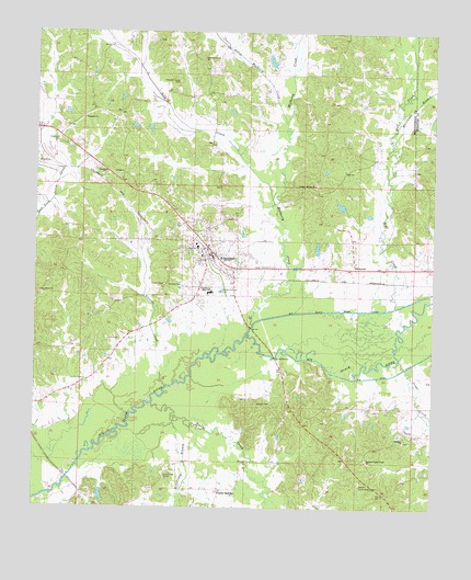
Kilmichael, MS USGS Topographic Map
Click on map above to begin viewing in our Map Viewer.

This topographic map contains these locations and features:
Feature Name Type Latitude Longitude GNIS ID View Map
Armstrong BranchStreamN33.3990°W89.5817°666373View Map
Barrett Lake DamDamN33.4735°W89.5001°682121View Map
Bethlehem ChurchChurchN33.4315°W89.6234°667010View Map
Big Black River CanalCanalN33.4270°W89.5308°667076View Map
Crape CreekStreamN33.4118°W89.5084°668931View Map
Dorris Bridge (historical)BridgeN33.4223°W89.5570°683300View Map
Elkhorn ChurchChurchN33.3932°W89.5087°669723View Map
Flowers CemeteryCemeteryN33.4337°W89.5851°670057View Map
Flowers CreekStreamN33.4068°W89.5840°670059View Map
Griffin CemeteryCemeteryN33.4087°W89.6095°670741View Map
Griffin CemeteryCemeteryN33.4193°W89.5987°670742View Map
H M Alexander Lake DamDamN33.4918°W89.5501°682141View Map
Hurricane BranchStreamN33.4710°W89.5134°671605View Map
J W Braswell Pond DamDamN33.3801°W89.6017°682032View Map
Jacks SloughStreamN33.4168°W89.5115°671765View Map
KilmichaelPopulated PlaceN33.4435°W89.5717°672122View Map
Kilmichael Baptist ChurchChurchN33.4421°W89.5701°683313View Map
Kilmichael City Police DepartmentBuildingN33.4414°W89.5697°2754161View Map
Kilmichael Elementary SchoolSchoolN33.4443°W89.5748°705906View Map
Kilmichael High SchoolSchoolN33.4435°W89.5742°705907View Map
Kilmichael HospitalHospitalN33.4414°W89.5727°2672751View Map
Kilmichael Lagoon DamDamN33.4268°W89.5667°682074View Map
Kilmichael Post OfficePost OfficeN33.4413°W89.5687°2768715View Map
Kilmichael Vocational High SchoolSchoolN33.4315°W89.5704°683314View Map
Kilmichael Volunteer Fire DepartmentBuildingN33.4395°W89.5693°2665821View Map
Kindred CemeteryCemeteryN33.4337°W89.5840°672138View Map
Lindsay Bridge (historical)BridgeN33.4223°W89.5098°683318View Map
Lindsey Spring ChurchChurchN33.4598°W89.5384°672511View Map
Lindsey Springs CemeteryCemeteryN33.4610°W89.5373°1959754View Map
Little Mulberry CreekStreamN33.4765°W89.5467°672651View Map
Mississippi No Name 222 DamDamN33.4468°W89.5017°682090View Map
Mississippi No Name 226 DamDamN33.4401°W89.5017°682084View Map
Montgomery CountyCivilN33.4941°W89.6164°711757View Map
Mulberry CreekStreamN33.4237°W89.5570°674458View Map
Nation Community CenterLocaleN33.3812°W89.5220°674521View Map
Nations Poplar Creek ChurchChurchN33.3873°W89.5206°674522View Map
Old Channel Big Black RiverStreamN33.4204°W89.5581°676607View Map
Peebles CemeteryCemeteryN33.4976°W89.5003°1890483View Map
Pleasant Grove CemeteryCemeteryN33.4873°W89.5817°675984View Map
Pleasant Grove ChurchChurchN33.4929°W89.5745°676022View Map
Poplar CreekStreamN33.4023°W89.5881°676223View Map
Poplar SpringsPopulated PlaceN33.3798°W89.5665°676232View Map
Reed CreekStreamN33.4554°W89.5506°676562View Map
Sewells Ferry (historical)CrossingN33.3826°W89.6145°683330View Map
SibleytonPopulated PlaceN33.4382°W89.5251°677768View Map
Stinson CemeteryCemeteryN33.4026°W89.5553°678298View Map
Supervisor District 4CivilN33.4012°W89.5381°711995View Map
Town of KilmichaelCivilN33.4404°W89.5674°2405946View Map
W M Lott Pond DamDamN33.4551°W89.5251°682100View Map
Wilmount CemeteryCemeteryN33.4707°W89.6184°679750View Map
Wilmount ChurchChurchN33.4773°W89.6106°679751View Map
Wolf CreekStreamN33.4279°W89.5123°679813View Map
Wolf Creek (historical)LocaleN33.4668°W89.5167°683337View Map

Note: Coordinates in the location and feature list above are referenced to NAD83 datum.


Copyright (C) 2008-2025 Ryan Niemi / Sunset Dynamics ... All Rights Reserved