TopoQuest Logo
Do you find TopoQuest useful?
Help keep TopoQuest running and adding new maps/features by donating!
Bitcoin:  19c7KJd3qBynnjoSw5npx9KScwjBe4ifkT
Litecoin:  LXs6TkuXGGXo1vDsWCkWVdjQX94eUKd6ui
Home View Maps Find Maps Find Places Resources & Links


Stewart, Mississippi Topographic Map

USGS Map Title: Stewart, MS
USGS Map MRC: 33089D4
DRG (GeoTIFF) Download: o33089d4.tif


Neighboring USGS Topographic Map Quads:


  Lodi, MS  
33089E5
 

  Little Sand Creek, MS  
33089E4
 

  Eupora, MS  
33089E3
 

  Kilmichael, MS  
33089D5
 

  Stewart, MS  
33089D4
 

  Tomnolen, MS  
33089D3
 

  Poplar Creek, MS  
33089C5
 

  French Camp, MS  
33089C4
 

  Weir, MS  
33089C3


Map MRC Location:

N34°
W90°
N34°
W89°
H8 H7 H6 H5 H4 H3 H2 H1
G8 G7 G6 G5 G4 G3 G2 G1
F8 F7 F6 F5 F4 F3 F2 F1
E8 E7 E6 E5 E4 E3 E2 E1
D8 D7 D6 D5 D4 D3 D2 D1
C8 C7 C6 C5 C4 C3 C2 C1
B8 B7 B6 B5 B4 B3 B2 B1
A8 A7 A6 A5 A4 A3 A2 A1
N33°
W90°
N33°
W89°

Stewart, MS USGS 1:24K Topographic Map Preview:
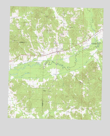
Stewart, MS USGS Topographic Map
Click on map above to begin viewing in our Map Viewer.

This topographic map contains these locations and features:
Feature Name Type Latitude Longitude GNIS ID View Map
Antioch Church (historical)ChurchN33.3779°W89.4498°685827View Map
Box BranchStreamN33.4257°W89.4329°667484View Map
Calabrella CreekStreamN33.4626°W89.3898°667911View Map
Church of GodChurchN33.4740°W89.4470°668468View Map
Crape Creek CemeteryCemeteryN33.3885°W89.4195°707501View Map
Crape Creek ChurchChurchN33.3882°W89.4206°668932View Map
Dacus CemeteryCemeteryN33.3773°W89.4423°669073View Map
Ebenezer BranchStreamN33.4293°W89.4165°669638View Map
Ebenezer CemeteryCemeteryN33.4154°W89.4040°707502View Map
Ebenezer ChurchChurchN33.4160°W89.4048°669651View Map
Ebenezer School (historical)SchoolN33.4146°W89.3934°685849View Map
Freewill CemeteryCemeteryN33.4051°W89.4459°707505View Map
Freewill ChurchChurchN33.4057°W89.4456°670197View Map
Gaylon Williams Lake DamDamN33.4168°W89.4434°682066View Map
Hunting Club Lake DamDamN33.4051°W89.4334°682058View Map
Jenkins CemeteryCemeteryN33.4218°W89.3895°671834View Map
Kilgore (historical)LocaleN33.4376°W89.4798°683312View Map
McCurtain CreekStreamN33.4460°W89.3928°673325View Map
Milligan Springs CemeteryCemeteryN33.4610°W89.4959°705706View Map
Milligan Springs ChurchChurchN33.4618°W89.4951°673650View Map
Mississippi No Name 223 DamDamN33.4451°W89.4967°682086View Map
Mississippi No Name 224 DamDamN33.4468°W89.4917°682089View Map
Murphy BranchStreamN33.4257°W89.4331°674476View Map
New Prospect ChurchChurchN33.4704°W89.4326°674810View Map
Old Antioch CemeteryCemeteryN33.3773°W89.4503°707522View Map
PellezPopulated PlaceN33.4771°W89.3817°675582View Map
Piney Grove ChurchChurchN33.4893°W89.4515°675897View Map
Pleasant Spring ChurchChurchN33.4462°W89.4590°676128View Map
Reeds ChapelChurchN33.4782°W89.4223°676567View Map
Reeds Chapel CemeteryCemeteryN33.4790°W89.4209°682857View Map
Reeds Chapel School (historical)SchoolN33.4785°W89.4187°705724View Map
Sarepta CemeteryCemeteryN33.4732°W89.4501°705726View Map
Serepta ChurchChurchN33.4723°W89.4504°677518View Map
StewartPopulated PlaceN33.4507°W89.4362°678280View Map
Stewart Post OfficePost OfficeN33.4514°W89.4363°2768722View Map
Stewart Volunteer Fire DepartmentBuildingN33.4514°W89.4364°2665822View Map
Sycamore School (historical)SchoolN33.3926°W89.4270°685883View Map
Thompson CemeteryCemeteryN33.4001°W89.4234°678695View Map
Union Baptist ChurchChurchN33.4935°W89.4304°679063View Map
Williams SpringSpringN33.4062°W89.4501°679721View Map
Yates CreekStreamN33.4473°W89.4153°679919View Map
Young CreekStreamN33.4407°W89.4492°679966View Map

Note: Coordinates in the location and feature list above are referenced to NAD83 datum.


Copyright (C) 2008-2025 Ryan Niemi / Sunset Dynamics ... All Rights Reserved