TopoQuest Logo
Do you find TopoQuest useful?
Help keep TopoQuest running and adding new maps/features by donating!
Bitcoin:  19c7KJd3qBynnjoSw5npx9KScwjBe4ifkT
Litecoin:  LXs6TkuXGGXo1vDsWCkWVdjQX94eUKd6ui
Home View Maps Find Maps Find Places Resources & Links


Little Sand Creek, Mississippi Topographic Map

USGS Map Title: Little Sand Creek, MS
USGS Map MRC: 33089E4
DRG (GeoTIFF) Download: o33089e4.tif


Neighboring USGS Topographic Map Quads:


  Sweatman, MS  
33089F5
 

  Cadaretta, MS  
33089F4
 

  Bellefontaine, MS  
33089F3
 

  Lodi, MS  
33089E5
 

  Little Sand Creek, MS  
33089E4
 

  Eupora, MS  
33089E3
 

  Kilmichael, MS  
33089D5
 

  Stewart, MS  
33089D4
 

  Tomnolen, MS  
33089D3


Map MRC Location:

N34°
W90°
N34°
W89°
H8 H7 H6 H5 H4 H3 H2 H1
G8 G7 G6 G5 G4 G3 G2 G1
F8 F7 F6 F5 F4 F3 F2 F1
E8 E7 E6 E5 E4 E3 E2 E1
D8 D7 D6 D5 D4 D3 D2 D1
C8 C7 C6 C5 C4 C3 C2 C1
B8 B7 B6 B5 B4 B3 B2 B1
A8 A7 A6 A5 A4 A3 A2 A1
N33°
W90°
N33°
W89°

Little Sand Creek, MS USGS 1:24K Topographic Map Preview:
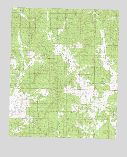
Little Sand Creek, MS USGS Topographic Map
Click on map above to begin viewing in our Map Viewer.

This topographic map contains these locations and features:
Feature Name Type Latitude Longitude GNIS ID View Map
Bogue Watershed Y-30-53 DamDamN33.6218°W89.4917°682247View Map
Edgeworth CemeteryCemeteryN33.5793°W89.4590°669672View Map
Edgeworth ChurchChurchN33.5793°W89.4592°669673View Map
Edward Springs CemeteryCemeteryN33.6021°W89.3912°669681View Map
Edward Springs ChurchChurchN33.6021°W89.3912°669682View Map
Greenboro CemeteryCemeteryN33.5226°W89.3787°670684View Map
Greenboro ChurchChurchN33.5226°W89.3787°670685View Map
Greensboro (historical)LocaleN33.5260°W89.3778°705693View Map
Greensboro Methodist Church (historical)ChurchN33.5279°W89.3762°705694View Map
Hightower CemeteryCemeteryN33.5648°W89.4901°682842View Map
Little Sand CreekStreamN33.5579°W89.3776°672683View Map
Macedonia CemeteryCemeteryN33.5884°W89.3776°672990View Map
Macedonia ChurchChurchN33.5885°W89.3776°673015View Map
Mount Vernon CemeteryCemeteryN33.5551°W89.3931°674290View Map
Mount Vernon ChurchChurchN33.5551°W89.3931°674306View Map
Mount Vernon SchoolSchoolN33.5487°W89.4020°674313View Map
Old Greenboro CemeteryCemeteryN33.5284°W89.3751°675192View Map
Pine Forest CemeteryCemeteryN33.5187°W89.4806°675806View Map
Pine Forest ChurchChurchN33.5187°W89.4806°675808View Map
Sand CreekStreamN33.5248°W89.3962°677333View Map
Supervisor District 1CivilN33.5966°W89.3900°712134View Map
Supervisor District 3CivilN33.5181°W89.3939°712136View Map
Wood ChapelChurchN33.5487°W89.4020°679830View Map

Note: Coordinates in the location and feature list above are referenced to NAD83 datum.


Copyright (C) 2008-2024 Ryan Niemi / Sunset Dynamics ... All Rights Reserved