TopoQuest Logo
Do you find TopoQuest useful?
Help keep TopoQuest running and adding new maps/features by donating!
Bitcoin:  19c7KJd3qBynnjoSw5npx9KScwjBe4ifkT
Litecoin:  LXs6TkuXGGXo1vDsWCkWVdjQX94eUKd6ui
Home View Maps Find Maps Find Places Resources & Links


Poplar Creek, Mississippi Topographic Map

USGS Map Title: Poplar Creek, MS
USGS Map MRC: 33089C5
DRG (GeoTIFF) Download: o33089c5.tif


Neighboring USGS Topographic Map Quads:


  Winona, MS  
33089D6
 

  Kilmichael, MS  
33089D5
 

  Stewart, MS  
33089D4
 

  Vaiden, MS  
33089C6
 

  Poplar Creek, MS  
33089C5
 

  French Camp, MS  
33089C4
 

  Hesterville, MS  
33089B6
 

  Kosciusko NE, MS  
33089B5
 

  Ethel North, MS  
33089B4


Map MRC Location:

N34°
W90°
N34°
W89°
H8 H7 H6 H5 H4 H3 H2 H1
G8 G7 G6 G5 G4 G3 G2 G1
F8 F7 F6 F5 F4 F3 F2 F1
E8 E7 E6 E5 E4 E3 E2 E1
D8 D7 D6 D5 D4 D3 D2 D1
C8 C7 C6 C5 C4 C3 C2 C1
B8 B7 B6 B5 B4 B3 B2 B1
A8 A7 A6 A5 A4 A3 A2 A1
N33°
W90°
N33°
W89°

Poplar Creek, MS USGS 1:24K Topographic Map Preview:
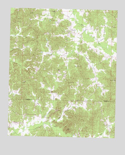
Poplar Creek, MS USGS Topographic Map
Click on map above to begin viewing in our Map Viewer.

This topographic map contains these locations and features:
Feature Name Type Latitude Longitude GNIS ID View Map
Adams CemeteryCemeteryN33.3537°W89.5053°666151View Map
Arnold MountainSummitN33.2587°W89.5567°666382View Map
Bagasha CreekStreamN33.2623°W89.5837°666448View Map
Bethany ChurchChurchN33.3151°W89.5662°666868View Map
Bethel ChurchChurchN33.3585°W89.5042°666932View Map
Bethsaida ChurchChurchN33.3065°W89.5020°667032View Map
Briscoes Mill (historical)LocaleN33.2632°W89.6209°710846View Map
Cross BranchStreamN33.2560°W89.6062°668963View Map
Friendship (historical)Populated PlaceN33.2854°W89.5459°710883View Map
Friendship CemeteryCemeteryN33.2826°W89.5467°670210View Map
Friendship ChurchChurchN33.2860°W89.5448°670232View Map
Friendship School (historical)SchoolN33.2854°W89.5465°710884View Map
Goodin CemeteryCemeteryN33.3648°W89.6165°670499View Map
Hebron ChurchChurchN33.3029°W89.6079°671073View Map
Horsepen BranchStreamN33.3451°W89.5220°671473View Map
Joe Walker CemeteryCemeteryN33.3112°W89.5678°671890View Map
Little Poplar CreekStreamN33.3596°W89.5417°672654View Map
North Center (historical)Populated PlaceN33.2696°W89.5904°710955View Map
North Center School (historical)SchoolN33.2701°W89.5931°710956View Map
Old Friendship CemeteryCemeteryN33.3029°W89.5523°675188View Map
Old Friendship CemeteryCemeteryN33.3037°W89.5556°675189View Map
Old Pine Bluff CemeteryCemeteryN33.3621°W89.6128°675223View Map
Panther CreekStreamN33.2640°W89.5767°675433View Map
Poplar CreekPopulated PlaceN33.3521°W89.5556°676219View Map
Poplar Creek Volunteer Fire DepartmentBuildingN33.3650°W89.5784°2665820View Map
Poplar Springs Union ChurchChurchN33.3723°W89.5720°676246View Map
Shiloh CemeteryCemeteryN33.3076°W89.5359°677667View Map
Simpsons Shop (historical)LocaleN33.3535°W89.5640°683331View Map
Spring Hill Number 2 ChurchChurchN33.3196°W89.5426°678143View Map
Supervisor District 5CivilN33.3621°W89.6204°711996View Map
Thrailkill (historical)LocaleN33.2932°W89.5148°683334View Map
Zilpha Post Office (historical)Post OfficeN33.2635°W89.6201°712973View Map

Note: Coordinates in the location and feature list above are referenced to NAD83 datum.


Copyright (C) 2008-2025 Ryan Niemi / Sunset Dynamics ... All Rights Reserved