TopoQuest Logo
Do you find TopoQuest useful?
Help keep TopoQuest running and adding new maps/features by donating!
Bitcoin:  19c7KJd3qBynnjoSw5npx9KScwjBe4ifkT
Litecoin:  LXs6TkuXGGXo1vDsWCkWVdjQX94eUKd6ui
Home View Maps Find Maps Find Places Resources & Links


Bar N Draw, Wyoming Topographic Map

USGS Map Title: Bar N Draw, WY
USGS Map MRC: 44106H7
DRG (GeoTIFF) Download: o44106h7.tif


Neighboring USGS Topographic Map Quads:


  Pearl School, MT  
45106A8
 

  Decker, MT  
45106A7
 

  Holmes Ranch, MT  
45106A6
 

  Acme, WY  
44106H8
 

  Bar N Draw, WY  
44106H7
 

  Cedar Canyon, WY  
44106H6
 

  Sheridan, WY  
44106G8
 

  Wyarno, WY  
44106G7
 

  Jones Draw, WY  
44106G6


Map MRC Location:

N45°
W107°
N45°
W106°
H8 H7 H6 H5 H4 H3 H2 H1
G8 G7 G6 G5 G4 G3 G2 G1
F8 F7 F6 F5 F4 F3 F2 F1
E8 E7 E6 E5 E4 E3 E2 E1
D8 D7 D6 D5 D4 D3 D2 D1
C8 C7 C6 C5 C4 C3 C2 C1
B8 B7 B6 B5 B4 B3 B2 B1
A8 A7 A6 A5 A4 A3 A2 A1
N44°
W107°
N44°
W106°

Bar N Draw, WY USGS 1:24K Topographic Map Preview:
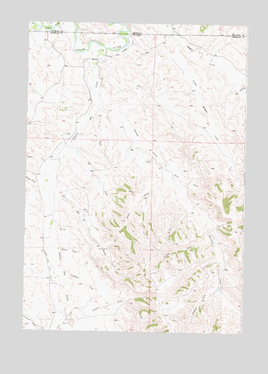
Bar N Draw, WY USGS Topographic Map
Click on map above to begin viewing in our Map Viewer.

This topographic map contains these locations and features:
Feature Name Type Latitude Longitude GNIS ID View Map
Ash DrawValleyN44.9505°W106.8465°1584967View Map
Badger Creek MineMineN44.9783°W106.7673°1704213View Map
Bar N DrawValleyN44.9319°W106.8595°1585107View Map
Carneyville MineMineN44.9008°W106.7726°1704214View Map
Cedar CanyonValleyN44.9730°W106.7540°1586484View Map
Cedar DrawValleyN44.9364°W106.7926°1586494View Map
Coutant CreekStreamN44.9658°W106.8342°1587096View Map
Enochs DrawValleyN44.8797°W106.8431°1588315View Map
Evans MineMineN44.9783°W106.7673°1704215View Map
Gorman Number 2 DamDamN44.9200°W106.8440°1606874View Map
Gorman Reservoir Number 2ReservoirN44.9210°W106.8437°1606875View Map
Heppner DrawValleyN44.8936°W106.7631°1589489View Map
Hickey DrawValleyN44.9164°W106.7706°1589516View Map
Home DrawValleyN44.9080°W106.8548°1589646View Map
Joe DrawValleyN44.9550°W106.8392°1590126View Map
Krenzien DrawValleyN44.8964°W106.8509°1590418View Map
Little Badger CreekStreamN44.9939°W106.7906°1590730View Map
Prairie Dog CreekStreamN44.9897°W106.8309°1602298View Map
Prairie Dog Ditch Number 13CanalN44.9014°W106.8612°1605423View Map
Prairie Dog Ditch Number 14CanalN44.8772°W106.8528°1605425View Map
Rock DrawValleyN44.9397°W106.7931°1593572View Map
Sheep DrawValleyN44.9325°W106.8667°1594201View Map
Wheat DrawValleyN44.9436°W106.8606°1596276View Map

Note: Coordinates in the location and feature list above are referenced to NAD83 datum.


Copyright (C) 2008-2024 Ryan Niemi / Sunset Dynamics ... All Rights Reserved