TopoQuest Logo
Do you find TopoQuest useful?
Help keep TopoQuest running and adding new maps/features by donating!
Bitcoin:  19c7KJd3qBynnjoSw5npx9KScwjBe4ifkT
Litecoin:  LXs6TkuXGGXo1vDsWCkWVdjQX94eUKd6ui
Home View Maps Find Maps Find Places Resources & Links


Holmes Ranch, Montana Topographic Map

USGS Map Title: Holmes Ranch, MT
USGS Map MRC: 45106A6
DRG (GeoTIFF) Download: o45106a6.tif


Neighboring USGS Topographic Map Quads:


  Tongue River Dam, MT  
45106B7
 

  Spring Gulch, MT  
45106B6
 

  Lacey Gulch, MT  
45106B5
 

  Decker, MT  
45106A7
 

  Holmes Ranch, MT  
45106A6
 

  Pine Butte School, MT  
45106A5
 

  Bar N Draw, WY  
44106H7
 

  Cedar Canyon, WY  
44106H6
 

  O T O Ranch, WY  
44106H5


Map MRC Location:

N46°
W107°
N46°
W106°
H8 H7 H6 H5 H4 H3 H2 H1
G8 G7 G6 G5 G4 G3 G2 G1
F8 F7 F6 F5 F4 F3 F2 F1
E8 E7 E6 E5 E4 E3 E2 E1
D8 D7 D6 D5 D4 D3 D2 D1
C8 C7 C6 C5 C4 C3 C2 C1
B8 B7 B6 B5 B4 B3 B2 B1
A8 A7 A6 A5 A4 A3 A2 A1
N45°
W107°
N45°
W106°

Holmes Ranch, MT USGS 1:24K Topographic Map Preview:
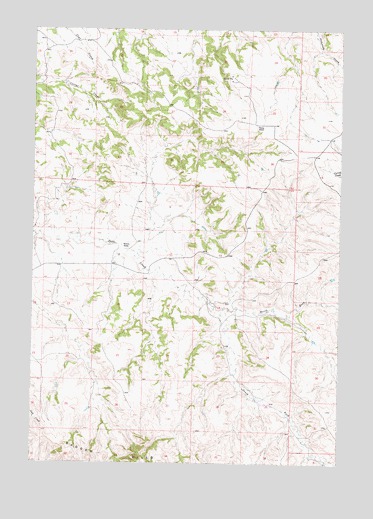
Holmes Ranch, MT USGS Topographic Map
Click on map above to begin viewing in our Map Viewer.

This topographic map contains these locations and features:
Feature Name Type Latitude Longitude GNIS ID View Map
08S41E21CABB01 WellWellN45.1155°W106.7201°807983View Map
08S41E23DBCA01 WellWellN45.1139°W106.6714°807976View Map
08S41E24DCBA01 WellWellN45.1119°W106.6512°807968View Map
08S41E25CCAB01 WellWellN45.0972°W106.6592°807895View Map
08S41E29BAAC01 WellWellN45.1091°W106.7381°807949View Map
08S41E32BBBA01 WellWellN45.0950°W106.7442°807889View Map
08S41E34BCCC01 WellWellN45.0883°W106.7042°807842View Map
09S41E01CBAC01 WellWellN45.0728°W106.6614°807735View Map
09S41E01DADD01 WellWellN45.0716°W106.6431°807728View Map
09S41E05CCDD01 WellWellN45.0683°W106.7417°807682View Map
09S41E05DCBD01 WellWellN45.0694°W106.7339°807694View Map
09S41E05DCBD02 WellWellN45.0861°W106.7339°807813View Map
09S41E05DCBD03 WellWellN45.0694°W106.7339°807695View Map
09S41E05DCCA01 WellWellN45.0683°W106.7339°807680View Map
09S41E05DCCA02 WellWellN45.0683°W106.7339°807681View Map
09S41E06DDCD01 WellWellN45.0680°W106.7498°807678View Map
09S41E08BBAA01 WellWellN45.0672°W106.7417°807668View Map
09S41E08BBAD01 WellWellN45.0658°W106.7426°807658View Map
09S41E08BBDA01 WellWellN45.0647°W106.7417°807639View Map
09S41E08CABC01 WellWellN45.0583°W106.7406°807595View Map
09S41E08CABC02 WellWellN45.0586°W106.7398°807597View Map
09S41E08CACD01 WellWellN45.0575°W106.7390°807594View Map
09S41E08CBAD01 WellWellN45.0586°W106.7417°807598View Map
09S41E08CDBD01 WellWellN45.0550°W106.7392°807572View Map
09S41E09ACBC01 WellWellN45.0628°W106.7145°807627View Map
09S41E12BDCD01 SpringSpringN45.0603°W106.6578°807607View Map
09S41E14ACCD01 WellWellN45.0455°W106.6731°807521View Map
09S41E15ABDB01 WellWellN45.0505°W106.6912°807551View Map
09S41E17CBCC01 WellWellN45.0425°W106.7456°807505View Map
09S41E20DDDD01 WellWellN45.0244°W106.7270°807374View Map
09S41E26AADA01 WellWellN45.0216°W106.6645°807359View Map
09S41E26ABBB01 WellWellN45.0233°W106.6731°807369View Map
09S41E26BABC01 WellWellN45.0230°W106.6792°807368View Map
09S41E35DADD01 WellWellN45.0714°W106.6445°807723View Map
09S42E31CBAC01 WellWellN45.0097°W106.6414°807304View Map
10S42E06ABDD01 WellWellN45.0003°W106.6298°807273View Map
Holmes RanchLocaleN45.0616°W106.7123°772485View Map
North Fork Deer CreekStreamN45.0450°W106.6728°774738View Map
Porter RanchLocaleN45.0975°W106.6601°775389View Map
South Fork Deer CreekStreamN45.0447°W106.6728°776818View Map

Note: Coordinates in the location and feature list above are referenced to NAD83 datum.


Copyright (C) 2008-2025 Ryan Niemi / Sunset Dynamics ... All Rights Reserved