TopoQuest Logo
Do you find TopoQuest useful?
Help keep TopoQuest running and adding new maps/features by donating!
Bitcoin:  19c7KJd3qBynnjoSw5npx9KScwjBe4ifkT
Litecoin:  LXs6TkuXGGXo1vDsWCkWVdjQX94eUKd6ui
Home View Maps Find Maps Find Places Resources & Links


Wyarno, Wyoming Topographic Map

USGS Map Title: Wyarno, WY
USGS Map MRC: 44106G7
DRG (GeoTIFF) Download: o44106g7.tif


Neighboring USGS Topographic Map Quads:


  Acme, WY  
44106H8
 

  Bar N Draw, WY  
44106H7
 

  Cedar Canyon, WY  
44106H6
 

  Sheridan, WY  
44106G8
 

  Wyarno, WY  
44106G7
 

  Jones Draw, WY  
44106G6
 

  Big Horn, WY  
44106F8
 

  Buffalo Run Creek, WY  
44106F7
 

  Verona, WY  
44106F6


Map MRC Location:

N45°
W107°
N45°
W106°
H8 H7 H6 H5 H4 H3 H2 H1
G8 G7 G6 G5 G4 G3 G2 G1
F8 F7 F6 F5 F4 F3 F2 F1
E8 E7 E6 E5 E4 E3 E2 E1
D8 D7 D6 D5 D4 D3 D2 D1
C8 C7 C6 C5 C4 C3 C2 C1
B8 B7 B6 B5 B4 B3 B2 B1
A8 A7 A6 A5 A4 A3 A2 A1
N44°
W107°
N44°
W106°

Wyarno, WY USGS 1:24K Topographic Map Preview:
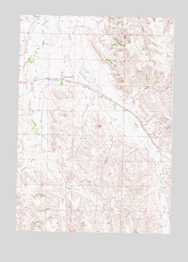
Wyarno, WY USGS Topographic Map
Click on map above to begin viewing in our Map Viewer.

This topographic map contains these locations and features:
Feature Name Type Latitude Longitude GNIS ID View Map
Allens DrawValleyN44.7630°W106.8384°1584798View Map
Arno Quarry MineMineN44.8153°W106.7767°1704223View Map
Bates DrawValleyN44.8700°W106.8578°1585197View Map
Burgass Reservoir Number 2ReservoirN44.8733°W106.8473°1606879View Map
Burgess Number 1 DamDamN44.8716°W106.8473°1606838View Map
Burgess Number 2 DamDamN44.8733°W106.8473°1606878View Map
Burgess Reservoir Number 1ReservoirN44.8716°W106.8473°1606839View Map
Clearmont Fire DistrictBuildingN44.8133°W106.7741°2673558View Map
Dawson DrawValleyN44.7939°W106.8551°1587379View Map
Dow ProngStreamN44.7905°W106.7606°1587756View Map
Dutch CreekStreamN44.8722°W106.8492°1609086View Map
Dutch CreekStreamN44.7919°W106.7503°1587942View Map
Eyechaner DrawValleyN44.8166°W106.7951°1588358View Map
Fields DrawValleyN44.7719°W106.8392°1588448View Map
Hape DamDamN44.8733°W106.8073°1606856View Map
Hape ReservoirReservoirN44.8733°W106.8073°1606857View Map
Hazel PeakSummitN44.8116°W106.8103°1589446View Map
Helvey DrawValleyN44.7755°W106.7584°1589478View Map
Johnston DrawValleyN44.8719°W106.8590°1590206View Map
Kahn and Roberts DamDamN44.8083°W106.8606°1606868View Map
Kahn and Roberts ReservoirReservoirN44.8083°W106.8606°1606869View Map
Kahn DamDamN44.8233°W106.8606°1606824View Map
Kahn ReservoirReservoirN44.8233°W106.8606°1606825View Map
McKey Boarding Home (historical)HospitalN44.8133°W106.7740°1794879View Map
Negro DrawValleyN44.8219°W106.7853°1591991View Map
Paul Number 3 DamDamN44.7766°W106.8373°1606880View Map
Paul Number 3 ReservoirReservoirN44.7766°W106.8373°1606881View Map
Plum CreekStreamN44.8330°W106.8134°1592882View Map
Prairie Dog Ditch Number 11CanalN44.8316°W106.8706°1605421View Map
Prairie Dog Ditch Number 13CanalN44.8639°W106.8665°1605424View Map
Symons AirportAirportN44.8394°W106.8204°1608891View Map
University of Wyoming Experiment StationLocaleN44.8397°W106.8395°1595847View Map
West Fork Wildcat CreekStreamN44.7775°W106.8378°1597003View Map
Wildcat CreekStreamN44.8480°W106.8642°1596387View Map
WyarnoPopulated PlaceN44.8133°W106.7740°1597548View Map
Wyarno DrawValleyN44.8053°W106.7640°1596639View Map
Wyarno Post OfficePost OfficeN44.8131°W106.7738°2768535View Map

Note: Coordinates in the location and feature list above are referenced to NAD83 datum.


Copyright (C) 2008-2025 Ryan Niemi / Sunset Dynamics ... All Rights Reserved