TopoQuest Logo
Do you find TopoQuest useful?
Help keep TopoQuest running and adding new maps/features by donating!
Bitcoin:  19c7KJd3qBynnjoSw5npx9KScwjBe4ifkT
Litecoin:  LXs6TkuXGGXo1vDsWCkWVdjQX94eUKd6ui
Home View Maps Find Maps Find Places Resources & Links


Kings Point, Missouri Topographic Map

USGS Map Title: Kings Point, MO
USGS Map MRC: 37093C8
DRG (GeoTIFF) Download: o37093c8.tif


Neighboring USGS Topographic Map Quads:


  Golden City, MO  
37094D1
 

  Lockwood, MO  
37093D8
 

  Greenfield, MO  
37093D7
 

  Dudenville, MO  
37094C1
 

  Kings Point, MO  
37093C8
 

  South Greenfield, MO  
37093C7
 

  La Russell, MO  
37094B1
 

  Rescue, MO  
37093B8
 

  Miller, MO  
37093B7


Map MRC Location:

N38°
W94°
N38°
W93°
H8 H7 H6 H5 H4 H3 H2 H1
G8 G7 G6 G5 G4 G3 G2 G1
F8 F7 F6 F5 F4 F3 F2 F1
E8 E7 E6 E5 E4 E3 E2 E1
D8 D7 D6 D5 D4 D3 D2 D1
C8 C7 C6 C5 C4 C3 C2 C1
B8 B7 B6 B5 B4 B3 B2 B1
A8 A7 A6 A5 A4 A3 A2 A1
N37°
W94°
N37°
W93°

Kings Point, MO USGS 1:24K Topographic Map Preview:
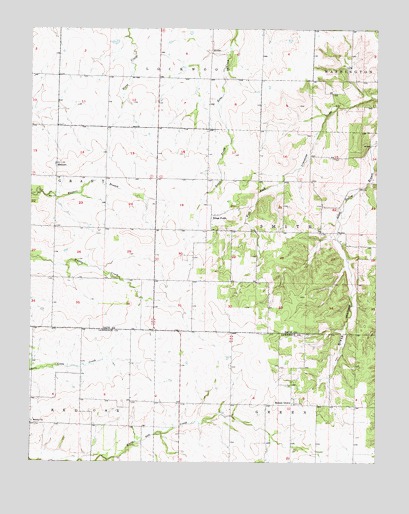
Kings Point, MO USGS Topographic Map
Click on map above to begin viewing in our Map Viewer.

This topographic map contains these locations and features:
Feature Name Type Latitude Longitude GNIS ID View Map
Boehne Field (historical)AirportN37.3667°W93.9919°758791View Map
Cherry Grove School (historical)SchoolN37.3620°W93.9908°746294View Map
Cross School (historical)SchoolN37.2678°W93.9635°746364View Map
Freedom School (historical)SchoolN37.3026°W93.9283°746299View Map
Glass HollowValleyN37.3139°W93.8894°718488View Map
Hedeman Farms Lake DamDamN37.3484°W93.9685°762954View Map
Hedeman LakeReservoirN37.3484°W93.9685°762955View Map
Higgins School (historical)SchoolN37.3575°W93.9266°746297View Map
Kings PointPopulated PlaceN37.3212°W93.9347°720626View Map
Kings Point School (historical)SchoolN37.3173°W93.9352°746298View Map
MeinertPopulated PlaceN37.3353°W93.9908°722203View Map
Monitor School (historical)SchoolN37.3034°W93.9849°746296View Map
Round GrovePopulated PlaceN37.2667°W93.9052°725597View Map
Round Grove School (historical)SchoolN37.2671°W93.9045°746365View Map
Salem ChurchChurchN37.2617°W93.9994°725931View Map
Spain LakeReservoirN37.3334°W93.9369°763056View Map
Spain Lake DamDamN37.3334°W93.9369°763055View Map
Sunnyside School (historical)SchoolN37.3326°W93.9830°746295View Map
Township of SmithCivilN37.3180°W93.9002°766561View Map

Note: Coordinates in the location and feature list above are referenced to NAD83 datum.


Copyright (C) 2008-2024 Ryan Niemi / Sunset Dynamics ... All Rights Reserved