TopoQuest Logo
Do you find TopoQuest useful?
Help keep TopoQuest running and adding new maps/features by donating!
Bitcoin:  19c7KJd3qBynnjoSw5npx9KScwjBe4ifkT
Litecoin:  LXs6TkuXGGXo1vDsWCkWVdjQX94eUKd6ui
Home View Maps Find Maps Find Places Resources & Links


Miller, Missouri Topographic Map

USGS Map Title: Miller, MO
USGS Map MRC: 37093B7
DRG (GeoTIFF) Download: o37093b7.tif


Neighboring USGS Topographic Map Quads:


  Kings Point, MO  
37093C8
 

  South Greenfield, MO  
37093C7
 

  Everton, MO  
37093C6
 

  Rescue, MO  
37093B8
 

  Miller, MO  
37093B7
 

  Halltown, MO  
37093B6
 

  Stotts City, MO  
37093A8
 

  Mount Vernon, MO  
37093A7
 

  Chesapeake, MO  
37093A6


Map MRC Location:

N38°
W94°
N38°
W93°
H8 H7 H6 H5 H4 H3 H2 H1
G8 G7 G6 G5 G4 G3 G2 G1
F8 F7 F6 F5 F4 F3 F2 F1
E8 E7 E6 E5 E4 E3 E2 E1
D8 D7 D6 D5 D4 D3 D2 D1
C8 C7 C6 C5 C4 C3 C2 C1
B8 B7 B6 B5 B4 B3 B2 B1
A8 A7 A6 A5 A4 A3 A2 A1
N37°
W94°
N37°
W93°

Miller, MO USGS 1:24K Topographic Map Preview:
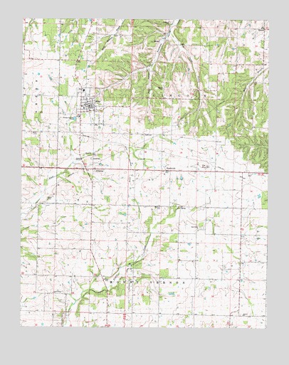
Miller, MO USGS Topographic Map
Click on map above to begin viewing in our Map Viewer.

This topographic map contains these locations and features:
Feature Name Type Latitude Longitude GNIS ID View Map
AlbatrossPopulated PlaceN37.1892°W93.8391°713186View Map
CallPopulated PlaceN37.2012°W93.7772°740471View Map
Center School (historical)SchoolN37.1481°W93.8677°746384View Map
Central Elementary SchoolSchoolN37.2144°W93.8444°2710334View Map
City of MillerCivilN37.2148°W93.8406°2395327View Map
Davis CemeteryCemeteryN37.2034°W93.8127°716707View Map
Fairplay School (historical)SchoolN37.1887°W93.7677°746388View Map
Grove CemeteryCemeteryN37.1934°W93.8396°718899View Map
HeatonvillePopulated PlaceN37.1884°W93.7994°755552View Map
Heatonville School (historical)SchoolN37.1892°W93.8037°746389View Map
Henson CemeteryCemeteryN37.1437°W93.8308°719389View Map
Hickman CemeteryCemeteryN37.1743°W93.8046°719424View Map
Highland ChapelChurchN37.2220°W93.8035°719565View Map
Liberty School (historical)SchoolN37.1463°W93.8360°746385View Map
MillerPopulated PlaceN37.2148°W93.8399°722367View Map
Miller Fire and RescueBuildingN37.2152°W93.8341°2621440View Map
Miller High SchoolSchoolN37.2211°W93.8439°2710335View Map
Miller Post OfficePost OfficeN37.2150°W93.8396°2782715View Map
Miller Rural Fire DepartmentBuildingN37.2152°W93.8341°2621308View Map
Ozark Prairie CemeteryCemeteryN37.1646°W93.7866°2702408View Map
Ozark Prairie ChurchChurchN37.1648°W93.7858°723942View Map
Piper HollowValleyN37.2303°W93.8094°724424View Map
Pleasant View School (historical)SchoolN37.1520°W93.7894°746390View Map
Salem CemeteryCemeteryN37.1386°W93.8581°2702409View Map
Salem ChapelChurchN37.1392°W93.8583°725930View Map
Shiloh School (historical)SchoolN37.1901°W93.8710°746383View Map
South Sycamore School (historical)SchoolN37.2403°W93.7916°746387View Map
Stahl CemeteryCemeteryN37.1773°W93.8619°726988View Map
StinsonPopulated PlaceN37.2464°W93.7524°727117View Map
Stinson School (historical)SchoolN37.2476°W93.7522°746386View Map
Summit ChurchChurchN37.1303°W93.7624°727292View Map
Sycamore CemeteryCemeteryN37.2487°W93.7996°727404View Map
Township of LincolnCivilN37.2300°W93.8024°766883View Map
Turner HollowValleyN37.2439°W93.7991°727903View Map
Webb CemeteryCemeteryN37.2034°W93.8674°728456View Map

Note: Coordinates in the location and feature list above are referenced to NAD83 datum.


Copyright (C) 2008-2024 Ryan Niemi / Sunset Dynamics ... All Rights Reserved