TopoQuest Logo
Do you find TopoQuest useful?
Help keep TopoQuest running and adding new maps/features by donating!
Bitcoin:  19c7KJd3qBynnjoSw5npx9KScwjBe4ifkT
Litecoin:  LXs6TkuXGGXo1vDsWCkWVdjQX94eUKd6ui
Home View Maps Find Maps Find Places Resources & Links


Knappton, Washington Topographic Map

USGS Map Title: Knappton, WA
USGS Map MRC: 46123C7
DRG (GeoTIFF) Download: o46123c7.tif


Neighboring USGS Topographic Map Quads:


  Long Island, WA  
46123D8
 

  Oman Ranch, WA  
46123D7
 

  Upper Naselle River, WA  
46123D6
 

  Chinook, WA  
46123C8
 

  Knappton, WA  
46123C7
 

  Rosburg, WA  
46123C6
 

  Warrenton, OR  
46123B8
 

  Astoria, OR  
46123B7
 

  Cathlamet Bay, OR  
46123B6


Map MRC Location:

N47°
W124°
N47°
W123°
H8 H7 H6 H5 H4 H3 H2 H1
G8 G7 G6 G5 G4 G3 G2 G1
F8 F7 F6 F5 F4 F3 F2 F1
E8 E7 E6 E5 E4 E3 E2 E1
D8 D7 D6 D5 D4 D3 D2 D1
C8 C7 C6 C5 C4 C3 C2 C1
B8 B7 B6 B5 B4 B3 B2 B1
A8 A7 A6 A5 A4 A3 A2 A1
N46°
W124°
N46°
W123°

Knappton, WA USGS 1:24K Topographic Map Preview:
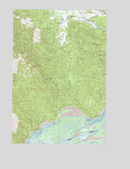
Knappton, WA USGS Topographic Map
Click on map above to begin viewing in our Map Viewer.

This topographic map contains these locations and features:
Feature Name Type Latitude Longitude GNIS ID View Map
Assembly of God ChurchChurchN46.3646°W123.8116°2609699View Map
Bald RidgeRidgeN46.3301°W123.7568°1503143View Map
Bean CreekStreamN46.3084°W123.7999°1503217View Map
Bear MountainSummitN46.2976°W123.8199°1512934View Map
Burnham CreekStreamN46.3384°W123.8035°1503659View Map
Cement CreekStreamN46.3362°W123.8026°1503887View Map
Cliff PointCapeN46.2626°W123.8404°1504021View Map
Congregational United Church of ChristChurchN46.3664°W123.8134°2609700View Map
Davis CreekStreamN46.3407°W123.8110°1504340View Map
Dell CreekStreamN46.3682°W123.8207°1504436View Map
FrankfortPopulated PlaceN46.2804°W123.7560°1510978View Map
Grays PointCapeN46.2746°W123.7710°1505251View Map
Grays Point LightLocaleN46.2734°W123.7671°1505252View Map
Hungry HarborHarborN46.2595°W123.8463°1505667View Map
Johnson CreekStreamN46.3095°W123.7985°1505839View Map
Johnson CreekStreamN46.3743°W123.8079°1505842View Map
Johnson RanchLocaleN46.3095°W123.8004°1505851View Map
KnapptonPopulated PlaceN46.2765°W123.8149°1511076View Map
Lane CreekStreamN46.3732°W123.7888°1506071View Map
MeglerPopulated PlaceN46.2509°W123.8576°1511142View Map
NasellePopulated PlaceN46.3654°W123.8107°1512495View Map
Naselle Census Designated PlaceCensusN46.3724°W123.7960°2408903View Map
Naselle Post OfficePost OfficeN46.3637°W123.8116°2781699View Map
Naselle RidgeRidgeN46.3098°W123.8268°1506928View Map
Naselle Timberland LibraryBuildingN46.3662°W123.8121°2610210View Map
Naselle Volunteer Fire DepartmentBuildingN46.3749°W123.8017°2606738View Map
Naselle-Grays River High SchoolSchoolN46.3620°W123.8110°1506930View Map
Naselle-Grays River SchoolSchoolN46.3693°W123.7918°1506931View Map
O'Conner CreekStreamN46.3745°W123.7968°1507121View Map
Peaceful Hill CemeteryCemeteryN46.3678°W123.8007°1507247View Map
Portuguese PointCapeN46.2765°W123.7607°1507593View Map
Salmon CreekStreamN46.3673°W123.7824°1508052View Map
South Burnham CreekStreamN46.3298°W123.7926°1508507View Map
South Naselle RiverStreamN46.3651°W123.8088°1508556View Map
Wirkkala AirportAirportN46.3562°W123.8146°1533849View Map
Wirkkala Dam Number ThreeDamN46.3398°W123.8046°1532893View Map
Wirkkala LakeReservoirN46.3398°W123.8046°1532894View Map

Note: Coordinates in the location and feature list above are referenced to NAD83 datum.


Copyright (C) 2008-2024 Ryan Niemi / Sunset Dynamics ... All Rights Reserved