TopoQuest Logo
Do you find TopoQuest useful?
Help keep TopoQuest running and adding new maps/features by donating!
Bitcoin:  19c7KJd3qBynnjoSw5npx9KScwjBe4ifkT
Litecoin:  LXs6TkuXGGXo1vDsWCkWVdjQX94eUKd6ui
Home View Maps Find Maps Find Places Resources & Links


Plaskett Ridge, California Topographic Map

USGS Map Title: Plaskett Ridge, CA
USGS Map MRC: 39122F8
DRG (GeoTIFF) Download: o39122f8.tif


Neighboring USGS Topographic Map Quads:


  Newhouse Ridge, CA  
39123G1
 

  Mendocino Pass, CA  
39122G8
 

  Log Spring, CA  
39122G7
 

  Thatcher Ridge, CA  
39123F1
 

  Plaskett Ridge, CA  
39122F8
 

  Plaskett Meadows, CA  
39122F7
 

  Sanhedrin Mountain, CA  
39123E1
 

  Hull Mountain, CA  
39122E8
 

  Kneecap Ridge, CA  
39122E7


Map MRC Location:

N40°
W123°
N40°
W122°
H8 H7 H6 H5 H4 H3 H2 H1
G8 G7 G6 G5 G4 G3 G2 G1
F8 F7 F6 F5 F4 F3 F2 F1
E8 E7 E6 E5 E4 E3 E2 E1
D8 D7 D6 D5 D4 D3 D2 D1
C8 C7 C6 C5 C4 C3 C2 C1
B8 B7 B6 B5 B4 B3 B2 B1
A8 A7 A6 A5 A4 A3 A2 A1
N39°
W123°
N39°
W122°

Plaskett Ridge, CA USGS 1:24K Topographic Map Preview:
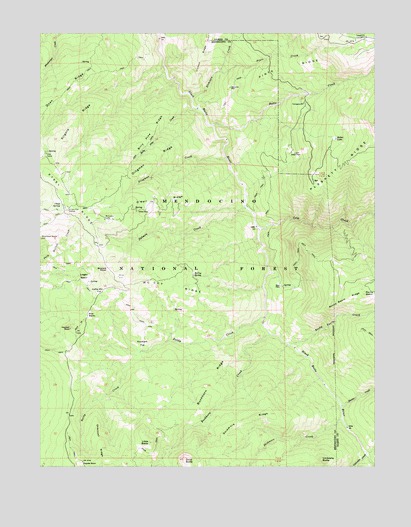
Plaskett Ridge, CA USGS Topographic Map
Click on map above to begin viewing in our Map Viewer.

This topographic map contains these locations and features:
Feature Name Type Latitude Longitude GNIS ID View Map
Atchison CreekStreamN39.7315°W122.9439°256363View Map
Baldy CreekStreamN39.6679°W122.9172°256474View Map
Billy Pike CreekStreamN39.7282°W122.9422°257066View Map
Billy Pike RidgeRidgeN39.7221°W122.9586°257067View Map
Blue RocksSummitN39.6688°W122.9833°1658086View Map
Buckhorn CreekStreamN39.6632°W122.9153°257615View Map
Buckhorn RidgeRidgeN39.6477°W122.9389°257624View Map
Butte CreekStreamN39.7232°W122.9358°257763View Map
Buzzard RoostSummitN39.6818°W122.9764°1658184View Map
Carpenter PlacePopulated PlaceN39.7346°W122.9297°1658226View Map
Charcoal RidgeRidgeN39.6307°W122.9775°258211View Map
Chief SpringSpringN39.7007°W122.9931°258274View Map
Coffee Mill FlatFlatN39.6760°W122.9769°258511View Map
Cold CreekStreamN39.6952°W122.9208°258533View Map
Coyote RockSummitN39.6263°W122.9853°1658336View Map
Dicks ButteSummitN39.6271°W122.9469°259355View Map
Dingman CreekStreamN39.7140°W122.9317°259377View Map
Dingman RidgeRidgeN39.7140°W122.9581°259378View Map
Doan RidgeRidgeN39.7332°W122.9919°266648View Map
French CreekStreamN39.6290°W122.8792°260380View Map
Grizzly Flat StationLocaleN39.6988°W122.9906°260920View Map
Haydon RockSummitN39.6649°W122.9897°1658725View Map
Hays PlacePopulated PlaceN39.6771°W122.9111°1658727View Map
Hunter CreekStreamN39.6427°W122.8889°261641View Map
Keller LakeLakeN39.7196°W122.8907°262098View Map
Keller PlacePopulated PlaceN39.7154°W122.9078°1658888View Map
Kilgore RidgeRidgeN39.7249°W122.9875°262171View Map
Little BaldySummitN39.6315°W122.9603°262511View Map
Logan BasinBasinN39.6799°W122.9869°262782View Map
McCombs CampLocaleN39.6963°W122.9769°263322View Map
McCoy RidgeRidgeN39.6768°W122.9522°263328View Map
McCoy SpringSpringN39.6804°W122.9439°263329View Map
O'Neil PlacePopulated PlaceN39.6988°W122.9603°1659264View Map
O'Neil RidgeRidgeN39.7021°W122.9561°264271View Map
Pinto CreekStreamN39.7388°W122.9333°264800View Map
Pinto RidgeRidgeN39.7404°W122.9078°264801View Map
Plaskett RidgeRidgeN39.7118°W122.8883°264840View Map
Post CampLocaleN39.7154°W122.9989°264975View Map
Rocky BasinBasinN39.6752°W122.8803°265523View Map
Rocky Basin CreekStreamN39.6607°W122.9083°265525View Map
Rocky Basin RidgeRidgeN39.6735°W122.8861°265526View Map
Salmon CreekStreamN39.6999°W122.9247°265752View Map
Skidmore CreekStreamN39.6385°W122.8886°266236View Map
Skidmore RidgeRidgeN39.6382°W122.9247°266237View Map
Surveyors FlatFlatN39.6604°W122.9625°267990View Map
Telephone CampgroundLocaleN39.7477°W122.8831°268126View Map
Umbrella ButteSummitN39.6271°W122.8958°268573View Map
Umbrella CreekStreamN39.6288°W122.8794°268574View Map

Note: Coordinates in the location and feature list above are referenced to NAD83 datum.


Copyright (C) 2008-2024 Ryan Niemi / Sunset Dynamics ... All Rights Reserved