TopoQuest Logo
Do you find TopoQuest useful?
Help keep TopoQuest running and adding new maps/features by donating!
Bitcoin:  19c7KJd3qBynnjoSw5npx9KScwjBe4ifkT
Litecoin:  LXs6TkuXGGXo1vDsWCkWVdjQX94eUKd6ui
Home View Maps Find Maps Find Places Resources & Links


Knob Noster NW, Missouri Topographic Map

USGS Map Title: Knob Noster NW, MO
USGS Map MRC: 38093H6
DRG (GeoTIFF) Download: o38093h6.tif


Neighboring USGS Topographic Map Quads:


  Mayview, MO  
39093A7
 

  Higginsville, MO  
39093A6
 

  Alma, MO  
39093A5
 

  Fayetteville, MO  
38093H7
 

  Knob Noster NW, MO  
38093H6
 

  Concordia, MO  
38093H5
 

  Warrensburg West, MO  
38093G7
 

  Warrensburg East, MO  
38093G6
 

  Knob Noster, MO  
38093G5


Map MRC Location:

N39°
W94°
N39°
W93°
H8 H7 H6 H5 H4 H3 H2 H1
G8 G7 G6 G5 G4 G3 G2 G1
F8 F7 F6 F5 F4 F3 F2 F1
E8 E7 E6 E5 E4 E3 E2 E1
D8 D7 D6 D5 D4 D3 D2 D1
C8 C7 C6 C5 C4 C3 C2 C1
B8 B7 B6 B5 B4 B3 B2 B1
A8 A7 A6 A5 A4 A3 A2 A1
N38°
W94°
N38°
W93°

Knob Noster NW, MO USGS 1:24K Topographic Map Preview:
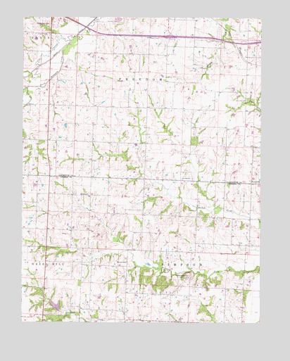
Knob Noster NW, MO USGS Topographic Map
Click on map above to begin viewing in our Map Viewer.

This topographic map contains these locations and features:
Feature Name Type Latitude Longitude GNIS ID View Map
BorlandLocaleN38.9597°W93.7236°740262View Map
Bowman School (historical)SchoolN38.9217°W93.6941°745496View Map
Dyer Lake DamDamN38.9567°W93.7286°762550View Map
East Lynn School (historical)SchoolN38.8867°W93.6758°745495View Map
Ebenezer School (historical)SchoolN38.9625°W93.6333°734338View Map
Elm Grove School (historical)SchoolN38.9497°W93.7319°734335View Map
ErnestvillePopulated PlaceN38.9322°W93.6302°717623View Map
Eureka School (historical)SchoolN38.9106°W93.6402°745497View Map
Foster CemeteryCemeteryN38.8938°W93.6650°718116View Map
Foster School (historical)SchoolN38.8806°W93.7177°745494View Map
Handly School (historical)SchoolN38.9633°W93.7041°734334View Map
Hazel Dell School (historical)SchoolN38.9933°W93.7488°734333View Map
Houston Lake DamDamN38.9917°W93.7436°762549View Map
Johnson County Fire Protection District Station 6 Valley CityBuildingN38.8755°W93.6747°2620765View Map
Lake PajastkaReservoirN38.8819°W93.7324°763297View Map
Lake Pajastka DamDamN38.8800°W93.7302°763296View Map
Mock School (historical)SchoolN38.9631°W93.6669°734337View Map
Mount OlivePopulated PlaceN38.9006°W93.6949°740005View Map
Mulkey (historical)LocaleN38.9817°W93.6324°734336View Map
New Hope CemeteryCemeteryN38.9664°W93.6330°723231View Map
North Blackjack CreekStreamN38.9870°W93.7297°735750View Map
Oak Grove ChurchChurchN38.9272°W93.7155°729789View Map
Priest Post Office (historical)Post OfficeN38.9006°W93.6949°745217View Map
Rattlesnake HillSummitN38.8942°W93.6647°725116View Map
Saint Matthews ChurchChurchN38.9333°W93.6308°747166View Map
Township of SimpsonCivilN38.8789°W93.6680°766841View Map
Zion Hill ChurchChurchN38.9339°W93.6624°729253View Map

Note: Coordinates in the location and feature list above are referenced to NAD83 datum.


Copyright (C) 2008-2025 Ryan Niemi / Sunset Dynamics ... All Rights Reserved