TopoQuest Logo
Do you find TopoQuest useful?
Help keep TopoQuest running and adding new maps/features by donating!
Bitcoin:  19c7KJd3qBynnjoSw5npx9KScwjBe4ifkT
Litecoin:  LXs6TkuXGGXo1vDsWCkWVdjQX94eUKd6ui
Home View Maps Find Maps Find Places Resources & Links


Kosciusko NE, Mississippi Topographic Map

USGS Map Title: Kosciusko NE, MS
USGS Map MRC: 33089B5
DRG (GeoTIFF) Download: o33089b5.tif


Neighboring USGS Topographic Map Quads:


  Vaiden, MS  
33089C6
 

  Poplar Creek, MS  
33089C5
 

  French Camp, MS  
33089C4
 

  Hesterville, MS  
33089B6
 

  Kosciusko NE, MS  
33089B5
 

  Ethel North, MS  
33089B4
 

  McAdams, MS  
33089A6
 

  Kosciusko, MS  
33089A5
 

  Ethel South, MS  
33089A4


Map MRC Location:

N34°
W90°
N34°
W89°
H8 H7 H6 H5 H4 H3 H2 H1
G8 G7 G6 G5 G4 G3 G2 G1
F8 F7 F6 F5 F4 F3 F2 F1
E8 E7 E6 E5 E4 E3 E2 E1
D8 D7 D6 D5 D4 D3 D2 D1
C8 C7 C6 C5 C4 C3 C2 C1
B8 B7 B6 B5 B4 B3 B2 B1
A8 A7 A6 A5 A4 A3 A2 A1
N33°
W90°
N33°
W89°

Kosciusko NE, MS USGS 1:24K Topographic Map Preview:
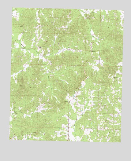
Kosciusko NE, MS USGS Topographic Map
Click on map above to begin viewing in our Map Viewer.

This topographic map contains these locations and features:
Feature Name Type Latitude Longitude GNIS ID View Map
Bethel CemeteryCemeteryN33.1510°W89.6179°710834View Map
Bethel Methodist ChurchChurchN33.1507°W89.6187°666929View Map
Braswell BranchStreamN33.2040°W89.5917°667532View Map
Burkettsville (historical)Populated PlaceN33.1557°W89.6195°710851View Map
Burks Precinct (historical)LocaleN33.2446°W89.5184°690013View Map
Chita (historical)Populated PlaceN33.2257°W89.6023°710862View Map
Forrest (historical)Populated PlaceN33.1760°W89.5173°710881View Map
Forrest School (historical)SchoolN33.1710°W89.5198°710882View Map
Harmony School (historical)SchoolN33.1807°W89.5340°710893View Map
Heath Post Office (historical)Post OfficeN33.2421°W89.5223°713048View Map
Holy Grove CemeteryCemeteryN33.1715°W89.5440°710895View Map
Holy Grove School (historical)SchoolN33.1712°W89.5445°710896View Map
Langley (historical)Populated PlaceN33.2198°W89.5423°710910View Map
Little Zilpha CreekStreamN33.2465°W89.5448°672715View Map
Macedonia (historical)Populated PlaceN33.1848°W89.5965°710916View Map
Macedonia Baptist Church (historical)ChurchN33.1876°W89.6123°710917View Map
Macedonia CemeteryCemeteryN33.1871°W89.5956°672986View Map
Macedonia School (historical)SchoolN33.1879°W89.6123°710918View Map
McCord CemeteryCemeteryN33.1390°W89.5028°710926View Map
Midway School (historical)SchoolN33.1596°W89.5848°710928View Map
New Hope School (historical)SchoolN33.2368°W89.5537°710951View Map
New Salem Baptist ChurchChurchN33.2323°W89.6129°674834View Map
New Salem CemeteryCemeteryN33.2323°W89.6120°691053View Map
New Salem School (historical)SchoolN33.2321°W89.6126°710952View Map
Newhope CemeteryCemeteryN33.2368°W89.5531°690925View Map
Oak Grove CemeteryCemeteryN33.2301°W89.5851°691054View Map
Oak Grove ChurchChurchN33.2301°W89.5845°690926View Map
Oak Ridge (historical)Populated PlaceN33.2404°W89.5084°710962View Map
Oak Ridge CemeteryCemeteryN33.2437°W89.5092°710963View Map
Oak Ridge Primitive Baptist ChurchChurchN33.2440°W89.5101°675098View Map
Oak Ridge School (historical)SchoolN33.2446°W89.5092°710964View Map
Pierce Chapel Methodist ChurchChurchN33.1621°W89.5598°675717View Map
Pierces ChapelPopulated PlaceN33.1610°W89.5598°710971View Map
Pierces Chapel CemeteryCemeteryN33.1618°W89.5601°710972View Map
Pierces Chapel School (historical)SchoolN33.1612°W89.5601°710973View Map
Pilgrim Rest CemeteryCemeteryN33.1857°W89.5092°710974View Map
Pilgrims Rest (historical)Populated PlaceN33.1857°W89.5104°710975View Map
Pilgrims Rest Baptist ChurchChurchN33.1860°W89.5095°675751View Map
Rochester Academy (historical)SchoolN33.1826°W89.5981°710985View Map
Shady GrovePopulated PlaceN33.2112°W89.5354°711000View Map
Shady Grove CemeteryCemeteryN33.2110°W89.5342°711001View Map
Shady Grove Methodist ChurchChurchN33.2110°W89.5351°677576View Map
Shady Grove School (historical)SchoolN33.2132°W89.5351°711002View Map
Smyrna CemeteryCemeteryN33.1760°W89.6120°711007View Map
Smyrna ChurchChurchN33.1762°W89.6120°677951View Map
Taylor CreekStreamN33.2121°W89.6129°678591View Map
Wade Lake DamDamN33.2435°W89.6151°681952View Map

Note: Coordinates in the location and feature list above are referenced to NAD83 datum.


Copyright (C) 2008-2025 Ryan Niemi / Sunset Dynamics ... All Rights Reserved