TopoQuest Logo
Do you find TopoQuest useful?
Help keep TopoQuest running and adding new maps/features by donating!
Bitcoin:  19c7KJd3qBynnjoSw5npx9KScwjBe4ifkT
Litecoin:  LXs6TkuXGGXo1vDsWCkWVdjQX94eUKd6ui
Home View Maps Find Maps Find Places Resources & Links


Hesterville, Mississippi Topographic Map

USGS Map Title: Hesterville, MS
USGS Map MRC: 33089B6
DRG (GeoTIFF) Download: o33089b6.tif


Neighboring USGS Topographic Map Quads:


  Peachahala Creek, MS  
33089C7
 

  Vaiden, MS  
33089C6
 

  Poplar Creek, MS  
33089C5
 

  West, MS  
33089B7
 

  Hesterville, MS  
33089B6
 

  Kosciusko NE, MS  
33089B5
 

  Durant, MS  
33089A7
 

  McAdams, MS  
33089A6
 

  Kosciusko, MS  
33089A5


Map MRC Location:

N34°
W90°
N34°
W89°
H8 H7 H6 H5 H4 H3 H2 H1
G8 G7 G6 G5 G4 G3 G2 G1
F8 F7 F6 F5 F4 F3 F2 F1
E8 E7 E6 E5 E4 E3 E2 E1
D8 D7 D6 D5 D4 D3 D2 D1
C8 C7 C6 C5 C4 C3 C2 C1
B8 B7 B6 B5 B4 B3 B2 B1
A8 A7 A6 A5 A4 A3 A2 A1
N33°
W90°
N33°
W89°

Hesterville, MS USGS 1:24K Topographic Map Preview:
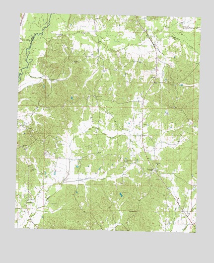
Hesterville, MS USGS Topographic Map
Click on map above to begin viewing in our Map Viewer.

This topographic map contains these locations and features:
Feature Name Type Latitude Longitude GNIS ID View Map
Armstrong Lake DamDamN33.2418°W89.6767°681951View Map
Auris (historical)Populated PlaceN33.2335°W89.6956°710827View Map
Baxter CreekStreamN33.2451°W89.6392°666576View Map
Brister CemeteryCemeteryN33.1660°W89.6748°667577View Map
Buzzard CreekStreamN33.2151°W89.7473°667874View Map
CarmackPopulated PlaceN33.2404°W89.6626°710852View Map
Carmack Elementary SchoolSchoolN33.2415°W89.6626°711561View Map
Clark Pond DamDamN33.1501°W89.6451°681881View Map
Dan Oak DamDamN33.2468°W89.7084°681954View Map
Daniel CemeteryCemeteryN33.1962°W89.6320°710865View Map
Guess CemeteryCemeteryN33.1398°W89.7245°670760View Map
HestervillePopulated PlaceN33.1607°W89.6542°671142View Map
Hesterville Church of ChristChurchN33.1593°W89.6551°690021View Map
Himan CemeteryCemeteryN33.1568°W89.7323°671228View Map
Hudson CreekStreamN33.2332°W89.7420°671563View Map
Little Sharkey CreekStreamN33.1524°W89.7173°672686View Map
Mayo BranchStreamN33.2337°W89.6965°673273View Map
Mayo CemeteryCemeteryN33.2260°W89.7009°673275View Map
Mitchells Mill (historical)LocaleN33.2362°W89.6356°690027View Map
Mount Harmon School (historical)SchoolN33.2251°W89.7056°710933View Map
Mount HermanPopulated PlaceN33.2254°W89.7029°710932View Map
North Union (historical)Populated PlaceN33.2015°W89.6959°710957View Map
North Union Baptist ChurchChurchN33.2029°W89.6970°674965View Map
North Union CemeteryCemeteryN33.2032°W89.6965°710958View Map
North Union School (historical)SchoolN33.2029°W89.6967°710959View Map
Northwest School (historical)SchoolN33.1793°W89.7395°710960View Map
Oakland School (historical)SchoolN33.1468°W89.7098°710961View Map
Palmer CemeteryCemeteryN33.1610°W89.6537°710965View Map
PossumneckPopulated PlaceN33.1412°W89.7417°676272View Map
Possumneck School (historical)SchoolN33.1399°W89.7470°710982View Map
Redden BranchStreamN33.2382°W89.6620°676547View Map
Rock Hill ChurchChurchN33.1726°W89.7456°676760View Map
Rocky PointPopulated PlaceN33.1687°W89.7001°710987View Map
Rocky Point CemeteryCemeteryN33.1740°W89.6990°710988View Map
Rocky Point ChurchChurchN33.1737°W89.6990°676803View Map
Rocky Point School (historical)SchoolN33.1737°W89.6984°710989View Map
Sand Hill (historical)Populated PlaceN33.1973°W89.6417°710995View Map
Sand Hill Baptist ChurchChurchN33.1976°W89.6423°677367View Map
Sand Hill CemeteryCemeteryN33.1973°W89.6420°710996View Map
Scoobachita CreekStreamN33.2385°W89.6576°677459View Map
Smyrna CemeteryCemeteryN33.1596°W89.7392°677947View Map
Smyrna Methodist Church (historical)ChurchN33.1599°W89.7384°711009View Map
Snyders Bluff School (historical)SchoolN33.1407°W89.6662°711011View Map
Supervisor District 3CivilN33.1647°W89.6613°711776View Map
Sweet Pilgrim CemeteryCemeteryN33.1362°W89.6662°711020View Map
Sweet Pilgrim ChurchChurchN33.1368°W89.6662°678486View Map
Thornton CemeteryCemeteryN33.1746°W89.7212°678727View Map
Unity (historical)Populated PlaceN33.1710°W89.7306°711028View Map
Unity Baptist ChurchChurchN33.1687°W89.7309°679136View Map
Unity CemeteryCemeteryN33.1682°W89.7309°711029View Map
Zilpha CreekStreamN33.2376°W89.7365°679981View Map

Note: Coordinates in the location and feature list above are referenced to NAD83 datum.


Copyright (C) 2008-2025 Ryan Niemi / Sunset Dynamics ... All Rights Reserved