TopoQuest Logo
Do you find TopoQuest useful?
Help keep TopoQuest running and adding new maps/features by donating!
Bitcoin:  19c7KJd3qBynnjoSw5npx9KScwjBe4ifkT
Litecoin:  LXs6TkuXGGXo1vDsWCkWVdjQX94eUKd6ui
Home View Maps Find Maps Find Places Resources & Links


Kuester Lake, Montana Topographic Map

USGS Map Title: Kuester Lake, MT
USGS Map MRC: 47104F8
DRG (GeoTIFF) Download: o47104f8.tif


Neighboring USGS Topographic Map Quads:


  Duplisse Creek South, MT  
47105G1
 

  Elmdale SW, MT  
47104G8
 

  Carda Coulee, MT  
47104G7
 

  Richey, MT  
47105F1
 

  Kuester Lake, MT  
47104F8
 

  Enid, MT  
47104F7
 

  Richey SE, MT  
47105E1
 

  Clay Butte, MT  
47104E8
 

  Enid SE, MT  
47104E7


Map MRC Location:

N48°
W105°
N48°
W104°
H8 H7 H6 H5 H4 H3 H2 H1
G8 G7 G6 G5 G4 G3 G2 G1
F8 F7 F6 F5 F4 F3 F2 F1
E8 E7 E6 E5 E4 E3 E2 E1
D8 D7 D6 D5 D4 D3 D2 D1
C8 C7 C6 C5 C4 C3 C2 C1
B8 B7 B6 B5 B4 B3 B2 B1
A8 A7 A6 A5 A4 A3 A2 A1
N47°
W105°
N47°
W104°

Kuester Lake, MT USGS 1:24K Topographic Map Preview:
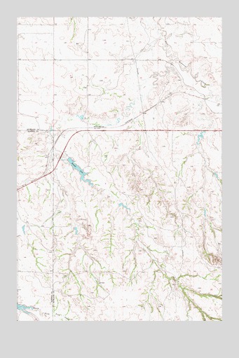
Kuester Lake, MT USGS Topographic Map
Click on map above to begin viewing in our Map Viewer.

This topographic map contains these locations and features:
Feature Name Type Latitude Longitude GNIS ID View Map
22N52E01BDBD01 WellWellN47.6981°W104.9911°824582View Map
22N52E24DADD01 WellWellN47.6495°W104.9775°824295View Map
22N52E25CBCA01 WellWellN47.6350°W104.9964°824189View Map
22N53E05CDAA01 WellWellN47.6920°W104.9475°824556View Map
22N53E10ABBD01 WellWellN47.6872°W104.9019°824532View Map
22N53E16ACCC01 WellWellN47.6678°W104.9241°824404View Map
22N53E18BCAB01 WellWellN47.6700°W104.9750°824425View Map
22N53E22BDCB01 WellWellN47.6533°W104.9080°824333View Map
22N53E23ABBD01 WellWellN47.6583°W104.8805°824361View Map
22N53E26BAAA01 WellWellN47.6447°W104.8833°824258View Map
22N53E29BDBD01 WellWellN47.6403°W104.9502°824225View Map
22N53E30ABBB01 WellWellN47.6447°W104.9669°824259View Map
23N52E24BCBB01 WellWellN47.7420°W104.9975°824773View Map
23N53E26CAAC01 WellWellN47.7236°W104.8839°824691View Map
23N53E27BBDA01 WellWellN47.7295°W104.9097°824708View Map
23N53E27BBDB01 WellWellN47.7295°W104.9105°824709View Map
23N53E28BABB01 WellWellN47.7317°W104.9291°824721View Map
23N53E30DCAA01 WellWellN47.7208°W104.9630°824683View Map
23N53E31ABCA01 WellWellN47.7150°W104.9655°824660View Map
23N53E32CCBD01 WellWellN47.7056°W104.9550°824623View Map
Bank DamDamN47.6733°W104.9372°797970View Map
Clem DamDamN47.6617°W104.8889°797606View Map
J Deckert Number 1 DamDamN47.6250°W104.9872°798159View Map
Kuester DamDamN47.6900°W104.9689°795343View Map
Kuester LakeReservoirN47.6869°W104.9626°773144View Map
Kuester Reservoir Fishing Access SiteLocaleN47.6908°W104.9664°1744322View Map
Manrock (historical)LocaleN47.7020°W104.9580°1714972View Map
Wold ReservoirReservoirN47.6310°W104.9976°799761View Map
Yodeling Valley DamDamN47.6617°W104.9639°798193View Map

Note: Coordinates in the location and feature list above are referenced to NAD83 datum.


Copyright (C) 2008-2025 Ryan Niemi / Sunset Dynamics ... All Rights Reserved