TopoQuest Logo
Do you find TopoQuest useful?
Help keep TopoQuest running and adding new maps/features by donating!
Bitcoin:  19c7KJd3qBynnjoSw5npx9KScwjBe4ifkT
Litecoin:  LXs6TkuXGGXo1vDsWCkWVdjQX94eUKd6ui
Home View Maps Find Maps Find Places Resources & Links


Kurtz, Indiana Topographic Map

USGS Map Title: Kurtz, IN
USGS Map MRC: 38086H2
DRG (GeoTIFF) Download: o38086h2.tif


Neighboring USGS Topographic Map Quads:


  Elkinsville, IN  
39086A3
 

  Story, IN  
39086A2
 

  Waymansville, IN  
39086A1
 

  Norman, IN  
38086H3
 

  Kurtz, IN  
38086H2
 

  Brownstown, IN  
38086H1
 

  Tunnelton, IN  
38086G3
 

  Medora, IN  
38086G2
 

  Vallonia, IN  
38086G1


Map MRC Location:

N39°
W87°
N39°
W86°
H8 H7 H6 H5 H4 H3 H2 H1
G8 G7 G6 G5 G4 G3 G2 G1
F8 F7 F6 F5 F4 F3 F2 F1
E8 E7 E6 E5 E4 E3 E2 E1
D8 D7 D6 D5 D4 D3 D2 D1
C8 C7 C6 C5 C4 C3 C2 C1
B8 B7 B6 B5 B4 B3 B2 B1
A8 A7 A6 A5 A4 A3 A2 A1
N38°
W87°
N38°
W86°

Kurtz, IN USGS 1:24K Topographic Map Preview:
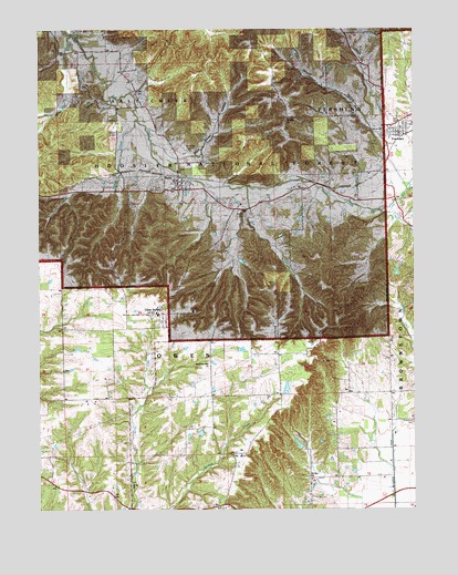
Kurtz, IN USGS Topographic Map
Click on map above to begin viewing in our Map Viewer.

This topographic map contains these locations and features:
Feature Name Type Latitude Longitude GNIS ID View Map
Bagwell CemeteryCemeteryN38.9517°W86.1815°450643View Map
Bee CreekStreamN38.9589°W86.1803°450668View Map
Blind Horse HollowValleyN38.9661°W86.1982°431184View Map
Callahan BranchStreamN38.9989°W86.2392°450747View Map
Charles Collins Lake DamReservoirN38.8917°W86.1617°448907View Map
Charles Collins Lake DamDamN38.8917°W86.1617°451809View Map
Clear SpringPopulated PlaceN38.9251°W86.2100°450782View Map
Cornett CemeteryCemeteryN38.9853°W86.2355°450804View Map
Cummings CemeteryCemeteryN38.9690°W86.1975°450825View Map
FreetownPopulated PlaceN38.9731°W86.1294°450936View Map
Freetown Census Designated PlaceCensusN38.9776°W86.1271°2629879View Map
Freetown Elementary SchoolSchoolN38.9764°W86.1297°451729View Map
Gorbetts ChurchChurchN38.9767°W86.1664°450972View Map
Hanner CemeteryCemeteryN38.9758°W86.2244°451005View Map
Hound HollowValleyN38.9753°W86.1376°451066View Map
Kiper CreekStreamN38.9589°W86.1269°451116View Map
KurtzPopulated PlaceN38.9606°W86.2033°451126View Map
Kurtz CemeteryCemeteryN38.9581°W86.2114°450699View Map
Little Salt CreekStreamN38.9528°W86.1372°451162View Map
Lucas CemeteryCemeteryN38.9705°W86.1370°451181View Map
McHargue DitchCanalN38.8839°W86.1322°451208View Map
Mount Zion ChurchChurchN38.8837°W86.1603°451258View Map
Mountain View ChurchChurchN38.9123°W86.1930°451262View Map
Owen - Salt Creek Township Volunteer Fire Department Station 1BuildingN38.9589°W86.2036°2626493View Map
Pershing Township Volunteer Fire DepartmentBuildingN38.9760°W86.1299°2626199View Map
Smallwood CemeteryCemeteryN38.8977°W86.1250°451473View Map
Tipton CreekStreamN38.9764°W86.2169°451571View Map
Township of OwenCivilN38.9112°W86.2057°453702View Map
Wrays ChurchChurchN38.8814°W86.2194°451646View Map

Note: Coordinates in the location and feature list above are referenced to NAD83 datum.


Copyright (C) 2008-2024 Ryan Niemi / Sunset Dynamics ... All Rights Reserved