TopoQuest Logo
Do you find TopoQuest useful?
Help keep TopoQuest running and adding new maps/features by donating!
Bitcoin:  19c7KJd3qBynnjoSw5npx9KScwjBe4ifkT
Litecoin:  LXs6TkuXGGXo1vDsWCkWVdjQX94eUKd6ui
Home View Maps Find Maps Find Places Resources & Links


Medora, Indiana Topographic Map

USGS Map Title: Medora, IN
USGS Map MRC: 38086G2
DRG (GeoTIFF) Download: o38086g2.tif


Neighboring USGS Topographic Map Quads:


  Norman, IN  
38086H3
 

  Kurtz, IN  
38086H2
 

  Brownstown, IN  
38086H1
 

  Tunnelton, IN  
38086G3
 

  Medora, IN  
38086G2
 

  Vallonia, IN  
38086G1
 

  Campbellsburg, IN  
38086F3
 

  Smedley, IN  
38086F2
 

  Kossuth, IN  
38086F1


Map MRC Location:

N39°
W87°
N39°
W86°
H8 H7 H6 H5 H4 H3 H2 H1
G8 G7 G6 G5 G4 G3 G2 G1
F8 F7 F6 F5 F4 F3 F2 F1
E8 E7 E6 E5 E4 E3 E2 E1
D8 D7 D6 D5 D4 D3 D2 D1
C8 C7 C6 C5 C4 C3 C2 C1
B8 B7 B6 B5 B4 B3 B2 B1
A8 A7 A6 A5 A4 A3 A2 A1
N38°
W87°
N38°
W86°

Medora, IN USGS 1:24K Topographic Map Preview:
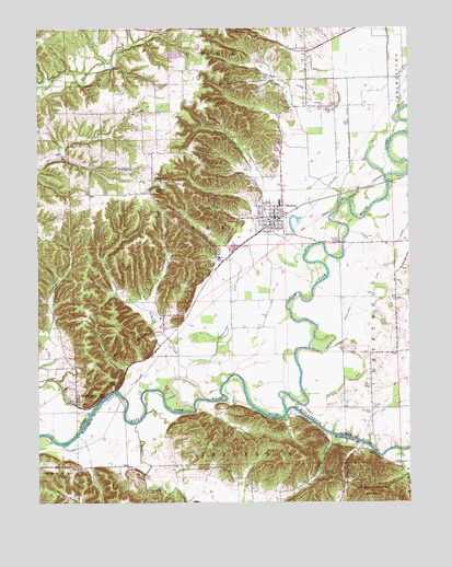
Medora, IN USGS Topographic Map
Click on map above to begin viewing in our Map Viewer.

This topographic map contains these locations and features:
Feature Name Type Latitude Longitude GNIS ID View Map
Beem Heighten Hill CemeteryCemeteryN38.8547°W86.1513°430743View Map
Buffalo CreekStreamN38.7706°W86.2175°431772View Map
Carr HollowValleyN38.8014°W86.2155°432171View Map
Carr Township Fire and RescueBuildingN38.8244°W86.1699°2626202View Map
Carr Township Fire RescueBuildingN38.8228°W86.1698°2625897View Map
Clear Spring CreekStreamN38.8712°W86.2172°451818View Map
Culletts Ferry (historical)LocaleN38.7734°W86.1675°448384View Map
Daulton HollowValleyN38.7958°W86.2455°433327View Map
Drusilla (historical)LocaleN38.7648°W86.1316°452187View Map
Empson CemeteryCemeteryN38.7738°W86.1378°434192View Map
Fleene RidgeRidgeN38.7520°W86.2403°434578View Map
Goss CemeteryCemeteryN38.8541°W86.1536°435241View Map
Greasy CreekStreamN38.7831°W86.2000°435376View Map
Harrell CemeteryCemeteryN38.7749°W86.1375°435773View Map
Heighton Hill CemeteryCemeteryN38.8539°W86.1519°435982View Map
Hinderlider CemeteryCemeteryN38.8325°W86.2103°436230View Map
Hinderlider DitchCanalN38.8120°W86.1816°436231View Map
Holmes CemeteryCemeteryN38.8325°W86.1765°436336View Map
Knobs OverlookLocaleN38.8742°W86.1789°437406View Map
Lanning Spur CemeteryCemeteryN38.8237°W86.1808°437624View Map
McMillan DitchCanalN38.8512°W86.1447°438919View Map
MedoraPopulated PlaceN38.8251°W86.1700°438962View Map
Medora Elementary and High SchoolSchoolN38.8245°W86.1722°447038View Map
Medora Police DepartmentBuildingN38.8256°W86.1700°2758312View Map
Muscatatuck RiverStreamN38.7739°W86.1661°439897View Map
Petersburg (historical)Populated PlaceN38.7670°W86.1414°452186View Map
PleasantvillePopulated PlaceN38.8634°W86.2053°452188View Map
Pollock CemeteryCemeteryN38.7650°W86.1894°441414View Map
Shelton HollowValleyN38.8028°W86.2116°443356View Map
Shoemaker CemeteryCemeteryN38.8270°W86.2078°443434View Map
Sparks Ferry (historical)LocaleN38.7787°W86.2236°448385View Map
SparksvillePopulated PlaceN38.7778°W86.2372°443912View Map
Steward HollowValleyN38.7855°W86.2202°444144View Map
Stewart CemeteryCemeteryN38.7814°W86.2239°444148View Map
Stuckwisch DitchCanalN38.8062°W86.1414°444288View Map
Thompson CemeteryCemeteryN38.7530°W86.2128°444699View Map
Town of MedoraCivilN38.8248°W86.1715°2396748View Map
Township of CarrCivilN38.8193°W86.2120°453159View Map
WeddlevillePopulated PlaceN38.8387°W86.2203°445630View Map
Wheeler CemeteryCemeteryN38.7578°W86.1539°445883View Map
Wheeler HollowValleyN38.7655°W86.1513°445889View Map
Zollman CemeteryCemeteryN38.8546°W86.1533°446495View Map
Zollman DitchCanalN38.7831°W86.1472°446496View Map

Note: Coordinates in the location and feature list above are referenced to NAD83 datum.


Copyright (C) 2008-2024 Ryan Niemi / Sunset Dynamics ... All Rights Reserved