TopoQuest Logo
Do you find TopoQuest useful?
Help keep TopoQuest running and adding new maps/features by donating!
Bitcoin:  19c7KJd3qBynnjoSw5npx9KScwjBe4ifkT
Litecoin:  LXs6TkuXGGXo1vDsWCkWVdjQX94eUKd6ui
Home View Maps Find Maps Find Places Resources & Links


Norman, Indiana Topographic Map

USGS Map Title: Norman, IN
USGS Map MRC: 38086H3
DRG (GeoTIFF) Download: o38086h3.tif


Neighboring USGS Topographic Map Quads:


  Allens Creek, IN  
39086A4
 

  Elkinsville, IN  
39086A3
 

  Story, IN  
39086A2
 

  Bartlettsville, IN  
38086H4
 

  Norman, IN  
38086H3
 

  Kurtz, IN  
38086H2
 

  Bedford East, IN  
38086G4
 

  Tunnelton, IN  
38086G3
 

  Medora, IN  
38086G2


Map MRC Location:

N39°
W87°
N39°
W86°
H8 H7 H6 H5 H4 H3 H2 H1
G8 G7 G6 G5 G4 G3 G2 G1
F8 F7 F6 F5 F4 F3 F2 F1
E8 E7 E6 E5 E4 E3 E2 E1
D8 D7 D6 D5 D4 D3 D2 D1
C8 C7 C6 C5 C4 C3 C2 C1
B8 B7 B6 B5 B4 B3 B2 B1
A8 A7 A6 A5 A4 A3 A2 A1
N38°
W87°
N38°
W86°

Norman, IN USGS 1:24K Topographic Map Preview:
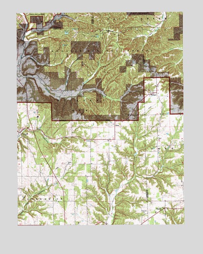
Norman, IN USGS Topographic Map
Click on map above to begin viewing in our Map Viewer.

This topographic map contains these locations and features:
Feature Name Type Latitude Longitude GNIS ID View Map
Brannaman BranchStreamN38.9514°W86.3297°450703View Map
Callahan CemeteryCemeteryN38.9767°W86.2517°450748View Map
Dennis Murphy HollowValleyN38.9984°W86.3450°450841View Map
Dry CreekStreamN38.9037°W86.2861°450868View Map
Faubion CemeteryCemeteryN38.9453°W86.3603°451820View Map
Guthrie Creek ChurchChurchN38.8817°W86.2797°450994View Map
Hickory Grove ChurchChurchN38.9892°W86.3067°451032View Map
Hickory Grove PondLakeN38.9837°W86.3139°452524View Map
Hunter CreekStreamN38.9862°W86.3689°451071View Map
Jackie BranchStreamN38.9542°W86.3164°451824View Map
Liberty ChurchChurchN38.9251°W86.2689°451141View Map
McPike BranchStreamN38.9737°W86.3717°451210View Map
Me Pike PondLakeN38.9770°W86.3564°451823View Map
Mitchell CemeteryCemeteryN38.9938°W86.3596°451228View Map
Mitchell RidgeRidgeN38.9778°W86.3303°452525View Map
Mundell ChurchChurchN38.9109°W86.3369°451265View Map
NormanPopulated PlaceN38.9526°W86.2750°451280View Map
Orchard RunStreamN38.9526°W86.3189°449592View Map
Pitzer RunStreamN38.9584°W86.3178°449594View Map
Pleasant Run Volunteer Fire DepartmentBuildingN38.9283°W86.3736°2626356View Map
Pole BranchStreamN38.8948°W86.3219°449595View Map
Scott - Wray CemeteryCemeteryN38.8925°W86.2612°2741180View Map
Shady Springs TabernacleChurchN38.8831°W86.2664°451446View Map
Tanyard BranchStreamN38.9987°W86.3683°451539View Map
Terrill BranchStreamN38.9506°W86.3433°451552View Map
Township of Pleasant RunCivilN38.9421°W86.3642°453752View Map
YellowstonePopulated PlaceN38.9989°W86.3425°451647View Map
ZelmaPopulated PlaceN38.9339°W86.3019°451653View Map

Note: Coordinates in the location and feature list above are referenced to NAD83 datum.


Copyright (C) 2008-2025 Ryan Niemi / Sunset Dynamics ... All Rights Reserved