TopoQuest Logo
Do you find TopoQuest useful?
Help keep TopoQuest running and adding new maps/features by donating!
Bitcoin:  19c7KJd3qBynnjoSw5npx9KScwjBe4ifkT
Litecoin:  LXs6TkuXGGXo1vDsWCkWVdjQX94eUKd6ui
Home View Maps Find Maps Find Places Resources & Links


Cadwell, Illinois Topographic Map

USGS Map Title: Cadwell, IL
USGS Map MRC: 39088F5
DRG (GeoTIFF) Download: o39088f5.tif


Neighboring USGS Topographic Map Quads:


  La Place, IL  
39088G6
 

  Hammond, IL  
39088G5
 

  Atwood, IL  
39088G4
 

  Lovington, IL  
39088F6
 

  Cadwell, IL  
39088F5
 

  Arthur, IL  
39088F4
 

  Kirksville, IL  
39088E6
 

  Sullivan, IL  
39088E5
 

  Cooks Mills, IL  
39088E4


Map MRC Location:

N40°
W89°
N40°
W88°
H8 H7 H6 H5 H4 H3 H2 H1
G8 G7 G6 G5 G4 G3 G2 G1
F8 F7 F6 F5 F4 F3 F2 F1
E8 E7 E6 E5 E4 E3 E2 E1
D8 D7 D6 D5 D4 D3 D2 D1
C8 C7 C6 C5 C4 C3 C2 C1
B8 B7 B6 B5 B4 B3 B2 B1
A8 A7 A6 A5 A4 A3 A2 A1
N39°
W89°
N39°
W88°

Cadwell, IL USGS 1:24K Topographic Map Preview:
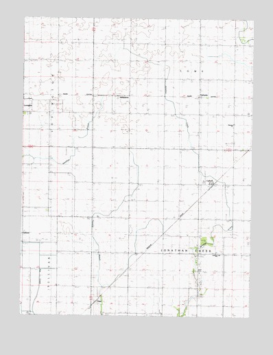
Cadwell, IL USGS Topographic Map
Click on map above to begin viewing in our Map Viewer.

This topographic map contains these locations and features:
Feature Name Type Latitude Longitude GNIS ID View Map
Boggs School (historical)SchoolN39.7106°W88.6031°404647View Map
CadwellPopulated PlaceN39.6811°W88.5217°405331View Map
Center School (historical)SchoolN39.6506°W88.5276°405810View Map
ChippsPopulated PlaceN39.6331°W88.5812°422548View Map
CushmanPopulated PlaceN39.6600°W88.6242°422597View Map
Durbin AirportAirportN39.6340°W88.6186°427858View Map
Dyer School (historical)SchoolN39.7395°W88.6065°407552View Map
Eagle Lake BasinBasinN39.6459°W88.6098°407572View Map
FairbanksPopulated PlaceN39.7173°W88.5301°422684View Map
Fairview School (historical)SchoolN39.7100°W88.5292°408215View Map
German School (historical)SchoolN39.7111°W88.5109°408972View Map
Grandview School (historical)SchoolN39.6859°W88.6101°409278View Map
Jonathan Creek SchoolSchoolN39.6517°W88.5189°1721083View Map
Jonathan Creek TownhallBuildingN39.6506°W88.5284°1721084View Map
Lowe TownhallBuildingN39.7170°W88.5295°1721089View Map
Mentzer School (historical)SchoolN39.7392°W88.5303°413412View Map
Merit School (historical)SchoolN39.6809°W88.5662°413429View Map
Minor School (historical)SchoolN39.6509°W88.5656°413661View Map
Morning Star School (historical)SchoolN39.6609°W88.6053°413828View Map
Moultrie CountyCivilN39.6415°W88.6193°1784885View Map
Plainview SchoolSchoolN39.7056°W88.5106°1721098View Map
Rosedale School (historical)SchoolN39.7398°W88.5667°416956View Map
Seass CemeteryCemeteryN39.6442°W88.5289°418170View Map
Township of Jonathan CreekCivilN39.6516°W88.5292°429189View Map
Township of LoweCivilN39.7437°W88.5300°429288View Map
Twomile School (historical)SchoolN39.6261°W88.5662°419997View Map
White School (historical)SchoolN39.7106°W88.5664°421074View Map
WilliamsburgPopulated PlaceN39.7175°W88.5720°423313View Map
WKJR-FM (Sullivan)TowerN39.6303°W88.5078°428308View Map

Note: Coordinates in the location and feature list above are referenced to NAD83 datum.


Copyright (C) 2008-2024 Ryan Niemi / Sunset Dynamics ... All Rights Reserved