TopoQuest Logo
Do you find TopoQuest useful?
Help keep TopoQuest running and adding new maps/features by donating!
Bitcoin:  19c7KJd3qBynnjoSw5npx9KScwjBe4ifkT
Litecoin:  LXs6TkuXGGXo1vDsWCkWVdjQX94eUKd6ui
Home View Maps Find Maps Find Places Resources & Links


Barley, Virginia Topographic Map

USGS Map Title: Barley, VA
USGS Map MRC: 36077E6
DRG (GeoTIFF) Download: o36077e6.tif


Neighboring USGS Topographic Map Quads:


  Powellton, VA  
36077F7
 

  Ante, VA  
36077F6
 

  Emporia, VA  
36077F5
 

  Valentines, VA  
36077E7
 

  Barley, VA  
36077E6
 

  Skippers, VA  
36077E5
 

  Thelma, NC  
36077D7
 

  Roanoke Rapids, NC  
36077D6
 

  Weldon, NC  
36077D5


Map MRC Location:

N37°
W78°
N37°
W77°
H8 H7 H6 H5 H4 H3 H2 H1
G8 G7 G6 G5 G4 G3 G2 G1
F8 F7 F6 F5 F4 F3 F2 F1
E8 E7 E6 E5 E4 E3 E2 E1
D8 D7 D6 D5 D4 D3 D2 D1
C8 C7 C6 C5 C4 C3 C2 C1
B8 B7 B6 B5 B4 B3 B2 B1
A8 A7 A6 A5 A4 A3 A2 A1
N36°
W78°
N36°
W77°

Barley, VA USGS 1:24K Topographic Map Preview:
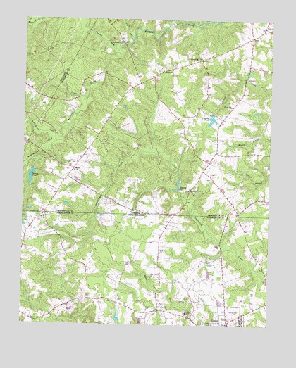
Barley, VA USGS Topographic Map
Click on map above to begin viewing in our Map Viewer.

This topographic map contains these locations and features:
Feature Name Type Latitude Longitude GNIS ID View Map
BarleyPopulated PlaceN36.5640°W77.7242°1477093View Map
Beddingfield CreekStreamN36.5746°W77.7328°1462987View Map
Bethany ChurchChurchN36.5102°W77.6661°981095View Map
BrinkPopulated PlaceN36.6179°W77.6344°1477143View Map
District 2CivilN36.6209°W77.6486°2390682View Map
Ebenezer ChurchChurchN36.5671°W77.7350°1466135View Map
Floyd CemeteryCemeteryN36.5171°W77.6466°985247View Map
Fontaine Creek ChurchChurchN36.6090°W77.6619°1466750View Map
Forrest Hill ChurchChurchN36.5896°W77.6450°1466788View Map
Garners DamDamN36.5585°W77.6697°1489955View Map
Garners MillPopulated PlaceN36.5560°W77.6705°1492986View Map
Garners MillpondReservoirN36.5585°W77.6697°1489956View Map
GastonPopulated PlaceN36.5004°W77.6450°985598View Map
Gaston Fire DepartmentBuildingN36.5014°W77.6464°2638545View Map
Gum ForksPopulated PlaceN36.5063°W77.6800°1006224View Map
Hicksford District (historical)CivilN36.6188°W77.6375°1927341View Map
Jerusalem ChurchChurchN36.5551°W77.6658°1468696View Map
Little CreekStreamN36.5929°W77.7178°1469515View Map
Macedonia ChurchChurchN36.6157°W77.7014°1469966View Map
Massey CemeteryCemeteryN36.5324°W77.6494°989444View Map
Moody CemeteryCemeteryN36.5085°W77.6764°990164View Map
Oak Grove ChurchChurchN36.5440°W77.7394°991410View Map
Paris StorePopulated PlaceN36.6168°W77.7011°1501017View Map
Quarrel CreekStreamN36.6140°W77.7025°1472892View Map
Rainey DamDamN36.5632°W77.7447°1489962View Map
Rainey PondReservoirN36.5605°W77.7457°1502104View Map
Rattlesnake CreekStreamN36.5746°W77.7330°1473017View Map
Rocky RunStreamN36.6168°W77.6953°1473489View Map
Rook CemeteryCemeteryN36.5246°W77.6958°993670View Map
Royland SchoolSchoolN36.6040°W77.6794°1473610View Map
Shiloh ChurchChurchN36.5004°W77.6530°994717View Map
Slates CornerPopulated PlaceN36.5632°W77.6586°1501031View Map
Smith CemeteryCemeteryN36.5301°W77.6797°994953View Map
Smith PondReservoirN36.5844°W77.6550°1474770View Map
Smiths DamDamN36.5865°W77.6541°1489957View Map
Squire CemeteryCemeteryN36.5104°W77.7008°995382View Map
Squire SchoolSchoolN36.5052°W77.6661°995383View Map
StancellPopulated PlaceN36.5438°W77.7400°1022773View Map
Township of GastonCivilN36.5116°W77.7208°1026997View Map

Note: Coordinates in the location and feature list above are referenced to NAD83 datum.


Copyright (C) 2008-2025 Ryan Niemi / Sunset Dynamics ... All Rights Reserved