TopoQuest Logo
Do you find TopoQuest useful?
Help keep TopoQuest running and adding new maps/features by donating!
Bitcoin:  19c7KJd3qBynnjoSw5npx9KScwjBe4ifkT
Litecoin:  LXs6TkuXGGXo1vDsWCkWVdjQX94eUKd6ui
Home View Maps Find Maps Find Places Resources & Links


Labadieville, Louisiana Topographic Map

USGS Map Title: Labadieville, LA
USGS Map MRC: 29090G8
DRG (GeoTIFF) Download: o29090g8.tif


Neighboring USGS Topographic Map Quads:


  Napoleonville, LA  
29091H1
 

  Madewood, LA  
29090H8
 

  Lagan, LA  
29090H7
 

  Grassy Lake, LA  
29091G1
 

  Labadieville, LA  
29090G8
 

  Thibodaux, LA  
29090G7
 

  Amelia, LA  
29091F1
 

  Gibson, LA  
29090F8
 

  Gray, LA  
29090F7


Map MRC Location:

N30°
W91°
N30°
W90°
H8 H7 H6 H5 H4 H3 H2 H1
G8 G7 G6 G5 G4 G3 G2 G1
F8 F7 F6 F5 F4 F3 F2 F1
E8 E7 E6 E5 E4 E3 E2 E1
D8 D7 D6 D5 D4 D3 D2 D1
C8 C7 C6 C5 C4 C3 C2 C1
B8 B7 B6 B5 B4 B3 B2 B1
A8 A7 A6 A5 A4 A3 A2 A1
N29°
W91°
N29°
W90°

Labadieville, LA USGS 1:24K Topographic Map Preview:
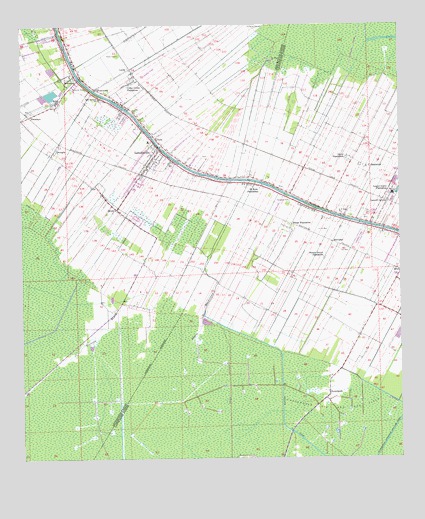
Labadieville, LA USGS Topographic Map
Click on map above to begin viewing in our Map Viewer.

This topographic map contains these locations and features:
Feature Name Type Latitude Longitude GNIS ID View Map
Assumption Parish Library Labadieville BranchBuildingN29.8322°W90.9609°2603024View Map
Bayou BoudreauxStreamN29.7783°W90.9443°532468View Map
BrulePopulated PlaceN29.8041°W90.8754°543032View Map
BrulePopulated PlaceN29.8222°W90.9687°533444View Map
Cedar Grove PlantationPopulated PlaceN29.8585°W90.9640°553933View Map
ChulaPopulated PlaceN29.8427°W90.9554°533950View Map
Dixie PlantationPopulated PlaceN29.8374°W90.8920°543148View Map
Forest Grove PlantationLocaleN29.8077°W90.9001°535037View Map
FreetownPopulated PlaceN29.8571°W90.9751°535098View Map
GeorgiaPopulated PlaceN29.8402°W90.9884°554523View Map
HimalayaPopulated PlaceN29.8494°W90.9973°554717View Map
KTIB-AM (Thibodaux)TowerN29.8516°W90.9134°1633246View Map
L T PlantationPopulated PlaceN29.8349°W90.8876°543367View Map
LabadievillePopulated PlaceN29.8374°W90.9562°554952View Map
Labadieville Census Designated PlaceCensusN29.8246°W90.9525°2403180View Map
Labadieville Head Start SchoolSchoolN29.8537°W90.9745°2600230View Map
Labadieville Middle SchoolSchoolN29.8416°W90.9579°2493321View Map
Labadieville Post OfficePost OfficeN29.8372°W90.9526°1632031View Map
Labadieville Primary SchoolSchoolN29.8539°W90.9743°552888View Map
Labadieville Volunteer Fire DepartmentBuildingN29.8400°W90.9553°2332456View Map
Laurel GrovePopulated PlaceN29.8238°W90.8790°543381View Map
Laurel Grove Gas FieldOilfieldN29.8166°W90.8862°557839View Map
Laurel Grove PlantationPopulated PlaceN29.8274°W90.8787°543382View Map
LechePopulated PlaceN29.8619°W90.9657°536383View Map
LowlandsPopulated PlaceN29.7694°W90.8990°536774View Map
MorvantPopulated PlaceN29.8127°W90.8970°541146View Map
Nerville BayouStreamN29.7741°W90.9829°537539View Map
New Belmont Baptist ChurchChurchN29.8537°W90.9735°2602304View Map
New Belmont SchoolSchoolN29.8541°W90.9740°537549View Map
New Morning Star Baptist ChurchChurchN29.8337°W90.9412°2602471View Map
New Mount Carmel Baptist ChurchChurchN29.8603°W90.9863°2602472View Map
North Laurel Grove Gas FieldOilfieldN29.8422°W90.8918°557852View Map
Opportunity Place Adult Education Center North CampusSchoolN29.8210°W90.8948°536235View Map
Phillips CanalCanalN29.7685°W90.9145°538107View Map
Saint John Gas FieldOilfieldN29.7963°W90.9043°557874View Map
Saint John Volunteer Fire DepartmentBuildingN29.8155°W90.8790°2332555View Map
Saint John's ChurchChurchN29.8152°W90.8808°2602660View Map
Saint Mark Baptist ChurchChurchN29.8571°W90.9743°2602700View Map
Saint Paul Baptist ChurchChurchN29.8720°W90.9928°2602730View Map
Saint Phillip Baptist ChurchChurchN29.8341°W90.9520°2602760View Map
Saint Philomena Catholic ChurchChurchN29.8394°W90.9548°552911View Map
Saint Philomena CemeteryCemeteryN29.8380°W90.9559°552912View Map
Saint Philomena Elementary School (historical)SchoolN29.8387°W90.9561°552913View Map
Saint Rose PlantationPopulated PlaceN29.8288°W90.9212°543641View Map
SupremePopulated PlaceN29.8594°W90.9812°556176View Map
Supreme Census Designated PlaceCensusN29.8604°W90.9955°2402906View Map
Supreme Post OfficePost OfficeN29.8613°W90.9826°1632038View Map
Supreme Sugar PondReservoirN29.8549°W90.9909°556806View Map
Supreme Sugar Pond DamDamN29.8552°W90.9918°556805View Map
White PlantationPopulated PlaceN29.8163°W90.9118°540373View Map

Note: Coordinates in the location and feature list above are referenced to NAD83 datum.


Copyright (C) 2008-2024 Ryan Niemi / Sunset Dynamics ... All Rights Reserved