TopoQuest Logo
Do you find TopoQuest useful?
Help keep TopoQuest running and adding new maps/features by donating!
Bitcoin:  19c7KJd3qBynnjoSw5npx9KScwjBe4ifkT
Litecoin:  LXs6TkuXGGXo1vDsWCkWVdjQX94eUKd6ui
Home View Maps Find Maps Find Places Resources & Links


Lacey Gulch, Montana Topographic Map

USGS Map Title: Lacey Gulch, MT
USGS Map MRC: 45106B5
DRG (GeoTIFF) Download: o45106b5.tif


Neighboring USGS Topographic Map Quads:


  Birney SW, MT  
45106C6
 

  Birney, MT  
45106C5
 

  Browns Mountain, MT  
45106C4
 

  Spring Gulch, MT  
45106B6
 

  Lacey Gulch, MT  
45106B5
 

  Stroud Creek, MT  
45106B4
 

  Holmes Ranch, MT  
45106A6
 

  Pine Butte School, MT  
45106A5
 

  Forks Ranch, MT  
45106A4


Map MRC Location:

N46°
W107°
N46°
W106°
H8 H7 H6 H5 H4 H3 H2 H1
G8 G7 G6 G5 G4 G3 G2 G1
F8 F7 F6 F5 F4 F3 F2 F1
E8 E7 E6 E5 E4 E3 E2 E1
D8 D7 D6 D5 D4 D3 D2 D1
C8 C7 C6 C5 C4 C3 C2 C1
B8 B7 B6 B5 B4 B3 B2 B1
A8 A7 A6 A5 A4 A3 A2 A1
N45°
W107°
N45°
W106°

Lacey Gulch, MT USGS 1:24K Topographic Map Preview:
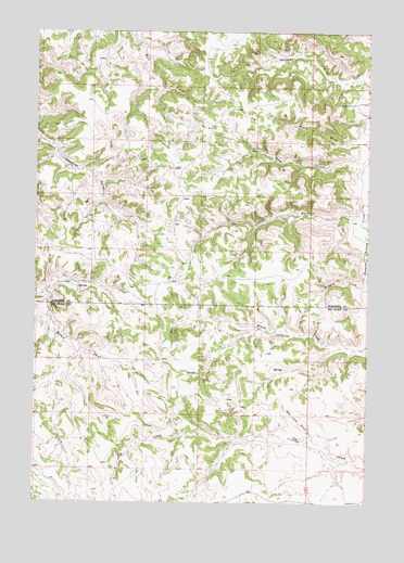
Lacey Gulch, MT USGS Topographic Map
Click on map above to begin viewing in our Map Viewer.

This topographic map contains these locations and features:
Feature Name Type Latitude Longitude GNIS ID View Map
07S42E20CAAA01 WellWellN45.2130°W106.6150°808442View Map
08S42E02ADDD01 WellWellN45.1708°W106.5431°808293View Map
08S42E09AACC01 WellWellN45.1594°W106.5887°808228View Map
08S42E10AADC01 SpringSpringN45.1594°W106.5647°808227View Map
08S42E14ADCB01 WellWellN45.1425°W106.5473°808158View Map
08S42E14DBAD01 WellWellN45.1397°W106.5487°808141View Map
08S42E14DBAD02 WellWellN45.1397°W106.5487°808142View Map
08S42E15CBBA01 WellWellN45.1428°W106.5795°808161View Map
08S42E16DDDC01 SpringSpringN45.1342°W106.5859°808107View Map
08S42E21AAAB01 WellWellN45.1339°W106.5853°808104View Map
08S42E22CAAC01 WellWellN45.1255°W106.5756°808052View Map
08S42E23BDBC01 WellWellN45.1286°W106.5581°808066View Map
08S43E07ADAA01 WellWellN45.1586°W106.5014°808221View Map
Bad Land GulchValleyN45.1425°W106.5212°768424View Map
Cox RanchLocaleN45.2311°W106.5078°770243View Map
Lacey GulchValleyN45.2011°W106.5070°773167View Map
Short DrawValleyN45.2211°W106.5031°776518View Map
Van Meter GulchValleyN45.2161°W106.5037°777992View Map

Note: Coordinates in the location and feature list above are referenced to NAD83 datum.


Copyright (C) 2008-2025 Ryan Niemi / Sunset Dynamics ... All Rights Reserved