TopoQuest Logo
Do you find TopoQuest useful?
Help keep TopoQuest running and adding new maps/features by donating!
Bitcoin:  19c7KJd3qBynnjoSw5npx9KScwjBe4ifkT
Litecoin:  LXs6TkuXGGXo1vDsWCkWVdjQX94eUKd6ui
Home View Maps Find Maps Find Places Resources & Links


Pine Butte School, Montana Topographic Map

USGS Map Title: Pine Butte School, MT
USGS Map MRC: 45106A5
DRG (GeoTIFF) Download: o45106a5.tif


Neighboring USGS Topographic Map Quads:


  Spring Gulch, MT  
45106B6
 

  Lacey Gulch, MT  
45106B5
 

  Stroud Creek, MT  
45106B4
 

  Holmes Ranch, MT  
45106A6
 

  Pine Butte School, MT  
45106A5
 

  Forks Ranch, MT  
45106A4
 

  Cedar Canyon, WY  
44106H6
 

  O T O Ranch, WY  
44106H5
 

  Roundup Draw, WY  
44106H4


Map MRC Location:

N46°
W107°
N46°
W106°
H8 H7 H6 H5 H4 H3 H2 H1
G8 G7 G6 G5 G4 G3 G2 G1
F8 F7 F6 F5 F4 F3 F2 F1
E8 E7 E6 E5 E4 E3 E2 E1
D8 D7 D6 D5 D4 D3 D2 D1
C8 C7 C6 C5 C4 C3 C2 C1
B8 B7 B6 B5 B4 B3 B2 B1
A8 A7 A6 A5 A4 A3 A2 A1
N45°
W107°
N45°
W106°

Pine Butte School, MT USGS 1:24K Topographic Map Preview:
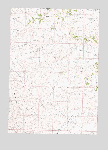
Pine Butte School, MT USGS Topographic Map
Click on map above to begin viewing in our Map Viewer.

This topographic map contains these locations and features:
Feature Name Type Latitude Longitude GNIS ID View Map
08S42E22DBCA01 WellWellN45.1244°W106.5714°808042View Map
08S42E26CBBB01 WellWellN45.1117°W106.5625°807966View Map
08S42E28CAAA01 WellWellN45.1122°W106.5951°807969View Map
08S42E29BDAC01 WellWellN45.1147°W106.6167°807981View Map
08S42E35BBBC01 WellWellN45.1039°W106.5628°807926View Map
08S42E35DDDB01 WellWellN45.0922°W106.5445°807870View Map
08S42E35DDDB02 WellWellN45.0922°W106.5445°807871View Map
08S43E30BBCD01 WellWellN45.1167°W106.5198°807993View Map
08S43E31BBDA01 WellWellN45.1025°W106.5173°807920View Map
08S43E31BBDA02 WellWellN45.1025°W106.5173°807921View Map
09S42E01BCAD01 WellWellN45.0847°W106.5384°807805View Map
09S42E01BCAD02 WellWellN45.0853°W106.5381°807806View Map
09S42E01BCAD03 WellWellN45.0855°W106.5378°807809View Map
09S42E02ADBB01 WellWellN45.0861°W106.5467°807812View Map
09S42E02BBBD01 WellWellN45.0889°W106.5614°807846View Map
09S42E02BBCA01 WellWellN45.0883°W106.5606°807840View Map
09S42E03AADA01 WellWellN45.0883°W106.5637°807841View Map
09S42E04BABA01 WellWellN45.0897°W106.5973°807852View Map
09S42E05AAAD01 C WellWellN45.0889°W106.6048°807847View Map
09S42E11BDAA01 WellWellN45.0714°W106.5531°807722View Map
09S42E11BDCA01 WellWellN45.0691°W106.5556°807687View Map
09S42E11BDCA02 WellWellN45.0694°W106.5556°807693View Map
09S42E12BCAA01 WellWellN45.0716°W106.5392°807727View Map
09S42E25DCAD01 WellWellN45.0200°W106.5275°807351View Map
09S42E26CDCA01 WellWellN45.0194°W106.5562°807349View Map
09S42E27CDCD01 WellWellN45.0183°W106.5767°807345View Map
09S42E35DCCC01 WellWellN45.0041°W106.5523°807290View Map
09S42E36BCAB01 WellWellN45.0139°W106.5395°807319View Map
09S42E36BCBA01 WellWellN45.0136°W106.5417°807318View Map
09S43E06DDBD01 WellWellN45.0780°W106.5037°807763View Map
09S43E06DDBD02 WellWellN45.0780°W106.5037°807764View Map
09S43E06DDBD03 WellWellN45.0783°W106.5039°807766View Map
09S43E06DDCA01 WellWellN45.0778°W106.5034°807762View Map
09S43E07BCAD01 WellWellN45.0711°W106.5167°807717View Map
09S43E07CADB01 WellWellN45.0772°W106.5042°807758View Map
09S43E07CADB02 WellWellN45.0664°W106.5128°807661View Map
10S42E01AADA01 WellWellN45.0003°W106.5231°807272View Map
10S43E06ABAC01 WellWellN45.0022°W106.5075°807284View Map
North Waddle Creek School (historical)SchoolN45.0380°W106.5520°1716447View Map
Pine Butte School (historical)SchoolN45.1244°W106.5720°775229View Map
South Fork Corral CreekStreamN45.0783°W106.5025°776804View Map

Note: Coordinates in the location and feature list above are referenced to NAD83 datum.


Copyright (C) 2008-2025 Ryan Niemi / Sunset Dynamics ... All Rights Reserved