TopoQuest Logo
Do you find TopoQuest useful?
Help keep TopoQuest running and adding new maps/features by donating!
Bitcoin:  19c7KJd3qBynnjoSw5npx9KScwjBe4ifkT
Litecoin:  LXs6TkuXGGXo1vDsWCkWVdjQX94eUKd6ui
Home View Maps Find Maps Find Places Resources & Links


Spring Gulch, Montana Topographic Map

USGS Map Title: Spring Gulch, MT
USGS Map MRC: 45106B6
DRG (GeoTIFF) Download: o45106b6.tif


Neighboring USGS Topographic Map Quads:


  Taintor Desert, MT  
45106C7
 

  Birney SW, MT  
45106C6
 

  Birney, MT  
45106C5
 

  Tongue River Dam, MT  
45106B7
 

  Spring Gulch, MT  
45106B6
 

  Lacey Gulch, MT  
45106B5
 

  Decker, MT  
45106A7
 

  Holmes Ranch, MT  
45106A6
 

  Pine Butte School, MT  
45106A5


Map MRC Location:

N46°
W107°
N46°
W106°
H8 H7 H6 H5 H4 H3 H2 H1
G8 G7 G6 G5 G4 G3 G2 G1
F8 F7 F6 F5 F4 F3 F2 F1
E8 E7 E6 E5 E4 E3 E2 E1
D8 D7 D6 D5 D4 D3 D2 D1
C8 C7 C6 C5 C4 C3 C2 C1
B8 B7 B6 B5 B4 B3 B2 B1
A8 A7 A6 A5 A4 A3 A2 A1
N45°
W107°
N45°
W106°

Spring Gulch, MT USGS 1:24K Topographic Map Preview:
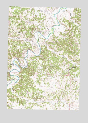
Spring Gulch, MT USGS Topographic Map
Click on map above to begin viewing in our Map Viewer.

This topographic map contains these locations and features:
Feature Name Type Latitude Longitude GNIS ID View Map
07S41E11____01 WellWellN45.2419°W106.6778°808550View Map
07S41E22ACDC01 WellWellN45.2147°W106.6948°808451View Map
07S41E22CDCD01 WellWellN45.2072°W106.7017°808426View Map
07S41E27DBBD01 WellWellN45.1983°W106.6970°808395View Map
07S41E27DBCB01 WellWellN45.1978°W106.6962°808394View Map
07S41E28DDAD01 WellWellN45.1950°W106.7095°808384View Map
07S41E33CAAB01 WellWellN45.1844°W106.7214°808344View Map
07S41E34BAAD01 WellWellN45.1914°W106.6978°808368View Map
08S42E06ADBA01 WellWellN45.1722°W106.6289°808304View Map
Anderson CreekStreamN45.1553°W106.7467°768242View Map
Canyon CreekStreamN45.2411°W106.6717°769571View Map
Canyon Creek School (historical)SchoolN45.2397°W106.6656°1716541View Map
Deadman GulchValleyN45.2461°W106.6437°770530View Map
Decker DivisionCivilN45.1305°W106.6990°1940728View Map
Dutch HollowValleyN45.2230°W106.6806°770929View Map
FL DitchCanalN45.2214°W106.6781°771421View Map
Flying V DitchCanalN45.2005°W106.6984°771482View Map
Four Mile School (historical)SchoolN45.2133°W106.7045°1716540View Map
Fourmile CreekStreamN45.2058°W106.6995°771567View Map
Harris CreekStreamN45.2111°W106.6839°772167View Map
Post CreekStreamN45.1708°W106.7451°775397View Map
Spring GulchValleyN45.1844°W106.7092°777081View Map

Note: Coordinates in the location and feature list above are referenced to NAD83 datum.


Copyright (C) 2008-2025 Ryan Niemi / Sunset Dynamics ... All Rights Reserved