TopoQuest Logo
Do you find TopoQuest useful?
Help keep TopoQuest running and adding new maps/features by donating!
Bitcoin:  19c7KJd3qBynnjoSw5npx9KScwjBe4ifkT
Litecoin:  LXs6TkuXGGXo1vDsWCkWVdjQX94eUKd6ui
Home View Maps Find Maps Find Places Resources & Links


Lacona, Iowa Topographic Map

USGS Map Title: Lacona, IA
USGS Map MRC: 41093B4
DRG (GeoTIFF) Download: o41093b4.tif


Neighboring USGS Topographic Map Quads:


  Indianola, IA  
41093C5
 

  Milo, IA  
41093C4
 

  Beech, IA  
41093C3
 

  Medora, IA  
41093B5
 

  Lacona, IA  
41093B4
 

  Newbern, IA  
41093B3
 

  Woodburn, IA  
41093A5
 

  Lucas, IA  
41093A4
 

  Chariton, IA  
41093A3


Map MRC Location:

N42°
W94°
N42°
W93°
H8 H7 H6 H5 H4 H3 H2 H1
G8 G7 G6 G5 G4 G3 G2 G1
F8 F7 F6 F5 F4 F3 F2 F1
E8 E7 E6 E5 E4 E3 E2 E1
D8 D7 D6 D5 D4 D3 D2 D1
C8 C7 C6 C5 C4 C3 C2 C1
B8 B7 B6 B5 B4 B3 B2 B1
A8 A7 A6 A5 A4 A3 A2 A1
N41°
W94°
N41°
W93°

Lacona, IA USGS 1:24K Topographic Map Preview:
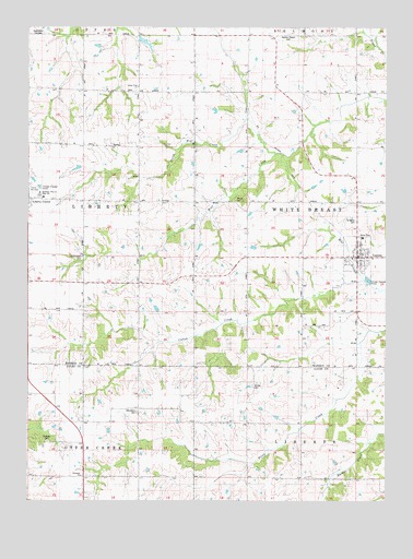
Lacona, IA USGS Topographic Map
Click on map above to begin viewing in our Map Viewer.

This topographic map contains these locations and features:
Feature Name Type Latitude Longitude GNIS ID View Map
Arnold CemeteryCemeteryN41.1554°W93.4214°1823386View Map
Arnold SchoolSchoolN41.1456°W93.4222°454241View Map
Center SchoolSchoolN41.1522°W93.4991°455301View Map
Church of the NazareneChurchN41.1897°W93.3830°1970030View Map
City of LaconaCivilN41.1899°W93.3850°2395579View Map
Fletcher CemeteryCemeteryN41.1408°W93.4933°1823388View Map
Fort Plain (historical)LocaleN41.2181°W93.4122°466033View Map
Graceland CemeteryCemeteryN41.1488°W93.4618°1823389View Map
Green Plain ChurchChurchN41.2344°W93.4619°1823394View Map
Green Plain SchoolSchoolN41.2342°W93.4594°457107View Map
Hendrickson CemeteryCemeteryN41.1894°W93.4811°1823391View Map
LaconaPopulated PlaceN41.1897°W93.3830°458165View Map
Lacona (historical)LocaleN41.1897°W93.3872°1970035View Map
Lacona Bible Baptist ChurchChurchN41.1897°W93.3830°1970031View Map
Lacona Christian ChurchChurchN41.1886°W93.3844°1970032View Map
Lacona Community HallBuildingN41.1897°W93.3844°1970024View Map
Lacona Fire and RescueBuildingN41.1898°W93.3850°2577177View Map
Lacona Post OfficePost OfficeN41.1897°W93.3830°1970027View Map
Lacona Public LibraryBuildingN41.1897°W93.3830°1970026View Map
Liberty CenterPopulated PlaceN41.2047°W93.4988°458322View Map
Liberty Center Post OfficePost OfficeN41.2033°W93.4997°1970048View Map
Liberty Center United Methodist ChurchChurchN41.2036°W93.4997°1970049View Map
Mount Olive SchoolSchoolN41.2047°W93.4608°459317View Map
Mumford SchoolSchoolN41.1456°W93.3841°459400View Map
North Liberty SchoolSchoolN41.2344°W93.4994°459602View Map
Norwood ChurchChurchN41.1314°W93.4813°1823387View Map
Plainville Chapel CemeteryCemeteryN41.2482°W93.4095°1823395View Map
Primrose SchoolSchoolN41.1750°W93.4597°460454View Map
Saint Mary's CemeteryCemeteryN41.1989°W93.3858°1823390View Map
Saint Marys Catholic ChurchChurchN41.1908°W93.3849°1970034View Map
Saint Paul Lutheran ChurchChurchN41.1897°W93.3830°1970029View Map
Shupe CemeteryCemeteryN41.2042°W93.4276°1823393View Map
Southeast Warren Intermediate CenterSchoolN41.1946°W93.3833°1970025View Map
Southeast Warren Junior - Senior High SchoolSchoolN41.2055°W93.4963°1823392View Map
Township of LibertyCivilN41.2045°W93.5000°468230View Map
Township of White BreastCivilN41.2043°W93.3850°468994View Map
Union SchoolSchoolN41.1458°W93.4591°462467View Map
United Methodist ChurchChurchN41.1886°W93.3838°1970033View Map
Willis Log CabinBuildingN41.1897°W93.3830°1970028View Map

Note: Coordinates in the location and feature list above are referenced to NAD83 datum.


Copyright (C) 2008-2025 Ryan Niemi / Sunset Dynamics ... All Rights Reserved