TopoQuest Logo
Do you find TopoQuest useful?
Help keep TopoQuest running and adding new maps/features by donating!
Bitcoin:  19c7KJd3qBynnjoSw5npx9KScwjBe4ifkT
Litecoin:  LXs6TkuXGGXo1vDsWCkWVdjQX94eUKd6ui
Home View Maps Find Maps Find Places Resources & Links


Woodburn, Iowa Topographic Map

USGS Map Title: Woodburn, IA
USGS Map MRC: 41093A5
DRG (GeoTIFF) Download: o41093a5.tif


Neighboring USGS Topographic Map Quads:


  New Virginia, IA  
41093B6
 

  Medora, IA  
41093B5
 

  Lacona, IA  
41093B4
 

  Jamison, IA  
41093A6
 

  Woodburn, IA  
41093A5
 

  Lucas, IA  
41093A4
 

  Weldon, IA  
40093H6
 

  Le Roy, IA  
40093H5
 

  Derby, IA  
40093H4


Map MRC Location:

N42°
W94°
N42°
W93°
H8 H7 H6 H5 H4 H3 H2 H1
G8 G7 G6 G5 G4 G3 G2 G1
F8 F7 F6 F5 F4 F3 F2 F1
E8 E7 E6 E5 E4 E3 E2 E1
D8 D7 D6 D5 D4 D3 D2 D1
C8 C7 C6 C5 C4 C3 C2 C1
B8 B7 B6 B5 B4 B3 B2 B1
A8 A7 A6 A5 A4 A3 A2 A1
N41°
W94°
N41°
W93°

Woodburn, IA USGS 1:24K Topographic Map Preview:
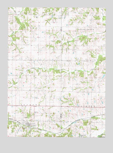
Woodburn, IA USGS Topographic Map
Click on map above to begin viewing in our Map Viewer.

This topographic map contains these locations and features:
Feature Name Type Latitude Longitude GNIS ID View Map
Box Elder SchoolSchoolN41.0508°W93.5416°454778View Map
Brush CreekStreamN41.0031°W93.5608°454892View Map
Center Star SchoolSchoolN41.0308°W93.6152°455308View Map
Chinquapin SchoolSchoolN41.0019°W93.5383°455396View Map
City of WoodburnCivilN41.0109°W93.5963°2397368View Map
Cleveland (historical)LocaleN41.0211°W93.5035°1970588View Map
Cleveland Post Office (historical)Post OfficeN41.0211°W93.5035°1970587View Map
Fox SchoolSchoolN41.0578°W93.5774°456716View Map
Harrison CemeteryCemeteryN41.1156°W93.5896°1823265View Map
Hill SchoolSchoolN41.1183°W93.5774°457491View Map
Jacksonville (historical)Populated PlaceN41.1056°W93.5585°465478View Map
JayPopulated PlaceN41.1067°W93.5866°464594View Map
Jay Post Office (historical)Post OfficeN41.1067°W93.5866°1969750View Map
Liberty Center SchoolSchoolN41.1175°W93.6141°458325View Map
Middleport Post Office (historical)Post OfficeN41.1000°W93.5863°1969747View Map
North Star SchoolSchoolN41.0589°W93.6147°459634View Map
OttawaPopulated PlaceN41.0300°W93.5910°459922View Map
Ottawa CemeteryCemeteryN41.0230°W93.5902°459923View Map
Ottawa SchoolSchoolN41.0308°W93.5769°459924View Map
Palestine SchoolSchoolN41.0536°W93.5144°459996View Map
Pleasant Ridge SchoolSchoolN41.1203°W93.5324°460290View Map
Powell SchoolSchoolN41.0853°W93.5785°460379View Map
Saint Marys CemeteryCemeteryN41.0189°W93.6043°1823264View Map
Spring Hill SchoolSchoolN41.0219°W93.5180°461900View Map
Township of JacksonCivilN41.0303°W93.6151°468096View Map
Township of LibertyCivilN41.1178°W93.6152°468214View Map
Victor SchoolSchoolN41.0883°W93.6144°462562View Map
Victory CreekStreamN41.1206°W93.6091°1823263View Map
Walker CemeteryCemeteryN41.1149°W93.5566°462611View Map
WoodburnPopulated PlaceN41.0119°W93.5991°463181View Map
WoodburnLocaleN41.0108°W93.5966°1969799View Map
Woodburn CemeteryCemeteryN41.0079°W93.6011°1969815View Map
Woodburn Christian ChurchChurchN41.0119°W93.5991°1969796View Map
Woodburn City HallBuildingN41.0119°W93.5991°1969797View Map
Woodburn Fire and Rescue DepartmentBuildingN41.0114°W93.5974°2577433View Map
Woodburn Post OfficePost OfficeN41.0119°W93.5991°1969798View Map
Wren Hill CemeteryCemeteryN41.0920°W93.5301°1975665View Map
Wren SchoolSchoolN41.0886°W93.5258°463214View Map

Note: Coordinates in the location and feature list above are referenced to NAD83 datum.


Copyright (C) 2008-2024 Ryan Niemi / Sunset Dynamics ... All Rights Reserved