TopoQuest Logo
Do you find TopoQuest useful?
Help keep TopoQuest running and adding new maps/features by donating!
Bitcoin:  19c7KJd3qBynnjoSw5npx9KScwjBe4ifkT
Litecoin:  LXs6TkuXGGXo1vDsWCkWVdjQX94eUKd6ui
Home View Maps Find Maps Find Places Resources & Links


Medora, Iowa Topographic Map

USGS Map Title: Medora, IA
USGS Map MRC: 41093B5
DRG (GeoTIFF) Download: o41093b5.tif


Neighboring USGS Topographic Map Quads:


  Martensdale, IA  
41093C6
 

  Indianola, IA  
41093C5
 

  Milo, IA  
41093C4
 

  New Virginia, IA  
41093B6
 

  Medora, IA  
41093B5
 

  Lacona, IA  
41093B4
 

  Jamison, IA  
41093A6
 

  Woodburn, IA  
41093A5
 

  Lucas, IA  
41093A4


Map MRC Location:

N42°
W94°
N42°
W93°
H8 H7 H6 H5 H4 H3 H2 H1
G8 G7 G6 G5 G4 G3 G2 G1
F8 F7 F6 F5 F4 F3 F2 F1
E8 E7 E6 E5 E4 E3 E2 E1
D8 D7 D6 D5 D4 D3 D2 D1
C8 C7 C6 C5 C4 C3 C2 C1
B8 B7 B6 B5 B4 B3 B2 B1
A8 A7 A6 A5 A4 A3 A2 A1
N41°
W94°
N41°
W93°

Medora, IA USGS 1:24K Topographic Map Preview:
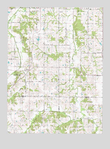
Medora, IA USGS Topographic Map
Click on map above to begin viewing in our Map Viewer.

This topographic map contains these locations and features:
Feature Name Type Latitude Longitude GNIS ID View Map
Bethel ChapelChurchN41.1403°W93.5785°454559View Map
Bethel Chapel CemeteryCemeteryN41.1393°W93.5783°1969816View Map
Christian Neck CemeteryCemeteryN41.1824°W93.5086°459939View Map
CoolPopulated PlaceN41.2233°W93.5774°455594View Map
Cool Post Office (historical)Post OfficeN41.2233°W93.5774°1969900View Map
Cool SchoolSchoolN41.2336°W93.5783°455595View Map
Handsome View Post Office (historical)Post OfficeN41.2250°W93.5863°1969890View Map
Hawkeye SchoolSchoolN41.1753°W93.5005°457333View Map
Hickory Hills County ParkParkN41.1842°W93.6138°1823009View Map
Highland SchoolSchoolN41.1469°W93.5377°457480View Map
Indian Valley CemeteryCemeteryN41.2029°W93.5767°455569View Map
Indian Valley SchoolSchoolN41.2050°W93.5785°457806View Map
LawrenceburgPopulated PlaceN41.2272°W93.5485°464254View Map
Lawrenceburg Post Office (historical)Post OfficeN41.2267°W93.5466°466584View Map
Liberty Center CemeteryCemeteryN41.2041°W93.5090°1970115View Map
MedoraPopulated PlaceN41.1869°W93.6027°458948View Map
Medora Post Office (historical)Post OfficeN41.1869°W93.6027°1969889View Map
Otter Creek County ParkParkN41.2450°W93.5313°1823011View Map
Schaver CemeteryCemeteryN41.2454°W93.5575°1823012View Map
SharonLocaleN41.2483°W93.5822°466032View Map
Sharon Post Office (historical)Post OfficeN41.2494°W93.5827°466585View Map
Skinaway CreekStreamN41.1908°W93.6091°461660View Map
Smith CemeteryCemeteryN41.2180°W93.6005°1823010View Map
Snyder SchoolSchoolN41.1475°W93.6160°461733View Map
South Otter CreekStreamN41.1442°W93.5252°461796View Map
Squaw Valley SchoolSchoolN41.2350°W93.6158°461940View Map
Thorn SchoolSchoolN41.1767°W93.5780°462225View Map
Township of SquawCivilN41.2052°W93.6156°468747View Map

Note: Coordinates in the location and feature list above are referenced to NAD83 datum.


Copyright (C) 2008-2025 Ryan Niemi / Sunset Dynamics ... All Rights Reserved