TopoQuest Logo
Do you find TopoQuest useful?
Help keep TopoQuest running and adding new maps/features by donating!
Bitcoin:  19c7KJd3qBynnjoSw5npx9KScwjBe4ifkT
Litecoin:  LXs6TkuXGGXo1vDsWCkWVdjQX94eUKd6ui
Home View Maps Find Maps Find Places Resources & Links


Lake Arrowhead, Michigan Topographic Map

USGS Map Title: Lake Arrowhead, MI
USGS Map MRC: 44084H7
DRG (GeoTIFF) Download: o44084h7.tif


Neighboring USGS Topographic Map Quads:


  Deadmans Hill, MI  
45084A8
 

  Elmira, MI  
45084A7
 

  Gaylord, MI  
45084A6
 

  Alba, MI  
44084H8
 

  Lake Arrowhead, MI  
44084H7
 

  Otsego Lake, MI  
44084H6
 

  Starvation Lake, MI  
44084G8
 

  Frederic, MI  
44084G7
 

  Big Bradford Lake, MI  
44084G6


Map MRC Location:

N45°
W85°
N45°
W84°
H8 H7 H6 H5 H4 H3 H2 H1
G8 G7 G6 G5 G4 G3 G2 G1
F8 F7 F6 F5 F4 F3 F2 F1
E8 E7 E6 E5 E4 E3 E2 E1
D8 D7 D6 D5 D4 D3 D2 D1
C8 C7 C6 C5 C4 C3 C2 C1
B8 B7 B6 B5 B4 B3 B2 B1
A8 A7 A6 A5 A4 A3 A2 A1
N44°
W85°
N44°
W84°

Lake Arrowhead, MI USGS 1:24K Topographic Map Preview:
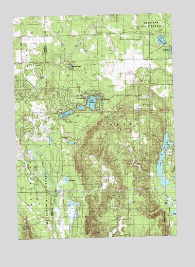
Lake Arrowhead, MI USGS Topographic Map
Click on map above to begin viewing in our Map Viewer.

This topographic map contains these locations and features:
Feature Name Type Latitude Longitude GNIS ID View Map
Buhl LakesLakeN44.9503°W84.8161°622213View Map
Deer LakeLakeN44.9080°W84.8361°624478View Map
Freedom Covenant Fellowship ChurchChurchN44.9722°W84.8106°2492503View Map
Hardwood LakeLakeN44.9714°W84.8305°627782View Map
Hayes Lookout TowerTowerN44.9411°W84.7786°1623400View Map
King PondLakeN44.8930°W84.7554°629702View Map
Lake ArrowheadLakeN44.9513°W84.8143°2568312View Map
Lake Little BearLakeN44.9538°W84.8096°2568313View Map
Lake TeconLakeN44.9052°W84.7579°1623194View Map
Lake WashwomenLakeN44.9300°W84.8358°1615836View Map
Lakes of the North Golf CourseLocaleN44.9111°W84.8633°2463775View Map
Little Fawn LakeLakeN44.9541°W84.8190°2568314View Map
Nisula LakeLakeN44.9476°W84.8098°2762343View Map
Pencil LakeLakeN44.9448°W84.8347°634582View Map
Swan LakeLakeN44.9552°W84.8208°2568315View Map
Thomas LakeLakeN44.9847°W84.7583°2100225View Map
Township of HayesCivilN44.9435°W84.7878°1626455View Map

Note: Coordinates in the location and feature list above are referenced to NAD83 datum.


Copyright (C) 2008-2024 Ryan Niemi / Sunset Dynamics ... All Rights Reserved