TopoQuest Logo
Do you find TopoQuest useful?
Help keep TopoQuest running and adding new maps/features by donating!
Bitcoin:  19c7KJd3qBynnjoSw5npx9KScwjBe4ifkT
Litecoin:  LXs6TkuXGGXo1vDsWCkWVdjQX94eUKd6ui
Home View Maps Find Maps Find Places Resources & Links


Frederic, Michigan Topographic Map

USGS Map Title: Frederic, MI
USGS Map MRC: 44084G7
DRG (GeoTIFF) Download: o44084g7.tif


Neighboring USGS Topographic Map Quads:


  Alba, MI  
44084H8
 

  Lake Arrowhead, MI  
44084H7
 

  Otsego Lake, MI  
44084H6
 

  Starvation Lake, MI  
44084G8
 

  Frederic, MI  
44084G7
 

  Big Bradford Lake, MI  
44084G6
 

  Black Creek, MI  
44084F8
 

  Lake Margrethe, MI  
44084F7
 

  Grayling, MI  
44084F6


Map MRC Location:

N45°
W85°
N45°
W84°
H8 H7 H6 H5 H4 H3 H2 H1
G8 G7 G6 G5 G4 G3 G2 G1
F8 F7 F6 F5 F4 F3 F2 F1
E8 E7 E6 E5 E4 E3 E2 E1
D8 D7 D6 D5 D4 D3 D2 D1
C8 C7 C6 C5 C4 C3 C2 C1
B8 B7 B6 B5 B4 B3 B2 B1
A8 A7 A6 A5 A4 A3 A2 A1
N44°
W85°
N44°
W84°

Frederic, MI USGS 1:24K Topographic Map Preview:
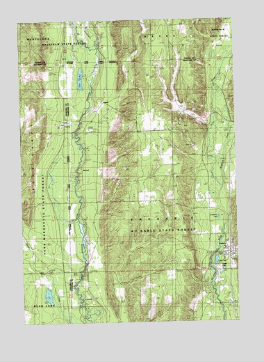
Frederic, MI USGS Topographic Map
Click on map above to begin viewing in our Map Viewer.

This topographic map contains these locations and features:
Feature Name Type Latitude Longitude GNIS ID View Map
Au Sable State ForestForestN44.7903°W84.8364°1619053View Map
Bradford CreekStreamN44.8058°W84.7575°621843View Map
Camel LakeLakeN44.7717°W84.7581°2104393View Map
Cameron BridgeBridgeN44.7997°W84.8403°1623269View Map
Cranberry LakeLakeN44.7930°W84.7607°623984View Map
DewardPopulated PlaceN44.8406°W84.8267°1617524View Map
Deward Lookout TowerTowerN44.7592°W84.8100°1623321View Map
Deward Post Office (historical)Post OfficeN44.8406°W84.8267°2498856View Map
Deward Station (historical)LocaleN44.8408°W84.8267°2498848View Map
First Baptist ChurchChurchN44.7792°W84.7522°2498840View Map
FredericPopulated PlaceN44.7786°W84.7545°626445View Map
Frederic Community LibraryBuildingN44.7847°W84.7539°2498839View Map
Frederic Elementary SchoolSchoolN44.7778°W84.7522°2498841View Map
Frederic Post OfficePost OfficeN44.7778°W84.7542°2498836View Map
Frederic StationLocaleN44.7783°W84.7542°2498835View Map
Frederic Township Volunteer Fire DepartmentBuildingN44.7791°W84.7562°2498838View Map
Frederic Township Volunteer Fire Department Ambulance GarageBuildingN44.7782°W84.7563°2661975View Map
Frenchman CreekStreamN44.8633°W84.8295°626484View Map
Goose Creek State Forest Campground and Trail CampLocaleN44.7600°W84.8403°2498779View Map
Happi Days Campground and DinerLocaleN44.7569°W84.7581°2498837View Map
IshawardPopulated PlaceN44.8133°W84.8395°1617644View Map
Kolke CreekStreamN44.8058°W84.7578°629846View Map
Leary ParkParkN44.7819°W84.7522°2498834View Map
Lost LakeLakeN44.8508°W84.8394°631093View Map
May LakeLakeN44.7752°W84.7625°631763View Map
Oakwood CemeteryCemeteryN44.7778°W84.7542°2498863View Map
Red BridgeBridgeN44.7708°W84.8417°1623594View Map
Shrine CemeteryCemeteryN44.8055°W84.7536°2498862View Map
Toll HillSummitN44.8317°W84.7867°1614933View Map
Township of FredericCivilN44.7713°W84.7868°1626311View Map

Note: Coordinates in the location and feature list above are referenced to NAD83 datum.


Copyright (C) 2008-2025 Ryan Niemi / Sunset Dynamics ... All Rights Reserved