TopoQuest Logo
Do you find TopoQuest useful?
Help keep TopoQuest running and adding new maps/features by donating!
Bitcoin:  19c7KJd3qBynnjoSw5npx9KScwjBe4ifkT
Litecoin:  LXs6TkuXGGXo1vDsWCkWVdjQX94eUKd6ui
Home View Maps Find Maps Find Places Resources & Links


Big Bradford Lake, Michigan Topographic Map

USGS Map Title: Big Bradford Lake, MI
USGS Map MRC: 44084G6
DRG (GeoTIFF) Download: o44084g6.tif


Neighboring USGS Topographic Map Quads:


  Lake Arrowhead, MI  
44084H7
 

  Otsego Lake, MI  
44084H6
 

  Turtle Lake, MI  
44084H5
 

  Frederic, MI  
44084G7
 

  Big Bradford Lake, MI  
44084G6
 

  K P Lake, MI  
44084G5
 

  Lake Margrethe, MI  
44084F7
 

  Grayling, MI  
44084F6
 

  Wakeley Lake, MI  
44084F5


Map MRC Location:

N45°
W85°
N45°
W84°
H8 H7 H6 H5 H4 H3 H2 H1
G8 G7 G6 G5 G4 G3 G2 G1
F8 F7 F6 F5 F4 F3 F2 F1
E8 E7 E6 E5 E4 E3 E2 E1
D8 D7 D6 D5 D4 D3 D2 D1
C8 C7 C6 C5 C4 C3 C2 C1
B8 B7 B6 B5 B4 B3 B2 B1
A8 A7 A6 A5 A4 A3 A2 A1
N44°
W85°
N44°
W84°

Big Bradford Lake, MI USGS 1:24K Topographic Map Preview:
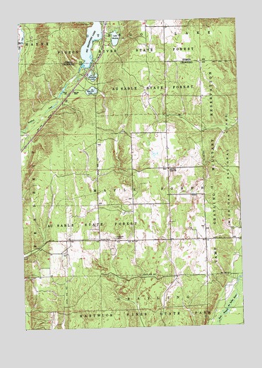
Big Bradford Lake, MI USGS Topographic Map
Click on map above to begin viewing in our Map Viewer.

This topographic map contains these locations and features:
Feature Name Type Latitude Longitude GNIS ID View Map
Bass Lake CabinsLocaleN44.8464°W84.7195°1619104View Map
Beaver LakeLakeN44.8474°W84.7248°620934View Map
Big Bradford LakeLakeN44.8662°W84.7085°621297View Map
Blue Gill LakeLakeN44.8467°W84.7086°621626View Map
Forbush CornerPopulated PlaceN44.7856°W84.7064°1617564View Map
Hartwick Pines Rest AreaLocaleN44.7806°W84.7125°2498872View Map
Headwaters Camping and CabinsLocaleN44.8556°W84.7122°2420829View Map
Horseshoe LakeLakeN44.8526°W84.7080°628620View Map
Interchange 264CrossingN44.7694°W84.7153°2498864View Map
Lake MarjoryLakeN44.8678°W84.6945°631566View Map
Lake Marjory State Forest CampgroundLocaleN44.8653°W84.6917°2492477View Map
Maple Forest CemeteryCemeteryN44.7856°W84.6961°631425View Map
Maple Forest Township HallLocaleN44.8145°W84.6659°631426View Map
Township of Maple ForestCivilN44.8144°W84.6650°1626673View Map

Note: Coordinates in the location and feature list above are referenced to NAD83 datum.


Copyright (C) 2008-2024 Ryan Niemi / Sunset Dynamics ... All Rights Reserved