TopoQuest Logo
Do you find TopoQuest useful?
Help keep TopoQuest running and adding new maps/features by donating!
Bitcoin:  19c7KJd3qBynnjoSw5npx9KScwjBe4ifkT
Litecoin:  LXs6TkuXGGXo1vDsWCkWVdjQX94eUKd6ui
Home View Maps Find Maps Find Places Resources & Links


Starvation Lake, Michigan Topographic Map

USGS Map Title: Starvation Lake, MI
USGS Map MRC: 44084G8
DRG (GeoTIFF) Download: o44084g8.tif


Neighboring USGS Topographic Map Quads:


  Mancelona, MI  
44085H1
 

  Alba, MI  
44084H8
 

  Lake Arrowhead, MI  
44084H7
 

  Westwood, MI  
44085G1
 

  Starvation Lake, MI  
44084G8
 

  Frederic, MI  
44084G7
 

  Sigma, MI  
44085F1
 

  Black Creek, MI  
44084F8
 

  Lake Margrethe, MI  
44084F7


Map MRC Location:

N45°
W85°
N45°
W84°
H8 H7 H6 H5 H4 H3 H2 H1
G8 G7 G6 G5 G4 G3 G2 G1
F8 F7 F6 F5 F4 F3 F2 F1
E8 E7 E6 E5 E4 E3 E2 E1
D8 D7 D6 D5 D4 D3 D2 D1
C8 C7 C6 C5 C4 C3 C2 C1
B8 B7 B6 B5 B4 B3 B2 B1
A8 A7 A6 A5 A4 A3 A2 A1
N44°
W85°
N44°
W84°

Starvation Lake, MI USGS 1:24K Topographic Map Preview:
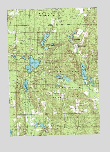
Starvation Lake, MI USGS Topographic Map
Click on map above to begin viewing in our Map Viewer.

This topographic map contains these locations and features:
Feature Name Type Latitude Longitude GNIS ID View Map
Barnhart SchoolSchoolN44.8400°W84.9887°620631View Map
Bass LakeLakeN44.8010°W84.8855°620704View Map
Blue LakeLakeN44.8086°W84.8947°621634View Map
Blue Lake Fire HallBuildingN44.8075°W84.8889°2420836View Map
Blue Lake SchoolSchoolN44.7717°W84.9331°621642View Map
Blue Lake Township Fire DepartmentBuildingN44.8226°W84.8933°2626756View Map
Blue Lake Township HallBuildingN44.8189°W84.9561°2420837View Map
Camp Flying EagleLocaleN44.8433°W84.9081°622576View Map
Deadmans LakeLakeN44.7917°W84.9379°624423View Map
Eagle LakeLakeN44.8360°W84.9466°625087View Map
East LakesLakeN44.7598°W84.9546°625218View Map
Indian LakeLakeN44.8077°W84.9305°628994View Map
Little Blue LakeLakeN44.8010°W84.8941°630570View Map
Little Twin LakeLakeN44.8142°W84.9713°630806View Map
MacNeil PondLakeN44.8395°W84.9386°631272View Map
North Blue LakeLakeN44.8174°W84.8967°633483View Map
North Crooked LakeLakeN44.8455°W84.9112°633561View Map
Oxbow LakeLakeN44.8277°W84.9784°634261View Map
Papoose LakeLakeN44.7990°W84.9323°634339View Map
Pickerel LakeLakeN44.8002°W84.9763°634790View Map
Pickerel Lake (Kalkaska) State Forest CampgroundLocaleN44.7958°W84.9725°2494739View Map
Pickerel Lake Lookout TowerTowerN44.7972°W84.9856°1623562View Map
Poplar LakeLakeN44.7947°W84.9096°635243View Map
South Crooked LakeLakeN44.8365°W84.9035°638336View Map
Squaw LakeLakeN44.8051°W84.9190°638680View Map
Starvation LakeLakeN44.8456°W84.9484°638755View Map
Timber LakeLakeN44.8285°W84.9919°1614867View Map
Township of Blue LakeCivilN44.8148°W84.9085°1625955View Map
Twin LakeLakeN44.8220°W84.9648°1615245View Map
Waddell PondLakeN44.8391°W84.9418°1615650View Map

Note: Coordinates in the location and feature list above are referenced to NAD83 datum.


Copyright (C) 2008-2025 Ryan Niemi / Sunset Dynamics ... All Rights Reserved