TopoQuest Logo
Do you find TopoQuest useful?
Help keep TopoQuest running and adding new maps/features by donating!
Bitcoin:  19c7KJd3qBynnjoSw5npx9KScwjBe4ifkT
Litecoin:  LXs6TkuXGGXo1vDsWCkWVdjQX94eUKd6ui
Home View Maps Find Maps Find Places Resources & Links


Lake Foursome, Louisiana Topographic Map

USGS Map Title: Lake Foursome, LA
USGS Map MRC: 32092F7
DRG (GeoTIFF) Download: o32092f7.tif


Neighboring USGS Topographic Map Quads:


  Arizona, LA  
32092G8
 

  Lisbon, LA  
32092G7
 

  Bernice, LA  
32092G6
 

  Marsalis, LA  
32092F8
 

  Lake Foursome, LA  
32092F7
 

  Dubach, LA  
32092F6
 

  Arcadia, LA  
32092E8
 

  Simsboro, LA  
32092E7
 

  Ruston West, LA  
32092E6


Map MRC Location:

N33°
W93°
N33°
W92°
H8 H7 H6 H5 H4 H3 H2 H1
G8 G7 G6 G5 G4 G3 G2 G1
F8 F7 F6 F5 F4 F3 F2 F1
E8 E7 E6 E5 E4 E3 E2 E1
D8 D7 D6 D5 D4 D3 D2 D1
C8 C7 C6 C5 C4 C3 C2 C1
B8 B7 B6 B5 B4 B3 B2 B1
A8 A7 A6 A5 A4 A3 A2 A1
N32°
W93°
N32°
W92°

Lake Foursome, LA USGS 1:24K Topographic Map Preview:
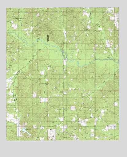
Lake Foursome, LA USGS Topographic Map
Click on map above to begin viewing in our Map Viewer.

This topographic map contains these locations and features:
Feature Name Type Latitude Longitude GNIS ID View Map
Alligator HoleBendN32.6960°W92.7960°546537View Map
Bennett Grove SchoolSchoolN32.6990°W92.8710°532941View Map
Blooming Hill School (historical)SchoolN32.6668°W92.7640°546547View Map
Brazells BridgeBridgeN32.7099°W92.8124°546549View Map
Bullock CreekStreamN32.7218°W92.8596°533542View Map
CorinthPopulated PlaceN32.7296°W92.7877°540799View Map
Corinth Baptist ChurchChurchN32.7296°W92.7868°554090View Map
CrossroadsPopulated PlaceN32.6707°W92.8127°556566View Map
Doc CreekStreamN32.7004°W92.8032°554248View Map
Feasterville (historical)Populated PlaceN32.6724°W92.8038°546571View Map
Fivemile CreekStreamN32.7010°W92.7571°534972View Map
Gee CreekStreamN32.6874°W92.8646°535199View Map
Horse CreekStreamN32.6982°W92.7513°535802View Map
Indian CreekStreamN32.7029°W92.8102°535920View Map
Knowles (historical)Populated PlaceN32.6390°W92.7813°546594View Map
Lake FoursomeReservoirN32.6341°W92.8536°554469View Map
Liberty HillPopulated PlaceN32.6293°W92.8038°546597View Map
Liberty Hill Missionary Baptist ChurchChurchN32.6296°W92.8035°546598View Map
Liberty Hill SchoolSchoolN32.6299°W92.8038°536430View Map
Lloyd School (historical)SchoolN32.7257°W92.7504°546657View Map
Louisville SchoolSchoolN32.6718°W92.7874°536753View Map
Noble SchoolSchoolN32.6396°W92.7602°537694View Map
Petty Lake BendBendN32.7015°W92.7596°546616View Map
Roger SchoolSchoolN32.7340°W92.8321°538685View Map
Saint Rest Baptist ChurchChurchN32.6724°W92.7927°555944View Map
Salem United Methodist ChurchChurchN32.6426°W92.7946°555956View Map
Sugar CreekStreamN32.7043°W92.8118°539711View Map
Terryville Gas FieldOilfieldN32.6279°W92.8085°546648View Map
Threemile CreekStreamN32.6426°W92.8613°539914View Map

Note: Coordinates in the location and feature list above are referenced to NAD83 datum.


Copyright (C) 2008-2025 Ryan Niemi / Sunset Dynamics ... All Rights Reserved