TopoQuest Logo
Do you find TopoQuest useful?
Help keep TopoQuest running and adding new maps/features by donating!
Bitcoin:  19c7KJd3qBynnjoSw5npx9KScwjBe4ifkT
Litecoin:  LXs6TkuXGGXo1vDsWCkWVdjQX94eUKd6ui
Home View Maps Find Maps Find Places Resources & Links


Marsalis, Louisiana Topographic Map

USGS Map Title: Marsalis, LA
USGS Map MRC: 32092F8
DRG (GeoTIFF) Download: o32092f8.tif


Neighboring USGS Topographic Map Quads:


  Homer, LA  
32093G1
 

  Arizona, LA  
32092G8
 

  Lisbon, LA  
32092G7
 

  Athens, LA  
32093F1
 

  Marsalis, LA  
32092F8
 

  Lake Foursome, LA  
32092F7
 

  Gibsland, LA  
32093E1
 

  Arcadia, LA  
32092E8
 

  Simsboro, LA  
32092E7


Map MRC Location:

N33°
W93°
N33°
W92°
H8 H7 H6 H5 H4 H3 H2 H1
G8 G7 G6 G5 G4 G3 G2 G1
F8 F7 F6 F5 F4 F3 F2 F1
E8 E7 E6 E5 E4 E3 E2 E1
D8 D7 D6 D5 D4 D3 D2 D1
C8 C7 C6 C5 C4 C3 C2 C1
B8 B7 B6 B5 B4 B3 B2 B1
A8 A7 A6 A5 A4 A3 A2 A1
N32°
W93°
N32°
W92°

Marsalis, LA USGS 1:24K Topographic Map Preview:
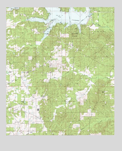
Marsalis, LA USGS Topographic Map
Click on map above to begin viewing in our Map Viewer.

This topographic map contains these locations and features:
Feature Name Type Latitude Longitude GNIS ID View Map
Allen CreekStreamN32.7415°W92.9357°546967View Map
AycockPopulated PlaceN32.7082°W92.9177°553333View Map
Bear CreekStreamN32.7399°W92.9210°547038View Map
Bridge 166BridgeN32.6807°W92.8802°533388View Map
Butler CreekStreamN32.7190°W92.9585°533590View Map
Coleman CreekStreamN32.7388°W92.9171°534037View Map
Cox CreekStreamN32.6807°W92.9024°534223View Map
Craighead CemeteryCemeteryN32.6554°W92.9735°549409View Map
Craighead PondLakeN32.6573°W92.9786°554115View Map
D'Arbonne ChurchChurchN32.7021°W92.9668°534383View Map
G CemeteryCemeteryN32.6804°W92.9054°535198View Map
Gee CreekStreamN32.7335°W92.8949°547389View Map
Horse CreekStreamN32.7374°W92.9060°547477View Map
Isaac CreekStreamN32.7432°W92.9402°535950View Map
Lake Claiborne DamDamN32.7404°W92.9040°556706View Map
Lake Claiborne State ParkParkN32.7232°W92.9204°540778View Map
Lisbon Oil FieldOilfieldN32.7174°W92.8777°536472View Map
MarsalisPopulated PlaceN32.6632°W92.9568°543446View Map
Marsalis PondsLakeN32.6868°W92.9987°555236View Map
Parish Governing Authority District 6CivilN32.6973°W92.8981°1930128View Map
Point PleasantPopulated PlaceN32.6879°W92.9729°541167View Map
Point Pleasant CemeteryCemeteryN32.6929°W92.9765°538305View Map
Richland SchoolSchoolN32.6729°W92.9315°538596View Map
Saint Johns SchoolSchoolN32.7182°W92.9990°538903View Map
Saint Luke SchoolSchoolN32.6568°W92.8849°538949View Map
Sapp CemeteryCemeteryN32.6463°W92.9318°539174View Map
Sugar CreekPopulated PlaceN32.6682°W92.8868°556156View Map
Sugar Creek Oil and Gas FieldOilfieldN32.6615°W92.9271°539712View Map
TulipPopulated PlaceN32.6818°W92.9865°541201View Map
Tulip CemeteryCemeteryN32.6821°W92.9818°540019View Map
Tulip Methodist ChurchChurchN32.6818°W92.9829°549414View Map
Ward SixCivilN32.6721°W92.9302°544986View Map
White CreekStreamN32.6807°W92.9024°540361View Map

Note: Coordinates in the location and feature list above are referenced to NAD83 datum.


Copyright (C) 2008-2025 Ryan Niemi / Sunset Dynamics ... All Rights Reserved