TopoQuest Logo
Do you find TopoQuest useful?
Help keep TopoQuest running and adding new maps/features by donating!
Bitcoin:  19c7KJd3qBynnjoSw5npx9KScwjBe4ifkT
Litecoin:  LXs6TkuXGGXo1vDsWCkWVdjQX94eUKd6ui
Home View Maps Find Maps Find Places Resources & Links


Bernice, Louisiana Topographic Map

USGS Map Title: Bernice, LA
USGS Map MRC: 32092G6
DRG (GeoTIFF) Download: o32092g6.tif


Neighboring USGS Topographic Map Quads:


  Summerfield, LA  
32092H7
 

  Lillie, LA  
32092H6
 

  Spearsville, LA  
32092H5
 

  Lisbon, LA  
32092G7
 

  Bernice, LA  
32092G6
 

  Shiloh, LA  
32092G5
 

  Lake Foursome, LA  
32092F7
 

  Dubach, LA  
32092F6
 

  Cedarton, LA  
32092F5


Map MRC Location:

N33°
W93°
N33°
W92°
H8 H7 H6 H5 H4 H3 H2 H1
G8 G7 G6 G5 G4 G3 G2 G1
F8 F7 F6 F5 F4 F3 F2 F1
E8 E7 E6 E5 E4 E3 E2 E1
D8 D7 D6 D5 D4 D3 D2 D1
C8 C7 C6 C5 C4 C3 C2 C1
B8 B7 B6 B5 B4 B3 B2 B1
A8 A7 A6 A5 A4 A3 A2 A1
N32°
W93°
N32°
W92°

Bernice, LA USGS 1:24K Topographic Map Preview:
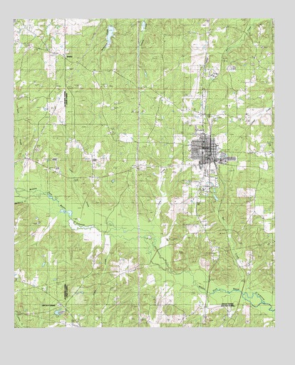
Bernice, LA USGS Topographic Map
Click on map above to begin viewing in our Map Viewer.

This topographic map contains these locations and features:
Feature Name Type Latitude Longitude GNIS ID View Map
Alabama Methodist Church (historical)ChurchN32.8599°W92.7254°544040View Map
Alabama-Weldon CemeteryCemeteryN32.8610°W92.7254°544041View Map
BernicePopulated PlaceN32.8221°W92.6579°542984View Map
Bernice CemeteryCemeteryN32.8143°W92.6540°544046View Map
Bernice High SchoolSchoolN32.8150°W92.6607°548696View Map
Bernice Police DepartmentBuildingN32.8209°W92.6561°2755321View Map
Bernice Post OfficePost OfficeN32.8213°W92.6579°1630743View Map
Bernice Volunteer Fire DepartmentBuildingN32.8210°W92.6564°2672878View Map
Bull CreekStreamN32.7601°W92.6304°533531View Map
Bull Creek Gas FieldOilfieldN32.7929°W92.7077°548698View Map
Cane CreekStreamN32.7863°W92.6835°533711View Map
Cane Ridge (historical)Populated PlaceN32.8135°W92.6954°1630748View Map
Harmony Chapel CemeteryCemeteryN32.7596°W92.7288°544128View Map
Harmony Chapel United Methodist ChurchChurchN32.7596°W92.7282°554662View Map
Hopewell CemeteryCemeteryN32.8482°W92.6843°535788View Map
HuntPopulated PlaceN32.8440°W92.6577°543320View Map
Jones CemeteryCemeteryN32.7793°W92.7107°536102View Map
Jones CreekStreamN32.7868°W92.7024°536106View Map
Lindsay DamDamN32.8018°W92.6518°556846View Map
Lindsays PondReservoirN32.8026°W92.6534°556847View Map
Lynn CreekStreamN32.7926°W92.7107°536787View Map
Lynn Creek Gas FieldOilfieldN32.8196°W92.6960°548719View Map
Mount Olive CemeteryCemeteryN32.8451°W92.6799°537349View Map
Mount Olive Oil and Gas FieldOilfieldN32.8396°W92.6807°548723View Map
Mount Tabor SchoolSchoolN32.8649°W92.7493°537410View Map
Mulberry CreekStreamN32.8029°W92.7457°537489View Map
New Bethel ChurchChurchN32.8149°W92.7349°537553View Map
New Land ChurchChurchN32.8638°W92.6315°537593View Map
Nick CreekStreamN32.8065°W92.7496°537676View Map
Pine Grove ChurchChurchN32.7940°W92.6310°538177View Map
PisgahPopulated PlaceN32.8601°W92.6340°548726View Map
Pisgah ChurchChurchN32.8588°W92.6349°538221View Map
Town of BerniceCivilN32.8277°W92.6585°2405249View Map
Tri - Ward General HospitalHospitalN32.8241°W92.6566°2674120View Map
Tubbs CemeteryCemeteryN32.7610°W92.6832°540013View Map
WeldonPopulated PlaceN32.8596°W92.7254°541211View Map
Weldon Baptist ChurchChurchN32.8604°W92.7260°544163View Map

Note: Coordinates in the location and feature list above are referenced to NAD83 datum.


Copyright (C) 2008-2025 Ryan Niemi / Sunset Dynamics ... All Rights Reserved