TopoQuest Logo
Do you find TopoQuest useful?
Help keep TopoQuest running and adding new maps/features by donating!
Bitcoin:  19c7KJd3qBynnjoSw5npx9KScwjBe4ifkT
Litecoin:  LXs6TkuXGGXo1vDsWCkWVdjQX94eUKd6ui
Home View Maps Find Maps Find Places Resources & Links


Lake Joy, Washington Topographic Map

USGS Map Title: Lake Joy, WA
USGS Map MRC: 47121F7
DRG (GeoTIFF) Download: o47121f7.tif


Neighboring USGS Topographic Map Quads:


  Monroe, WA  
47121G8
 

  Sultan, WA  
47121G7
 

  Gold Bar, WA  
47121G6
 

  Carnation, WA  
47121F8
 

  Lake Joy, WA  
47121F7
 

  Devils Slide, WA  
47121F6
 

  Fall City, WA  
47121E8
 

  Snoqualmie, WA  
47121E7
 

  Mount Si, WA  
47121E6


Map MRC Location:

N48°
W122°
N48°
W121°
H8 H7 H6 H5 H4 H3 H2 H1
G8 G7 G6 G5 G4 G3 G2 G1
F8 F7 F6 F5 F4 F3 F2 F1
E8 E7 E6 E5 E4 E3 E2 E1
D8 D7 D6 D5 D4 D3 D2 D1
C8 C7 C6 C5 C4 C3 C2 C1
B8 B7 B6 B5 B4 B3 B2 B1
A8 A7 A6 A5 A4 A3 A2 A1
N47°
W122°
N47°
W121°

Lake Joy, WA USGS 1:24K Topographic Map Preview:
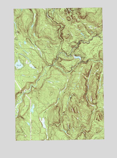
Lake Joy, WA USGS Topographic Map
Click on map above to begin viewing in our Map Viewer.

This topographic map contains these locations and features:
Feature Name Type Latitude Longitude GNIS ID View Map
Beaver CreekStreamN47.6326°W121.7823°1516324View Map
Canyon CreekStreamN47.6543°W121.7640°1517339View Map
East Fork Griffin CreekStreamN47.6340°W121.8318°1519098View Map
Eastside Fire and Rescue Battalion 4 Station 86 - Lake JoyBuildingN47.6921°W121.8702°2619830View Map
Hull LakeLakeN47.6655°W121.7986°1521053View Map
Lake JoyLakeN47.6966°W121.8699°1521481View Map
Lower Snoqualmie Valley Division (historical)CensusN47.7082°W121.8093°1939546View Map
Moss LakeLakeN47.6941°W121.8501°1523410View Map
North Fork CreekStreamN47.7054°W121.8093°1523763View Map
North Fork Tolt RiverStreamN47.6957°W121.8207°1523866View Map
Sawns Mill Pond DamDamN47.7132°W121.8446°1532846View Map
Snoqualmie LookoutLocaleN47.6607°W121.7834°1530245View Map
South Fork Tolt RiverStreamN47.6957°W121.8207°1526271View Map
Stossel CreekStreamN47.6945°W121.8310°1526606View Map
Swans Mill PondReservoirN47.7147°W121.8466°1532847View Map
Todd LakeLakeN47.6815°W121.8015°1530261View Map
Tolt Regulating BasinBasinN47.7034°W121.7871°1533361View Map
Tolt River Regulating BasinReservoirN47.7065°W121.7912°1532237View Map
Tolt River Regulating Basin South DamDamN47.6998°W121.7829°1532238View Map
Tolt River Regulating Basin West DamDamN47.7065°W121.7912°1532236View Map
Yellow CreekStreamN47.7229°W121.7601°1528355View Map

Note: Coordinates in the location and feature list above are referenced to NAD83 datum.


Copyright (C) 2008-2025 Ryan Niemi / Sunset Dynamics ... All Rights Reserved