TopoQuest Logo
Do you find TopoQuest useful?
Help keep TopoQuest running and adding new maps/features by donating!
Bitcoin:  19c7KJd3qBynnjoSw5npx9KScwjBe4ifkT
Litecoin:  LXs6TkuXGGXo1vDsWCkWVdjQX94eUKd6ui
Home View Maps Find Maps Find Places Resources & Links


Gold Bar, Washington Topographic Map

USGS Map Title: Gold Bar, WA
USGS Map MRC: 47121G6
DRG (GeoTIFF) Download: o47121g6.tif


Neighboring USGS Topographic Map Quads:


  Lake Chaplain, WA  
47121H7
 

  Wallace Lake, WA  
47121H6
 

  Mount Stickney, WA  
47121H5
 

  Sultan, WA  
47121G7
 

  Gold Bar, WA  
47121G6
 

  Index, WA  
47121G5
 

  Lake Joy, WA  
47121F7
 

  Devils Slide, WA  
47121F6
 

  Mount Phelps, WA  
47121F5


Map MRC Location:

N48°
W122°
N48°
W121°
H8 H7 H6 H5 H4 H3 H2 H1
G8 G7 G6 G5 G4 G3 G2 G1
F8 F7 F6 F5 F4 F3 F2 F1
E8 E7 E6 E5 E4 E3 E2 E1
D8 D7 D6 D5 D4 D3 D2 D1
C8 C7 C6 C5 C4 C3 C2 C1
B8 B7 B6 B5 B4 B3 B2 B1
A8 A7 A6 A5 A4 A3 A2 A1
N47°
W122°
N47°
W121°

Gold Bar, WA USGS 1:24K Topographic Map Preview:
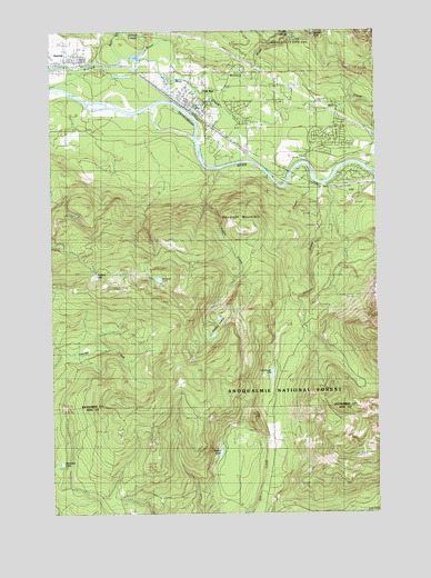
Gold Bar, WA USGS Topographic Map
Click on map above to begin viewing in our Map Viewer.

This topographic map contains these locations and features:
Feature Name Type Latitude Longitude GNIS ID View Map
Airplane LakeLakeN47.8116°W121.7347°1529340View Map
Alpine Meadows Mobile Home ParkPopulated PlaceN47.8543°W121.6892°2607260View Map
Bear CreekStreamN47.8682°W121.7229°1516240View Map
Bengston LakeLakeN47.7628°W121.7478°1516412View Map
Camp HustonSchoolN47.8651°W121.6776°1517288View Map
City of Gold BarCivilN47.8562°W121.6918°2410608View Map
Crystal CreekStreamN47.8343°W121.6598°1518370View Map
Duffey CreekStreamN47.8387°W121.6865°1518992View Map
Gold BarPopulated PlaceN47.8568°W121.6971°1520077View Map
Gold Bar Elementary SchoolSchoolN47.8570°W121.6967°2518461View Map
Gold Bar Post OfficePost OfficeN47.8527°W121.6916°2781580View Map
Haleyon LakeLakeN47.8105°W121.7100°1529341View Map
Haystack MountainSummitN47.8234°W121.6773°1520633View Map
Little Cavanaugh LakeLakeN47.7861°W121.6665°1517509View Map
May CreekStreamN47.8679°W121.7196°1522817View Map
May CreekPopulated PlaceN47.8543°W121.6673°1852950View Map
May Creek Census Designated PlaceCensusN47.8555°W121.6741°2408190View Map
McDaniels Mobile VillagePopulated PlaceN47.8598°W121.7056°2607261View Map
North Fork Wallace RiverStreamN47.8732°W121.6582°1523877View Map
Olney CreekStreamN47.8726°W121.7126°1524031View Map
Proctor CreekStreamN47.8345°W121.6443°1524652View Map
ReiterPopulated PlaceN47.8412°W121.6309°1524991View Map
Snohomish County Fire District 26 Station 53BuildingN47.8564°W121.6961°2619476View Map
Snohomish County Fire District 26 Station 54BuildingN47.8416°W121.6684°2619760View Map
Snohomish County Sheriff's Office Gold BarBuildingN47.8558°W121.6977°2722095View Map
StartupPopulated PlaceN47.8679°W121.7404°1526502View Map
Startup Census Designated PlaceCensusN47.8670°W121.7491°2409997View Map
Startup Post OfficePost OfficeN47.8673°W121.7423°2781602View Map
Wallace FallsFallsN47.8732°W121.6490°1527774View Map
Wallace Falls State ParkParkN47.8707°W121.6540°1529333View Map
Wallace River BridgeBridgeN47.8663°W121.7278°2608034View Map
Wallace River Mobile Home ParkPopulated PlaceN47.8664°W121.7488°2607549View Map
Winter LakeLakeN47.7656°W121.6868°1528256View Map

Note: Coordinates in the location and feature list above are referenced to NAD83 datum.


Copyright (C) 2008-2025 Ryan Niemi / Sunset Dynamics ... All Rights Reserved