TopoQuest Logo
Do you find TopoQuest useful?
Help keep TopoQuest running and adding new maps/features by donating!
Bitcoin:  19c7KJd3qBynnjoSw5npx9KScwjBe4ifkT
Litecoin:  LXs6TkuXGGXo1vDsWCkWVdjQX94eUKd6ui
Home View Maps Find Maps Find Places Resources & Links


Monroe, Washington Topographic Map

USGS Map Title: Monroe, WA
USGS Map MRC: 47121G8
DRG (GeoTIFF) Download: o47121g8.tif


Neighboring USGS Topographic Map Quads:


  Snohomish, WA  
47122H1
 

  Lake Roesiger, WA  
47121H8
 

  Lake Chaplain, WA  
47121H7
 

  Maltby, WA  
47122G1
 

  Monroe, WA  
47121G8
 

  Sultan, WA  
47121G7


  Carnation, WA  
47121F8
 

  Lake Joy, WA  
47121F7


Map MRC Location:

N48°
W122°
N48°
W121°
H8 H7 H6 H5 H4 H3 H2 H1
G8 G7 G6 G5 G4 G3 G2 G1
F8 F7 F6 F5 F4 F3 F2 F1
E8 E7 E6 E5 E4 E3 E2 E1
D8 D7 D6 D5 D4 D3 D2 D1
C8 C7 C6 C5 C4 C3 C2 C1
B8 B7 B6 B5 B4 B3 B2 B1
A8 A7 A6 A5 A4 A3 A2 A1
N47°
W122°
N47°
W121°

Monroe, WA USGS 1:24K Topographic Map Preview:
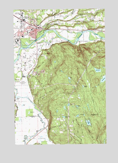
Monroe, WA USGS Topographic Map
Click on map above to begin viewing in our Map Viewer.

This topographic map contains these locations and features:
Feature Name Type Latitude Longitude GNIS ID View Map
Al Borlin ParkParkN47.8518°W121.9643°1533354View Map
Alden FarmsLocaleN47.8189°W121.9894°2706250View Map
B and M Ranch AirportAirportN47.8665°W121.9012°1533842View Map
BacusLocaleN47.7676°W121.9562°1530292View Map
Barr CreekStreamN47.8457°W121.9121°1516158View Map
Big BendBendN47.7562°W121.9860°1516467View Map
Bolles Organic FarmLocaleN47.8306°W121.9908°2706251View Map
Brugger RanchLocaleN47.8681°W121.9414°2706253View Map
Cascade MeadowsLocaleN47.8306°W121.9744°2706255View Map
Cherry CreekStreamN47.7684°W121.9604°1517661View Map
Cherry ValleyValleyN47.7687°W121.9604°1517664View Map
City of MonroeCivilN47.8594°W121.9854°2411137View Map
Country Green Turf FarmsLocaleN47.8528°W121.9236°2706256View Map
Duvall Fire / King County Fire Protection District 45 Station 68BuildingN47.7555°W121.9130°2619589View Map
Evergreen State FairgroundsLocaleN47.8682°W121.9887°1519413View Map
EvergreenHealth MonroeHospitalN47.8641°W121.9897°2462540View Map
First Air FieldAirportN47.8710°W121.9915°1533843View Map
Foye CreekStreamN47.8298°W121.9698°1519761View Map
Frank Wagner Elementary SchoolSchoolN47.8539°W121.9816°1530678View Map
Frank Wagner Elementary SchoolSchoolN47.8526°W121.9820°2462339View Map
Frohning DairyLocaleN47.8242°W121.9975°2705847View Map
Hannan CreekStreamN47.7684°W121.8768°1520510View Map
Hanstead CreekStreamN47.7651°W121.9573°1520521View Map
Harts SwampSwampN47.7751°W121.9338°1520588View Map
Haskel SloughStreamN47.8387°W121.9810°1520594View Map
High RockPopulated PlaceN47.8129°W121.9826°1520787View Map
High RockSummitN47.8345°W121.9532°1520789View Map
High Rock CreekStreamN47.8343°W121.9682°1520790View Map
Holland America NurseryBuildingN47.8536°W121.9997°2706265View Map
Hollandia FarmsLocaleN47.8189°W121.9786°2705991View Map
Independent Order of Odd Fellows CemeteryCemeteryN47.8640°W121.9409°1528382View Map
Isakson CreekStreamN47.7657°W121.9154°1533324View Map
Johnsons SwampLakeN47.8030°W121.9072°1521446View Map
Kids Country Child Care Center MonroeSchoolN47.8620°W121.9750°2606267View Map
King LakeLakeN47.8107°W121.9255°1521685View Map
Kosterland DairyLocaleN47.8550°W121.9283°2705923View Map
Lake FontalLakeN47.8179°W121.8868°1519677View Map
Lake HannanLakeN47.8094°W121.8791°1520511View Map
Lake MargaretReservoirN47.7696°W121.9006°1522727View Map
Lake Margaret DamDamN47.7665°W121.9012°1532234View Map
Lakes Unlimited DamDamN47.7815°W121.9312°1532185View Map
Leaders in Learning High SchoolSchoolN47.8537°W121.9791°1530697View Map
Leaders in Learning SchoolSchoolN47.8531°W121.9788°2462393View Map
Long LakeLakeN47.7896°W121.9882°1530154View Map
Majerle StripAirportN47.7569°W121.9802°2443345View Map
McCauley FallsFallsN47.7648°W121.9537°1522860View Map
Miedema DairyLocaleN47.8211°W121.9956°2705864View Map
MonroePopulated PlaceN47.8554°W121.9710°1523319View Map
Monroe Christian SchoolSchoolN47.8521°W121.9846°1530696View Map
Monroe Fire District 3 Station 31 HeadquartersBuildingN47.8505°W121.9830°2619412View Map
Monroe General HospitalHospitalN47.8634°W121.9901°1523321View Map
Monroe Golf CourseLocaleN47.8629°W121.9340°1533174View Map
Monroe Historical Society MuseumBuildingN47.8565°W121.9689°2610457View Map
Monroe Honor FarmLocaleN47.8117°W121.9878°2706089View Map
Monroe JunctionPopulated PlaceN47.8562°W121.9623°1523322View Map
Monroe Memorial ParkCemeteryN47.8631°W121.9419°1523323View Map
Monroe Middle SchoolSchoolN47.8561°W121.9755°1530654View Map
Monroe Mobile Home ParkPopulated PlaceN47.8592°W121.9578°2607376View Map
Monroe Montessori SchoolSchoolN47.8519°W121.9809°2506666View Map
Monroe Montessori SchoolSchoolN47.8303°W121.9556°2506669View Map
Monroe Plaza Shopping CenterLocaleN47.8601°W121.9676°2462560View Map
Monroe Police DepartmentBuildingN47.8514°W121.9816°2721941View Map
Monroe Post OfficePost OfficeN47.8560°W121.9725°2769194View Map
Monroe Public Schools District OfficeSchoolN47.8544°W121.9689°2506675View Map
Monroe ReservoirReservoirN47.8720°W121.9466°1523324View Map
Monroe Sewage Treatment PlantLocaleN47.8487°W121.9758°2610698View Map
Park Place Middle SchoolSchoolN47.8502°W121.9888°2462419View Map
Park Place SchoolSchoolN47.8518°W121.9926°1524211View Map
Pearson EddyPopulated PlaceN47.7926°W121.9979°1524289View Map
Peoples CreekStreamN47.7940°W121.9843°1524329View Map
Pine Creek NurseryBuildingN47.8539°W121.9194°2706260View Map
Regency Care Center at MonroeBuildingN47.8514°W121.9886°2607703View Map
Richardson CreekStreamN47.8657°W121.9448°1525027View Map
Roths SwampSwampN47.7840°W121.9053°1525229View Map
Round LakeLakeN47.7796°W121.9807°1525232View Map
Sky Valley Adventist SchoolSchoolN47.8494°W121.9870°1530679View Map
Skyhart FarmsLocaleN47.8461°W121.9528°2706082View Map
Skykomish River Centennial ParkParkN47.8459°W121.9721°1533374View Map
Snohomish County Sheriff's Office MonroeBuildingN47.8667°W121.9915°2722090View Map
Soup HoleLakeN47.7766°W121.9062°1526119View Map
Steffen CreekStreamN47.8336°W121.9684°2791112View Map
Treen LakeLakeN47.7867°W121.9898°1527365View Map
Trestle SwampLakeN47.7848°W121.9151°1527368View Map
Tualco ValleyBasinN47.8327°W121.9740°1527426View Map
Van de Plasch AirportAirportN47.8716°W121.9236°1533844View Map
Wagner SchoolSchoolN47.8723°W121.9326°1527749View Map
Wellin LakeLakeN47.8421°W121.9495°1527888View Map
Werkhoven DairyLocaleN47.8319°W121.9875°2705842View Map
West Fork Woods CreekStreamN47.8712°W121.9201°1527987View Map
Woods CreekStreamN47.8470°W121.9704°1528304View Map
Woods Creek FarmLocaleN47.8736°W121.9189°2706264View Map

Note: Coordinates in the location and feature list above are referenced to NAD83 datum.


Copyright (C) 2008-2025 Ryan Niemi / Sunset Dynamics ... All Rights Reserved