TopoQuest Logo
Do you find TopoQuest useful?
Help keep TopoQuest running and adding new maps/features by donating!
Bitcoin:  19c7KJd3qBynnjoSw5npx9KScwjBe4ifkT
Litecoin:  LXs6TkuXGGXo1vDsWCkWVdjQX94eUKd6ui
Home View Maps Find Maps Find Places Resources & Links


Eldon, Missouri Topographic Map

USGS Map Title: Eldon, MO
USGS Map MRC: 38092C5
DRG (GeoTIFF) Download: o38092c5.tif


Neighboring USGS Topographic Map Quads:


  Barnett, MO  
38092D6
 

  Olean, MO  
38092D5
 

  Enon, MO  
38092D4
 

  Rocky Mount, MO  
38092C6
 

  Eldon, MO  
38092C5
 

  Eugene, MO  
38092C4
 

  Lake Ozark, MO  
38092B6
 

  Bagnell, MO  
38092B5
 

  Tuscumbia, MO  
38092B4


Map MRC Location:

N39°
W93°
N39°
W92°
H8 H7 H6 H5 H4 H3 H2 H1
G8 G7 G6 G5 G4 G3 G2 G1
F8 F7 F6 F5 F4 F3 F2 F1
E8 E7 E6 E5 E4 E3 E2 E1
D8 D7 D6 D5 D4 D3 D2 D1
C8 C7 C6 C5 C4 C3 C2 C1
B8 B7 B6 B5 B4 B3 B2 B1
A8 A7 A6 A5 A4 A3 A2 A1
N38°
W93°
N38°
W92°

Eldon, MO USGS 1:24K Topographic Map Preview:
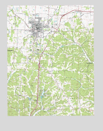
Eldon, MO USGS Topographic Map
Click on map above to begin viewing in our Map Viewer.

This topographic map contains these locations and features:
Feature Name Type Latitude Longitude GNIS ID View Map
Artz-Wenzel CemeteryCemeteryN38.2981°W92.5624°742832View Map
Aurora SpringsPopulated PlaceN38.3248°W92.5852°713489View Map
Barn HollowValleyN38.2525°W92.5827°713661View Map
City of EldonCivilN38.3511°W92.5767°2394638View Map
Cooper (historical)LocaleN38.2573°W92.5938°744707View Map
Cooper School (historical)SchoolN38.2820°W92.6105°744521View Map
Dry BranchStreamN38.3301°W92.5250°717070View Map
EldonPopulated PlaceN38.3484°W92.5816°729476View Map
Eldon CemeteryCemeteryN38.3642°W92.5871°717434View Map
Eldon Fire Department Station 1 HeadquartersBuildingN38.3488°W92.5807°2621163View Map
Eldon Fire Department Station 2BuildingN38.3428°W92.5868°2620503View Map
Eldon Fire Department Station 3BuildingN38.3465°W92.5986°2620502View Map
Eldon High SchoolSchoolN38.3503°W92.5827°742828View Map
Eldon Junior High SchoolSchoolN38.3648°W92.5835°742826View Map
Eldon Model AirparkAirportN38.3574°W92.5699°758667View Map
Eldon Police DepartmentBuildingN38.3487°W92.5807°2752234View Map
Eldon Post OfficePost OfficeN38.3494°W92.5799°2782826View Map
Franklin School (historical)SchoolN38.3270°W92.6105°744519View Map
Gateway ChurchChurchN38.3003°W92.5644°742831View Map
Ginger Ridge School (historical)SchoolN38.2709°W92.5019°744525View Map
Harmony School (historical)SchoolN38.2514°W92.5355°744524View Map
Jukes CemeteryCemeteryN38.2567°W92.5491°742835View Map
Kelsay CemeteryCemeteryN38.2664°W92.5399°742836View Map
KKNO-FM (Eldon)TowerN38.2803°W92.5855°754246View Map
KLDN-FM (Eldon)TowerN38.3409°W92.5927°759050View Map
Lake Ja-HaReservoirN38.3567°W92.5558°763933View Map
Lake Ja-Ha DamDamN38.3567°W92.5569°763932View Map
Land of Lakes IncorporatedReservoirN38.2753°W92.5738°763926View Map
Milldale Church (historical)ChurchN38.3345°W92.5121°744518View Map
Moreau Fire Protection District Station 1BuildingN38.3493°W92.5587°2620902View Map
Moreau Fire Protection District Station 6BuildingN38.3032°W92.5757°2621309View Map
Mount Carmel ChurchChurchN38.2675°W92.5832°729558View Map
Mount PleasantPopulated PlaceN38.3681°W92.5235°729565View Map
Mount Pleasant CemeteryCemeteryN38.3668°W92.5301°2702465View Map
Mount Vernon CemeteryCemeteryN38.3625°W92.5607°742827View Map
Old Path ChurchChurchN38.3142°W92.5910°742830View Map
Pleasant Hill School (historical)SchoolN38.3567°W92.5655°744517View Map
Salem CemeteryCemeteryN38.3697°W92.5716°725924View Map
Skinner CemeteryCemeteryN38.2806°W92.5482°742837View Map
Skinner School (historical)SchoolN38.2859°W92.5516°744523View Map
Thompson RidgeRidgeN38.3017°W92.5499°727609View Map
Tol-Wood CemeteryCemeteryN38.2559°W92.5846°742833View Map
Town-N-Country Lake DamDamN38.2734°W92.5752°763925View Map
Township of FranklinCivilN38.2936°W92.6242°767017View Map
Township of SalineCivilN38.3687°W92.5111°767022View Map
Tri-County Tech SchoolSchoolN38.3489°W92.5816°742829View Map
Vaughn CemeteryCemeteryN38.2575°W92.5738°742834View Map
Vaughn HollowValleyN38.2561°W92.5755°728156View Map
Vernon School (historical)SchoolN38.3295°W92.5421°728174View Map
Walnut Grove School (historical)SchoolN38.2514°W92.6041°744522View Map
West AuroraPopulated PlaceN38.3145°W92.5957°728526View Map
West Aurora School (historical)SchoolN38.3148°W92.5919°744520View Map

Note: Coordinates in the location and feature list above are referenced to NAD83 datum.


Copyright (C) 2008-2024 Ryan Niemi / Sunset Dynamics ... All Rights Reserved