TopoQuest Logo
Do you find TopoQuest useful?
Help keep TopoQuest running and adding new maps/features by donating!
Bitcoin:  19c7KJd3qBynnjoSw5npx9KScwjBe4ifkT
Litecoin:  LXs6TkuXGGXo1vDsWCkWVdjQX94eUKd6ui
Home View Maps Find Maps Find Places Resources & Links


Lancaster, Wisconsin Topographic Map

USGS Map Title: Lancaster, WI
USGS Map MRC: 42090G6
DRG (GeoTIFF) Download: o42090g6.tif


Neighboring USGS Topographic Map Quads:


  Mount Hope, WI  
42090H7
 

  Fennimore, WI  
42090H6
 

  Stitzer, WI  
42090H5
 

  Hurricane, WI  
42090G7
 

  Lancaster, WI  
42090G6
 

  Ellenboro, WI  
42090G5
 

  Balltown, IA  
42090F7
 

  Potosi, WI  
42090F6
 

  Dickeyville, WI  
42090F5


Map MRC Location:

N43°
W91°
N43°
W90°
H8 H7 H6 H5 H4 H3 H2 H1
G8 G7 G6 G5 G4 G3 G2 G1
F8 F7 F6 F5 F4 F3 F2 F1
E8 E7 E6 E5 E4 E3 E2 E1
D8 D7 D6 D5 D4 D3 D2 D1
C8 C7 C6 C5 C4 C3 C2 C1
B8 B7 B6 B5 B4 B3 B2 B1
A8 A7 A6 A5 A4 A3 A2 A1
N42°
W91°
N42°
W90°

Lancaster, WI USGS 1:24K Topographic Map Preview:
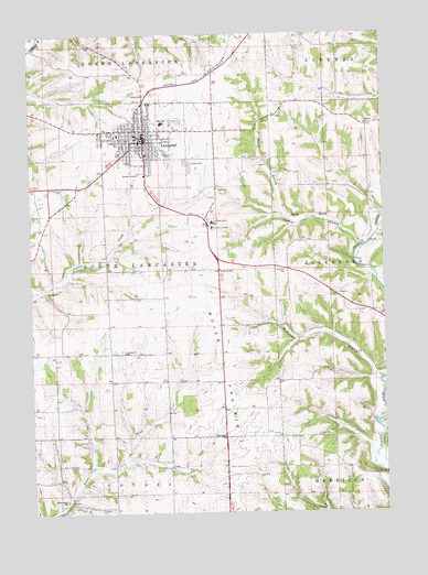
Lancaster, WI USGS Topographic Map
Click on map above to begin viewing in our Map Viewer.

This topographic map contains these locations and features:
Feature Name Type Latitude Longitude GNIS ID View Map
Aupperle CemeteryCemeteryN42.8133°W90.6598°1561017View Map
Aupperle SchoolSchoolN42.8133°W90.6832°1561018View Map
Austin BranchStreamN42.8183°W90.6340°1561026View Map
Bethlehem United Church of ChristChurchN42.8453°W90.7093°1840473View Map
Boice Creek CemeteryCemeteryN42.7622°W90.7412°1562032View Map
Boice Creek SchoolSchoolN42.7533°W90.7385°1562033View Map
Boice PrairieFlatN42.7880°W90.6829°1562034View Map
Boice Prairie CemeteryCemeteryN42.7617°W90.6815°1562035View Map
Cement SchoolSchoolN42.8511°W90.6312°1562875View Map
Christ Lutheran ChurchChurchN42.8475°W90.7023°1840482View Map
City of LancasterCivilN42.8473°W90.7064°1583524View Map
Cunningham MuseumBuildingN42.8478°W90.7087°1840485View Map
Dee Dee AcresLocaleN42.8008°W90.7039°2709134View Map
Eden Valley FarmsLocaleN42.7875°W90.6614°2709148View Map
Fairview SchoolSchoolN42.7919°W90.7173°1564822View Map
Faith Lutheran ChurchChurchN42.8475°W90.7151°1840489View Map
Five Flags TheaterBuildingN42.7644°W90.6660°463963View Map
Four Corners RanchLocaleN42.7639°W90.6456°2709131View Map
Grant Community ClinicHospitalN42.8497°W90.7093°1840497View Map
Grant CountyCivilN42.8675°W90.7062°1581081View Map
Grant County CourthouseBuildingN42.8475°W90.7101°1840499View Map
Grant County FairgroundsLocaleN42.8522°W90.6985°1840500View Map
Grant County Law Enforcement CenterBuildingN42.8569°W90.7079°1840501View Map
Grant County PrisonBuildingN42.8567°W90.7080°2759825View Map
Grant County Sheriff's OfficeBuildingN42.8567°W90.7080°2759718View Map
Grant Regional Health CenterHospitalN42.8440°W90.7089°1840512View Map
Hampton CemeteryCemeteryN42.7511°W90.7265°1566026View Map
Hillside CemeteryCemeteryN42.8414°W90.6940°1566456View Map
Koeller DairyLocaleN42.8325°W90.7336°2709128View Map
Krohn FarmLocaleN42.8303°W90.7486°2709149View Map
LancasterPopulated PlaceN42.8475°W90.7107°1567823View Map
Lancaster Christian ChapelChurchN42.8458°W90.7104°1840508View Map
Lancaster City HallBuildingN42.8469°W90.7093°1840509View Map
Lancaster Fire DepartmentBuildingN42.8505°W90.7123°2697657View Map
Lancaster High SchoolSchoolN42.8512°W90.7028°1840510View Map
Lancaster Industrial ParkLocaleN42.8633°W90.6932°1840511View Map
Lancaster Middle SchoolSchoolN42.8518°W90.7031°1840513View Map
Lancaster Municipal AirportAirportN42.7812°W90.6811°1582050View Map
Lancaster Police DepartmentBuildingN42.8466°W90.7092°2759743View Map
Lancaster Post OfficePost OfficeN42.8478°W90.7118°1840514View Map
Leeser FarmsLocaleN42.7833°W90.6561°2709137View Map
Macland FarmsLocaleN42.8053°W90.7200°2709136View Map
Majestic View DairyLocaleN42.8658°W90.6964°2709235View Map
McPherson BranchStreamN42.7844°W90.6265°1569272View Map
Moore BranchStreamN42.8275°W90.6612°1569704View Map
Prairie Dairy FarmsLocaleN42.7797°W90.7208°2709144View Map
Prairie Dell Stock FarmLocaleN42.7819°W90.6711°2709147View Map
Prairie View FarmsLocaleN42.7836°W90.6917°2709143View Map
Reorganized Church of Jesus Christ of Latter Day SaintsChurchN42.8461°W90.7123°1840533View Map
Riverboat MuseumBuildingN42.7653°W90.6618°463967View Map
Rock SchoolSchoolN42.7700°W90.6826°1572473View Map
Ryland ParkParkN42.8505°W90.7098°1840536View Map
Saint Clement SchoolSchoolN42.8478°W90.7125°1840538View Map
Saint Clements CemeteryCemeteryN42.8353°W90.7387°1572902View Map
Saint Clements ChurchChurchN42.8472°W90.7123°1840539View Map
Santerra DairyLocaleN42.7817°W90.7406°2709130View Map
Schreiner Memorial LibraryBuildingN42.8505°W90.7098°1840548View Map
Schreiner ParkParkN42.8553°W90.7196°1840549View Map
Town of South LancasterCivilN42.8112°W90.7244°1584178View Map
WGLR-AM (Lancaster)TowerN42.8394°W90.6721°1582314View Map
WGLR-FM (Lancaster)TowerN42.8383°W90.6707°1582398View Map
Windswept FarmsLocaleN42.8711°W90.6517°2709135View Map
Winskill Elementary SchoolSchoolN42.8483°W90.7189°1840559View Map

Note: Coordinates in the location and feature list above are referenced to NAD83 datum.


Copyright (C) 2008-2025 Ryan Niemi / Sunset Dynamics ... All Rights Reserved